Varied coastal dune habitats, including sand, slacks, grassland, marsh, woodland and beaches, supporting a great range of plants and animals. Includes Kenfig Pool, a large freshwater lake
Management
Natural Resources Wales
Entry
Free
Location
Kenfig village, 3 miles north of Porthcawl; CF33 4PT
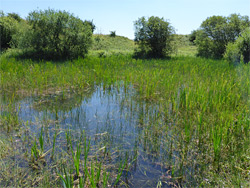
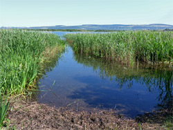
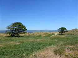
A great band of sand dunes extending over a mile inland once covered the south Wales coast for 20 miles between the Gower Peninsula and the Ogmore River, and although the majority has been cleared and developed, occupied mainly by the suburbs and steelworks of Port Talbot, large areas survive in two places; Merthyr Mawr and Kenfig, this latter the most spectacular area, protected as a national nature reserve. Within this 1,300 acre region are the second largest freshwater lake in south Wales (Kenfig Pool), a buried castle and medieval village, and 2.5 miles of remote, sand/pebble beach, but mostly it contains sand dunes, mixed with patches of damp woodland, dry and wet grassland, marsh, streams and slacks, these being flat, low-lying areas between the dunes.
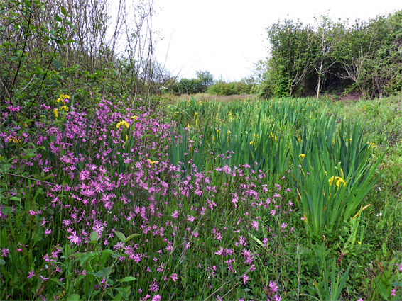
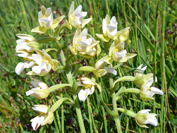
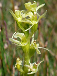
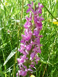
The nature reserve is scenic and photogenic, crossed by many trails, some quite busy but most infrequently used, so the interior can be surprisingly empty and remote-feeling, yet it is the varied plant and animal life for which the place is most renowned, recognised not just as one of Wales's 24 important plant areas (IPAs), but amongst the finest wildflower locations in the whole of the UK. Over 500 plant species have been recorded here, including 15 types of orchid, plus dozens of different birds and a wide range of insects, amphibians, reptiles and mammals. The most famous plant is the fen orchid (liparis loeselii), a delicate, green/yellow-flowered species that is found only here and one site in East Anglia. Just a short walk around the reserve in summer, of an hour or so, is enough to see several dozen species of flowering plants.
Kenfig Pool provides a focal point for many visitors, since it is close to the entrance, and has several shoreline access points and birdwatching hides. The second most popular activity is hiking a three mile loop trail to the south. The rest of the reserve is much less visited, despite the many intersecting paths, most of which are not signposted, and although the inland hills and towers of the steelworks provide distant navigation aids, it is easy to get lost amongst the undulating landscape.
The reserve stretches 2.5 miles north to south and is 1.5 miles across at the widest point, though here the dunes extend a little further east, on the far side of the M4. Other areas border an industrial estate and the grassland of Margam Moors to the north, and farm fields and a golf course to the south. The entrance is towards the southeast, at the edge of Kenfig village (2.5 miles from M4 junction 37), which was relocated in late medieval times from its original location one mile north; the one trace of the earlier settlement is part of the wall at the top of the castle keep, the remainder being buried beneath up to 50 feet of sand. The reserve has a large, free car park, vending machines and a visitor centre/bookstore (not always open), from where free brochures and maps are available, including a detailed orienteering map covering the southern half of the reserve, showing vegetation types, every path, and contour lines at 5 metre intervals. The northern half of the dunes is less interesting since it has larger open areas with less water, and is the usual location of the herd of cattle that graze across the reserve.
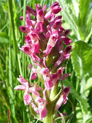
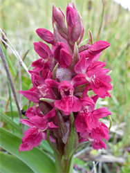
The main path west from the visitor centre very soon reaches a junction, at the start of the 3 mile loop, the northern half of which passes through several dune slacks, perhaps the best locations for wildflowers, and meets a vehicle track running along the coast, which forms part of the loop. The return section crosses somewhat drier, grassier terrain near the south edge of the reserve. Another path allows a much shorter loop (0.7 miles), partly along the south side of Kenfig Pool, and connects with a narrower, more overgrown trail close to the eastern shoreline - the inland (west) side of the pool borders private land so has no paths. One other major trail, a public bridleway, heads west from the north side of the pool, also meeting with the vehicle track along the coast, and this approximately forms a divide between the generally more interesting and varied southern section of the reserve and the northern half, which has more uniform terrain of dry dunes, plus a patch of saltmarsh. The fen orchids are found mostly along the western edge of the largest dune slack - around 2,200 feet west of the southern edge of Kenfig Pool, while the other orchids are also concentrated in the slacks, and the wetter areas close to Kenfig Pool. The most abundant is the marsh helleborine, a generally rare species but here abundant, with many thousands of plants in bloom in midsummer; both the usual reddish flowers and the less common yellow variety.
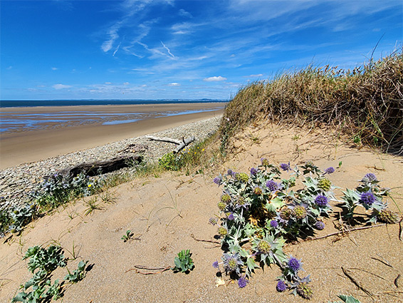
Sker Beach (or Kenfig Sands), bordering the reserve to the west, is not much visited since there are no closer access points north or south; this section of the coast is reached only through the reserve, a walk of at least a mile. All is similar in appearance, backed by a sandy, grass-covered ridge that slopes down to a broad band of light-coloured pebbles either side of the high water mark, while the inter tidal zone is nearly all sand, with just a few minor rock outcrops. Plant life is more limited alongside the beach though there are several specialised, salt-tolerant species here including sea holly, sea stock and sand cat's-tail.
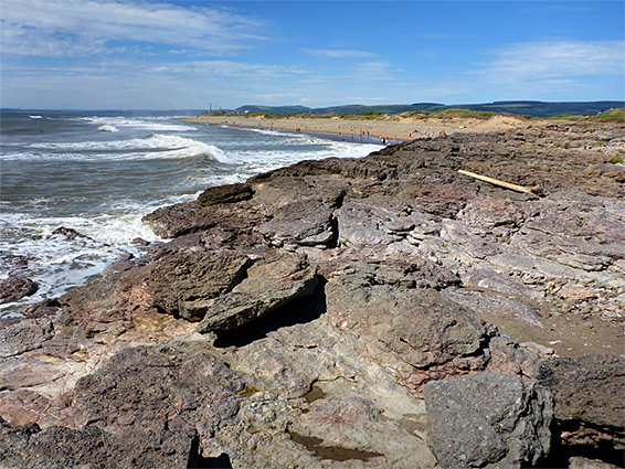
Sker Point
At the south end of the beach, the sand and pebbles are replaced by an outcrop of reddish-grey rocks (Mercia Mudstone) at Sker Point, about a third of a mile across, with, at low tide, a narrow inlet in the middle, named Pwll Dafan. Just inland is a is a broad, grassy bench, good for wildflowers.