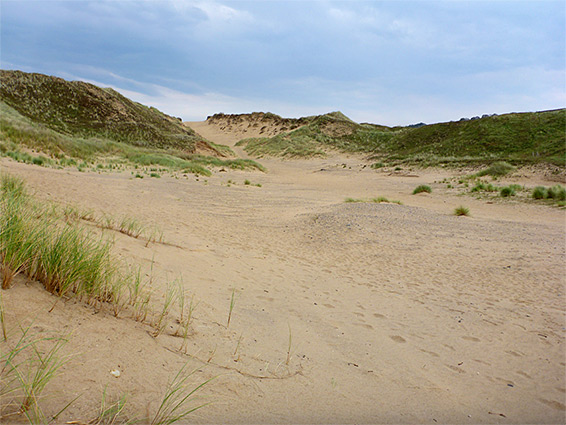
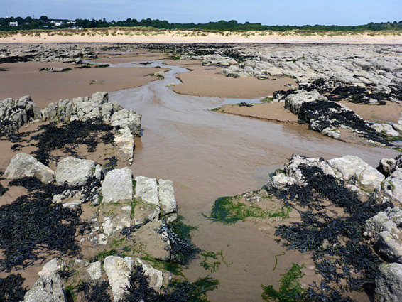
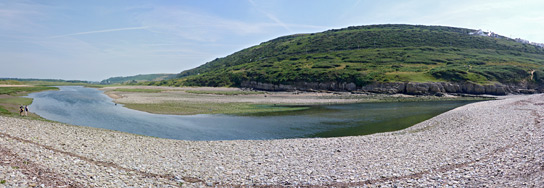
Two miles east of Newton and Porthcawl on the Glamorgan coast, Merthyr Mawr National Nature Reserve contains an extensive area of sand dunes (Merthyr Mawr Warren), supposedly the second largest in Europe, stretching nearly two miles along the seafront and over one mile inland, bordered to the southeast by the River Ogmore and to the north by a ridge of carboniferous limestone, partly wooded. The southern boundary of the reserve runs just above the high water mark, but the sands continue out to sea, forming a thousand foot-wide beach at low tide, mingling with low, eroded limestone exposures towards Newton.
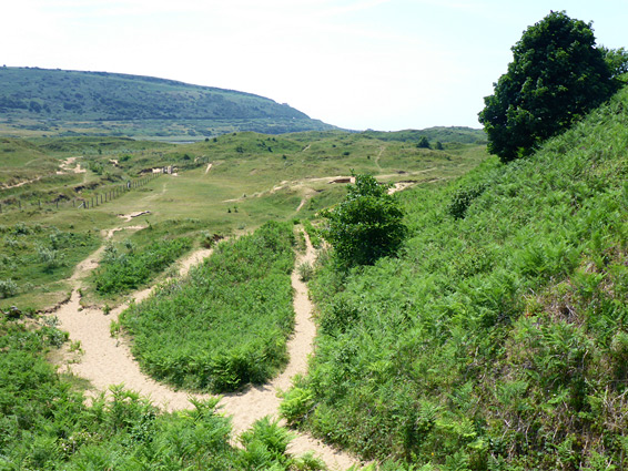
Until relatively recently the dunes were little vegetated and hence quite mobile, but they have in the last few decades become overgrown, with marram grass and sand couch near the coast, and sea buckthorn inland, so now they are more stable. Several centuries ago the dunes were just part of a continuous belt of sand that continued all the way to the Gower Peninsula, but now only two sections remain, here and around Kenfig, on the far side of Porthcawl.
Two of the largest areas of pure sand, including the highest dune in the reserve, are near the inland edge, above a little valley containing a small stream (Candleston Brook) which forms the boundary between the sands and the higher, wooded land beyond. The ivy-covered ruin of Candleston Castle lies a little way above the brook, occupied for nearly 500 years despite problems with the encroaching sand, which covered nearby land once used for agriculture.
The parking area at the castle, at the end of a narrow country lane from Merthyr Mawr village, also serves as the main entrance to the nature reserve; several paths head south and west, reaching the coast after between one and two miles. Most visitors take the southern paths, close to the Ogmore River; those towards the north are less frequented, though the out-of-the way location and limited signage ensure that no part of the reserve is ever particularly busy, in contrast to the popular coastline of Ogmore-by-Sea on the far side of the river.
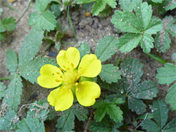
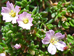
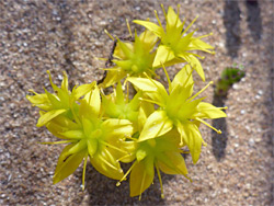
The reserve is a noted wildflower destination, home to dozens of species, and also supports a wide range of wildlife. A less-visited area in the centre is used for cattle grazing at some times of the year, in part to control the increasing undergrowth. Neither the dunes nor the coast are particularly photogenic, but interest comes from the general remote, wild ambience, and the abundant plant life.
The reserve can be accessed by walking east from Newton, or by wading across the lower end of the Ogmore River from Ogmore-by-Sea, but the usual entry is along the road from Merthyr Mawr (2.5 miles from Bridgend), past fields and woods, to the good-sized, metered parking area. The main path crosses Candleston Brook, still in the forest, then emerges abruptly to the open, grassy dunes, soon climbing a ridge to reveal views of the sea and the river valley. Other routes head more to the west, crossing somewhat higher elevation land, partly covered by trees and bushes. Features away from the perimeter of the reserve are few and not all are easy to locate, though there are a few springs, wells, seasonal streams and ancient relics, including building foundations, the base of a cross, the remains of a windmill and stretches of abandoned roads. The best way to explore the area, visiting all the different habitats, is a 4.5 mile circuit, south over sand and short grass dunes to the mouth of the river, along the beach towards the far side of the reserve and back along mostly unsigned paths through more varied terrain of meadows, wooded thickets, boggy patches and bushy hillsides. The numerous, intersecting trails can make route-finding difficult, though the ridge that overlooks the reserve to the north provides a visible landmark.