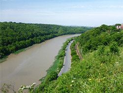
Spectacular ravine along the River Avon, between limestone cliffs up to 300 feet high, crossed by the Clifton Suspension Bridge. A noted wildflower location
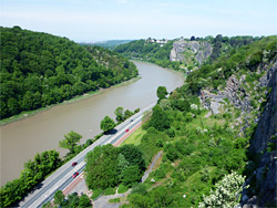
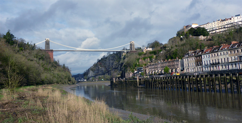
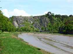
The Avon Gorge is formed by the River Avon as it cuts through a broad ridge of limestone that extends ten miles southwest towards Clevedon, the same rocks that lie beneath the Mendip Hills to the south, and is believed to be a result of glaciation, when the natural, lowland course, south of the ridge, was blocked by ice, causing the river to divert. The gorge is nearly 2 miles long and 350 feet across at its base, and the cliffs at either side rise up to 300 feet above the tidal river, making this one of the most impressive canyons in the country, very well-known owing to its proximity to Bristol, and because of Brunel's Clifton Suspension Bridge which crosses the narrowest part.
The bridge links the city with the ancient forest of Leigh Woods on the opposite side of the gorge, and it was the opening (in 1864) that precipitated development of a group of upmarket homes, the village of Leigh Woods; a few are perched right on the rim of the river canyon, overlooking the bridge. Apart from this small area, all land immediately west of the gorge is undeveloped, while the east, city side is also largely free of houses, as these have been built only at the north and south ends, part of Sneyd Park and Clifton. The 1.5 miles in between is mostly open, limestone grassland, the Clifton (and Durdham) Downs, which are protected against all forms of development by an Act of Parliament of 1861. The downs were once used by locals to graze sheep, and hence never became wooded, and are now one of the premier recreation areas in the city. Below the rim, the sides of the gorge are a mix of sheer, mostly bare rock faces, and steep, wooded slopes.
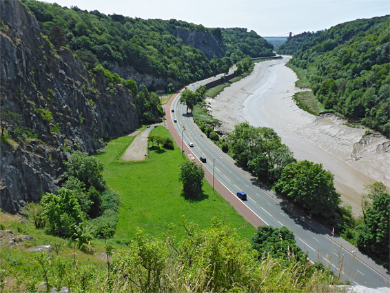
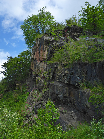
Away from the suspension bridge, viewpoints along the west side of the gorge are very limited due to the trees of Leigh Woods, but there are several popular, extended viewpoints on the east side. At the bottom of the valley, a path and a railway line follow the east side of the river, and the busy Portway parallels the west side, this linked to Clifton Down above by several paths and one road. Most people visiting the gorge see it only from above or below; the cliffs are in general only used by rock climbers, though many places are accessible by careful walking and scrambling.
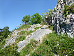
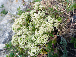
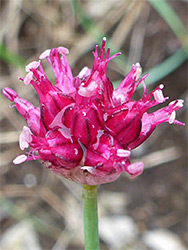
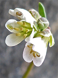
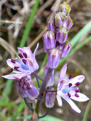
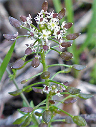
Apart from the differing views, the valley sides are also of interest for the great variety of plants that grow here, including several particularly rare species, such as honewort, Bristol onion, autumn squill, Bristol rockcress and Bristol whitebeam (a tree). The gorge is considered one of the top ten areas for wildflowers in the UK; the diversity is due to the mix of habitats, and relatively large area of inaccessible and therefore protected terrain, much of which has a well-drained, south-facing aspect, sheltered from the prevailing wind. Besides the cliffs themselves, and the associated calcareous grassland, the gorge also contains woodland and riparian areas, plus neutral grassland, marsh and salt flats around the river.
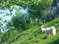
The northernmost of the three main overlooks on the east side of the Avon Gorge is at Sea Walls, a prominent set of cliffs, the top of which offers views of Avonmouth and the Bristol Channel, five miles away, as well as the river below. This overlook is along Circular Road, the meandering loop across the Clifton Downs, and for 600 feet this runs right along the rim of the cliffs, guarded by metal railings above a stone wall. To the south, the road curves abruptly away from the rim to avoid a steep-sided valley, known as The Gully, or Walcombe Slade, which provides a walking route down to the bottom of the gorge. The valley was traditionally thickly wooded, but in 2005 a decision was taken to fell about half the trees to create sunnier conditions on the ground and encourage the growth of calcareous grassland plants. A small herd of wild goats was introduced a few years later to stop re-growth of trees and scrub, and are kept in place by fences all around the valley rim and across the lower end, creating an enclosure of about three acres. The plants have indeed returned, and grow most strongly across the exposed cliffs, slopes and ledges along the north side of the valley. The Gully is one of two places in the gorge where the very rare round-headed leek (also known as the Bristol onion) can be found. Honewort is another uncommon species growing here. The path through the Gully leads to a parking area along the Portway, just south of a little side road below the Sea Walls overlook, at the base of a dramatic outcrop known as Black Rocks. The upper part of the rocks are sheer but the lower section slopes not too steeply, and is sheltered by the curving cliffs above, making this another particularly good wildflower location.
South of the Gully, Circular Road stays out of sight of the gorge for a while, hidden by a thick belt of trees, while on the other side, a sizeable section of the Downs is a designated wildflower meadow; the grass is not mowed until late in the season, and in summer many plants are found here including several orchids (autumn lady's-tresses, bee, common spotted, pyramidal and southern marsh).
Circular Road reaches a second viewpoint near the south edge of the Downs, above another set of near-vertical cliffs, site of an old quarry, one that was later used as a rifle range. Again the lower reaches include an area of sheltered ledges and benches, good for plants, and accessible from a layby along the Portway. The viewpoint is a good place to look for the peregrine falcons who nest in the gorge, having been re-established here in the 1990s. A path follows the rim southwards a way and curves back towards a road (Ladies Mile), near the junction with Bridge Valley Road, which descends to the Portway. Another path, the New Zigzag, follows the north side of the road, descending steeply through a shady combe. South of the road junction, the sides of the gorge are wooded, generally lacking any rock outcrops for the next quarter of a mile, though all the trees are fairly recent, dating from the time when communal sheep grazing was prohibited. This section of the gorge is followed both by a walkway, the Promenade, and a wide road (Clifton Down), the east side of which is lined by especially large and elegant houses, many built in the 1700s. At this time they would have enjoyed sweeping views across the gorge to Leigh Woods, but now the grand panorama is completely obscured by the trees. The woods contain a few lightly-used paths, descending towards the river.
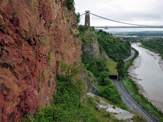
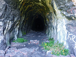
The final overlook is Observatory Hill, a grassy summit topped by the Clifton Observatory, which was constructed as a snuff mill in 1766 and later converted to a camera obscura. An excavated tunnel runs from its base to a viewing area at the mouth of a natural cave about three quarters of the way up the cliffs. The view south from the hill is perhaps the most iconic in Bristol, across the Clifton Suspension Bridge to the city centre beyond. Below the hill is another large area of sloping limestone forming part of the west side of the gorge - St Vincents Rocks, the top of which is reachable by a well-used path forking off the northern approach to the hill, from Clifton Down. The crevices and ledges provide one of the best plant habitats in the gorge - species found here include autumn squill, spiked speedwell, little robin, dwarf mouse-ear, spring cinquefoil and bristol rockcress. The rocks are also home to an unusual import, a colony of the common wall lizard, a green-flecked species from northern Italy.
On the south side of the bridge is a small area of rocks and woodland, crossed by another path to the river (the original Zigzag), before the land slopes quite quickly down, to the Hotwells district at the entrance to the gorge. The famous Clifton Down Hotel overlooks the bridge and the south end of the gorge, adjoining the upper entrance of the disused Clifton Rocks Railway, a funicular structure that opened in 1893 and closed in 1934.
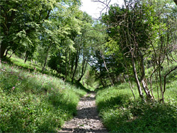
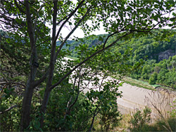
The south side of the Avon Gorge is much more overgrown than the north, and the woodland greatly restricts views from the top of the cliffs, but the floor is followed by a wide path, starting in the south at either a park beside the Brunel Way or a footbridge over the railway from Rownham Hill (A369), and in the north from Chapel Pill Lane. There are several connecting routes from Leigh Woods, the two most popular being down Nightingale Valley, just north of the suspension bridge, and via Paradise Bottom, a similar, wooded ravine 1.5 miles north. Although the land beside the path is mostly wooded, the limestone is exposed in a few places, as low cliffs, rockfalls or old quarries. One such location, half a mile north of the suspension bridge, is notable for a small population of the rare fly orchid, while directly under the bridge is a group of hutchinsia.