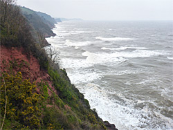
Three mile stretch of the east Devon coastline near Teignmouth, lined by high cliffs of red breccia, explorable via the coast path, or, at low tide, by walking beneath the cliffs
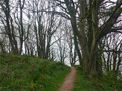
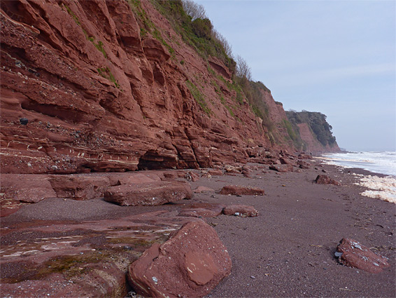
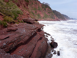
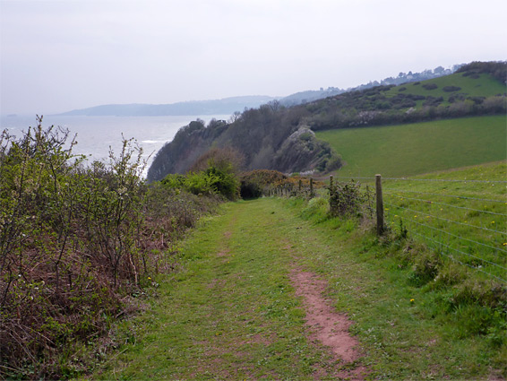
Red rocks line the east Devon coast from Branscombe westwards to the vicinity of Torquay; mostly sandstone and conglomerate (the Teignmouth Breccia) from the Permian period, forming narrow beaches and small coves but mostly tall cliffs, rising up to 400 feet above the sea. The three mile section from Shaldon south through Maidencombe to Watcombe is typical of the region, and may be viewed from above via the coast path which passes a number of viewpoints right on the brink of cliffs though is often shielded from the sea by hedgebanks or patches of woodland, while in other locations it moves inland to cross gullies.
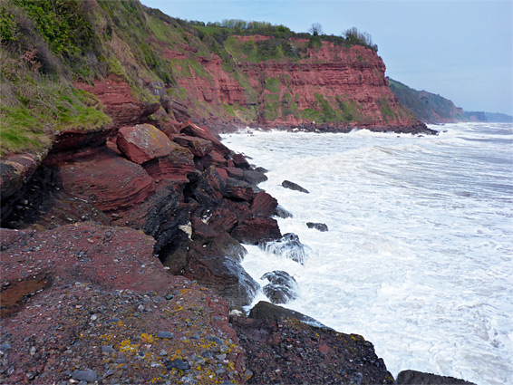
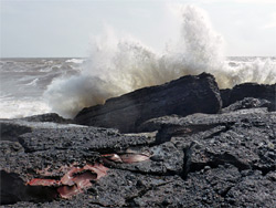
With more effort the shoreline itself can be explored, at least around low tide, by walking along the beaches and scrambling over the rocky patches in between, which include a few benches and low cliffs but are largely formed of irregular clumps of big boulders. The intertidal zone is wider towards the north, becoming gradually narrower southwards, where a few places are essentially cliff-bound even at low tide, the first such location being the north side of Mackerel Cove, about two thirds of the way from Sheldon to Watcombe, but the area beyond here can also be seen by starting at Maidencombe, which is the only other beach access point along this section of the coast.
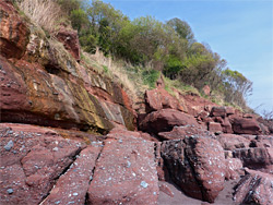
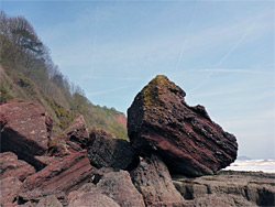
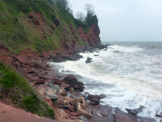
The rocks are richly coloured, coarsely grained, and often have a knobbly texture due to inclusions of fragments of lighter-hued rocks, mostly quartzite and limestone. There are only a few large formations of note, one being Bell Rock, an isolated stack containing an arch, though plenty of rugged, red rock scenery. Apart from Ness Cove at Shaldon, this area is not often visited, especially the shoreline.
Watcombe has a small parking area, as does the beach access road from Maidencombe, but there is much more space at The Ness, a high, tree-lined promontory at the mouth of the River Teign, at the edge of Shaldon. Near here are a cafe, a golf course and a small zoo, occupying part of the woods on the headland. The coast path leaves from the far side of the car park while the adjacent beach (Ness Cove), a hundred feet below, is reached by a sunken path leading to a tunnel through the rocks, round a few corners, out to a north-facing viewpoint and finally down a flight of steps to the north end of the third of a mile-long sandy beach, which can also be reached by walking round the headland on the opposite side, since here the cliffs quickly recede.
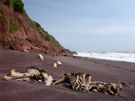
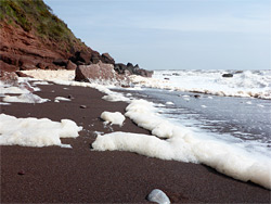
Ness Cove is formed of dull red sand, like all the beaches along this part of the coast, and backed by layered, steeply-sloping cliffs, mostly free of vegetation. The south end transitions to piles of boulders, on which several notices warn of the danger of rockfalls from the cliffs. The boulders continue to the minor point of Bundle Head, then are replaced by sands again at Smuggler's Cove, a shorter beach that is overlooked by a house, high above on the brink of the cliffs. Moving south, after another boulder section is a much smaller beach, perhaps named Cherry Red Cove, with a trickling stream at the far side, originating from a spring a little way above. A faint path follows the stream, seemingly a private route to another house. The cove is bordered to the south by a large flat rock, and south of here are a thousand feet of boulders and terraces until the next sandy area - two small beaches (Plantation Cove) separated by a rocky point. The sea hereabouts is known as Labrador Bay, named after a secluded public house, the Labrador Inn, that once stood on a ledge above Smuggler's Cove, until destroyed by fire in 1938.
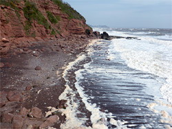
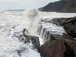
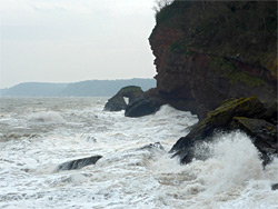
South of the twin beaches, for which the sand is only exposed below the high water mark, the coast is more generally rocky, with steeper, narrower lines of boulders interrupted by ledges, cliffs and terraces, and a few isolated rocks out to sea. One terrace is 200 feet wide, quite flat, and cut by several fissures. Further south, another beach (Border Cove) is followed by more rocks around a minor headland, and then Herring Cove, which has only a small amount of sand. The boulders on the far side lead to more extensive terraces cut by deeper ravines, and on to the next bay, Mackerel Cove. The rocky ledge on the north side of this cove is the first point not easily passable around high water, and perhaps difficult at all times, though there are no similar obstructions for nearly a mile south, past the similar-looking Blackaller's Cove, round a point to the sands of Maidencombe Beach, then over more big boulders to Shackley Bench, a low, projecting promontory with a sheer drop on the far side. The bench is close to the unusual sea arch of Bell Rock, and is reachable by about 15 minutes of scrambling starting at Maidencombe Beach, this being the next place south of Shaldon that is accessible from inland. South of Bell Rock the coast is more generally cliff-bound, to Torquay and beyond. If turning back north of Mackerel Cove, it is possible in some places to ascend the cliffs and reach the coastal path, but all the land is overgrown and very steep.
The coast path south of the Ness carpark enters a belt of trees, directly above though out-of-sight of the beach below, then runs along the edge of the local golf course, sometimes right on the fairways, at other places in shrubbery. On the far side it crosses a grassy bowl and climbs quite steeply, past a few viewpoints of the coast, alongside a hedge and onto the pavement beside the A379 in order to bypass an area of private land, formerly site of the Labrador Inn and now the location of the two houses viewable from the beach below. The path resumes after a few hundred feet as the road bends westwards - down a slope, below an extended clump of gorse bushes and into the main part of the Labrador Bay Nature Reserve, an RSPB-managed site where the chief aim is to provide a safe habitat for the cirl bunting. The reserve contains a mix of woods and pasture as well as the cliffs. The trail follows the edge of fields, offering more fleeting views up and down the coast, then enters a wooded area after climbing and descending several times to cross valleys and ridges.
There are several junctions with paths inland, the most used being opposite Mackerel Cove, before the path descends via some steps, rounds the edge of a field and meets a road from Maidencombe village; the road is followed downhill to a parking area where the coast path continues south and a short spur descends to the beach, which is overlooked by a small building selling refreshments in the summer. The beach has a narrow patch of tidal sand with the familiar red boulders at either side, below steep cliffs. A walk south from here over the boulders reaches Shackley Bench and the viewpoint of Bell Rock, while the northern shore leads to Blackaller's Cove and then Mackerel Cove.
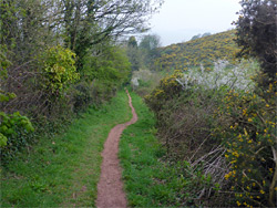
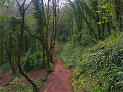
South of Maidencombe, the coast path rises through woodland and emerges to the edge of a field, where a gap in the adjacent hedgerow allows views of Bell Rock, 120 feet below. The field gives way to more extensive woodland and the path descends quite steeply by more steps, then crosses a patch of rough grassland and enters the woods again, followed by a descent to the lower end of the Valley of Rocks, once a dramatic, treeless ravine containing big cliffs and other shapely formations, but now completely enveloped by trees. On the far side, the path meets a vehicle track that leads downhill a way towards Watcombe Cove, which is similar to Maidencombe Cove in appearance, also with a small patch of boulder-lined sand overlooked by a patio and an unprepossessing stone building, staffed in high season. The village of Watcombe, and the A379, are a short distance uphill. The next section of the coast path climbs again, reaching a high point of 350 feet above Shag Cliff, then rounds several promontories before dropping down towards Torquay.