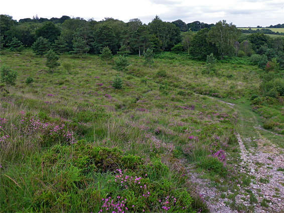
Heath, rough grassland and a spring-fed raised bog, home to rare plant species. Occupies part of Venn Ottery Common, overlooking the valley of the River Otter
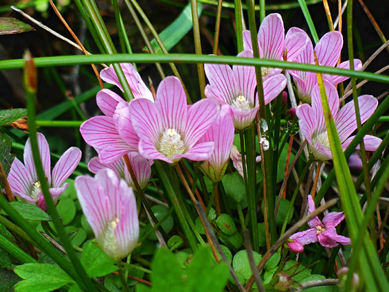
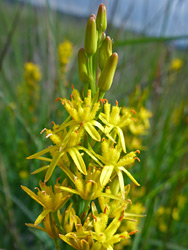
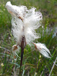
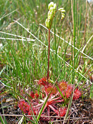
Venn Ottery Nature Reserve in east Devon takes its name from a nearby village, originally known as Fen Ottery, itself deriving from a patch of marshy land in the vicinity, and also from the River Otter one mile east, once home to a substantial population of otters. The 62 acre reserve contains heath, grassland and a raised bog, which supports a number of rare plant species including butterwort, bog asphodel, big pimpernel and round-leaved sundew. The habitat is also good for reptiles, with four of the six UK species resident (slow worm, common lizard, adder and grass snake), together with several dozen bird species.
The reserve is part of the much larger East Devon Pebblebed Heaths, a six mile-long ridge of high ground underlain by the Triassic-era Bunter pebble boats, thought to have been deposited by a large, fast-growing river originating in what is now Brittany, France. Devon Wildlife Trust also manage one other nature reserve on the ridge, Bystock Pools.
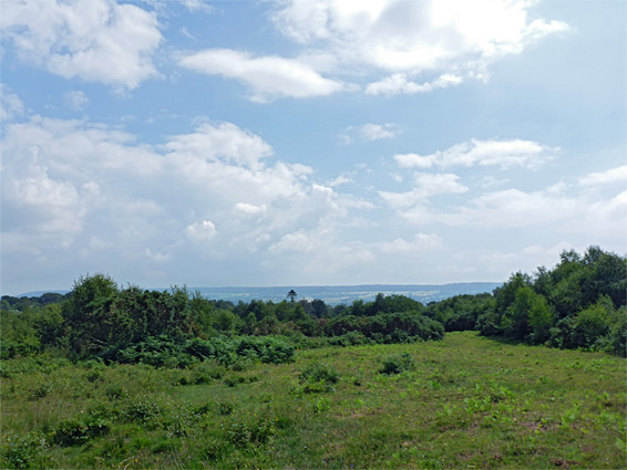
Despite the relatively low elevation (300 feet), the reserve is high enough for good views across the surroundings, especially east down the River Otter valley. The nature reserve adjoins a similar sized RSPB reserve, which also contains heath, all dry, and offers even better views. The land in both reserves is known collectively as Venn Ottery Common (a Site of Special Scientific Interset), comprising the northern half of Venn Ottery Hill. Neither is much visited, in part due to the rather remote location, though the RSPB is easiest to explore, and closer to the road. Paths cross the drier part of the nature reserve however most of the interesting plants are within the boggy section which is pathless, and difficult to traverse, because of tussocks, overgrown holes and marshy patches.
The nature reserve is accessed by an unnamed lane west of Venn Ottery village, linking with the B3180. The small parking area has an information board and map, beside a gated track into the RSPB reserve, used by farmers who graze cattle here. The track crosses part of a ridge, and a left fork descends a pebbly slope towards a belt of woodland along the west side of the reserve, then continues through the trees (which include a small pond) to a gate, and along the edge of an adjacent field to a second gate, at the entrance to the nature reserve, at its northeast corner. From here the path climbs again, southwards, later veering west towards the bog, which is fed by a number of tiny streams originating from springs along the south edge of the enclosure. The wet area is around 400 feet across, bordered by a strip of trees to the west, beyond which is a smaller field also containing springs and boggy ground.