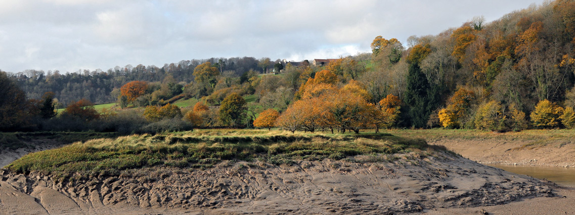
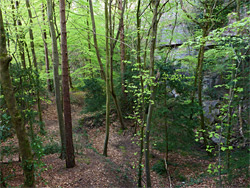
Lancaut Nature Reserve, one of the foremost wildlife areas in Gloucestershire, contains woodland and tall limestone cliffs around three sides of a tight bend along the valley of the River Wye - towards the lower end of the valley, 2 miles north of Chepstow. The site is named after the nearby settlement of Lancaut, now just a farm and a few houses, but significantly larger in medieval times, and one relic from this era is the ruined St James's Church, scenically situated towards the floor of the valley, next to the northern entrance to the nature reserve. From here, a 0.8 mile path follows the river downstream, initially close to water level then gradually rising, passing some abandoned quarry workings and a few side trails to the base of the cliffs, then exiting the woods on the valley rim.
Because of the generally south or west-facing aspect of the cliffs, and the varied habitats of riverside, forest, exposed rocks and grassy areas on the rim, the reserve is home to a much greater range of plants than might be expected from a predominantly wooded area, with about 350 species reported, and a good range of birds. The reserve also forms part of a site of special scientific interest, together with the adjacent Ban-y-Gor Woods, just upstream.
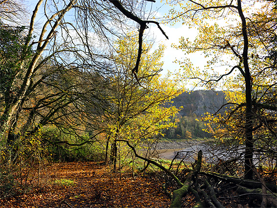
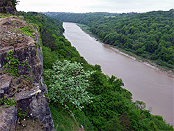
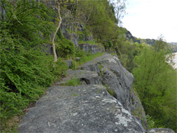
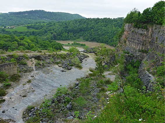
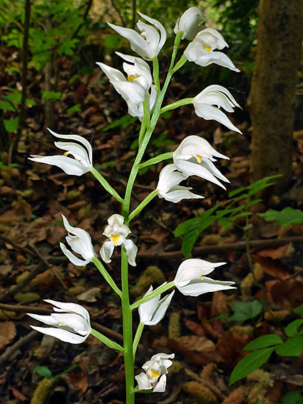
Lancaut is also notable for the views, up and down the dramatic, tidal river valley; more spectacular than most nature reserves. The best overall vista is from the valley rim rather than the main path, at a place known as Wintour's Leap, just off the main road north of Chepstow, where the cliffs drop vertically by several hundred feet. Most of the other land along the cliff rim is privately owned, and it is the main path that provides the only access to the reserve interior. Along the path, nearly all of which is through the trees, the plant selection is not so special; the majority of the rarer species are found in less accessible areas, across the cliffs and along the rim. Two orchids of note are bird's nest orchid, found in shady wooded areas, and sword-leaved helleborine, at the edge of clearings and paths.
The southern entrance to Lancaut Nature Reserve is just off the southern approach to Woodcroft, the B4228, 800 feet north of St Luke's Church - along Offa's Dyke Path a short distance, alongside a field, to a junction, marked by a Gloucestershire Wildlife Trust notice. The more popular north entrance is via a path from Lancaut Road, beginning a quarter of a mile west of the B4228, parking in a layby just before; the path descends gradually through woodland, passing an old limekiln near the start, then drops down more steeply alongside a meadow to the ruined church, just beyond which is a gate at the edge of the reserve. The Woodcroft entrance is approximately in the middle of the reserve; the southern half, extending towards Chepstow, and including all of Chapelhouse Wood, is inaccessible - pathless and fenced off, perhaps because most is very steep.
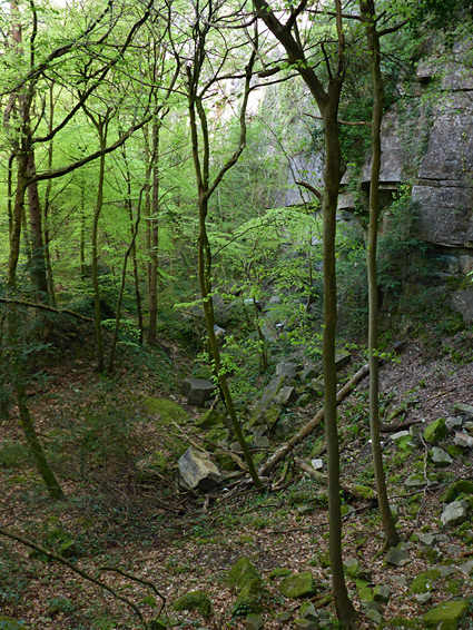
Starting in the north, the path runs right beside the river through a wooded area and rises slightly across the remains of the first of the Lancaut Quarries, used for limestone extraction in the 18th and 19th centuries. It then re-enters the woods, staying close to the water's edge for a few more hundred feet before starting a gradual climb, to pass a protruding, steep-sided spur. Around the top are several short side paths to the base of the cliffs, used mostly by rock climbers. In at least one place the cliffs rise via a series of ledges and slopes rather than vertical faces, allowing a relatively easy ascent above the trees for fine views over the valley, and continuing all the way up to the rim. The main path then descends, coming close to the river once more, crosses a corridor of big boulders from an ancient rockfall and climbs again, heading towards the southern entrance to the reserve. Shortly before is the main part of Lancaut Quarry, now completely overgrown and filled with full-size trees, though as recently as the early 1900s this was still in operation, and for several hundred feet north and south the valley sides had no trees, covered instead by spoil heaps, rock piles and excavations. The northern section of the wood, close to the ruined church, is by far the oldest.
The older quarries are along the base of the cliffs, and are now filled with trees, but higher up is a more recently abandoned excavation, Woodcroft Quarry, in use until the mid 20th century. This was originally accessed by a short track off what is now another section of Offa's Dyke Path (near Moyle Old School Lane), and although the entrance is closed off, and the site secured with barbed wire fence, the quarry can instead be entered from below, by walking up an unofficial path that branches off the main route through the nature reserve just north of the rockslide area, and it is the elevated rocks along the west edge of the quarry that give the best overall views, up and down the river valley. Once above the rockslide, the path leads up a gap between two cliffs, then ascends a little further above the rim of a deeper part of the quarry, up to a wide, flat ridge, then links with the former entrance track. The limestone ridge is also a good location for wildflowers, while the cliffs are another favoured site for rock climbing.