Midger Wood extends for about one mile along the northwest side of Kilcott Brook, a minor stream flowing through a relatively deep and narrow valley, towards the south side of the Cotswold Hills in south Gloucestershire. 22 acres is protected as a nature reserve while all is part of a Site of Special Scientific Interest, extending to include the similar Back Common and Whitewell woods on the opposite side of the stream. Most of the land is also within the Badminton Estate.
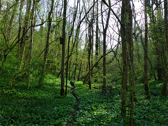
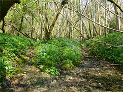
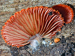
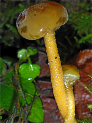
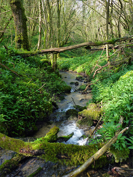
The environment in the valley is moist and secluded, shaded by tall trees, and the ground is densely covered by moss and ferns, mingling with fungi and wildflowers; although there do not seem to be any particularly rare plants here, some of the species are especially numerous, most visible in late spring, including bluebell, wild garlic, wood anemone, primrose and greater celandine. Other, less common species are herb paris, marsh marigold and lily-of-the-valley. Fungi, meanwhile, are especially numerous and varied.
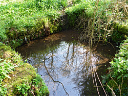
Added interest comes from the brook and its spring fed tributaries, which flow over limestone, dissolving calcium carbonate, which is deposited in the form of tufa, lining most parts of the water channels and creating little cascades and waterfalls. Several footpaths run through the woodland, the main one right next to the creek, and about two hours could be spent exploring.
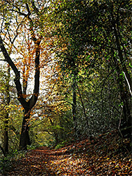
Like most nature reserves in the county, Midger Wood is not signposted from the nearby main roads. Access is along a minor road that forks southwest off the A46, 2 miles north of the A433 junction, leading to Lower Kilcott. Parking is available in a small layby on the south side after half a mile, or just beyond to the north, from where a track enters the woods, leading down to the stream, across via a ford and up the slope on the far side to the start of the path, marked with a Gloucestershire Wildlife Trust noticeboard. The path climbs a little at first, past another junction, then descends back to stream level, later crossing to the south side over a small bridge and entering Whitewell Wood, named after an ancient, stone-lined well next to the brook. The path then meets another track in the middle of an open area and curves round to the northwest, heading towards the upper end of the valley. Another route returns to the start point on the west side of the stream, staying quite high up.
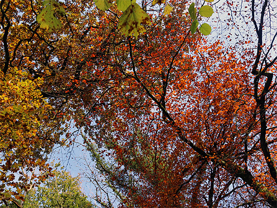
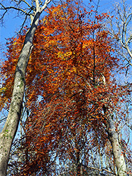
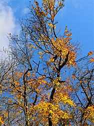
The trees in the valley are a mix of pedunculate oak, ash, hazel, beech and field maple, generally quite well separated. In autumn, the most colourful of the trees (beech) are best observed along the higher ground, in particular on the north side of the brook. The wood has for several centuries been managed as a coppice, trees being selectively cut down every few decades. One side effect, caused by more light reaching the floor, is an increase in the diversity of the undergrowth, which in turn attracts more wildlife. The woodland is home to significant population of dormice, a threatened species, though these are secretive and nocturnal creatures, so are rarely seen by the visitor. The trust has installed a hundred or more nesting boxes for the mice, fixed to tree trunks quite high above the ground. The SSSI also includes a meadow (Saddlewood Rough), on the north edge of the forested area, where a rather different selection of wildflowers can be seen.