Varied relics from the major Roman settlement of Venta Silurum, including a temple, forum, basilica, houses, and most spectacularly, extensive, unaltered and well preserved walls up to 17 feet high
The Romans established about a hundred towns in England and Wales, the majority of which grew into large cities though sometimes with few visible ancient remnants, while a lesser number remained small, and lightly developed. Such is the case for two (out of only three) significant Roman towns in Wales, both in the southeast; at Caerleon near Newport, and at Caerwent, 5 miles southwest of Chepstow.
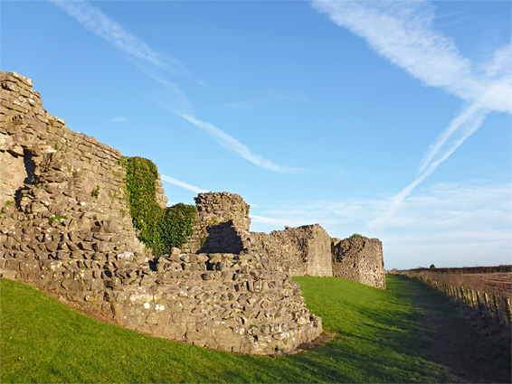
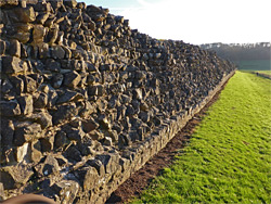
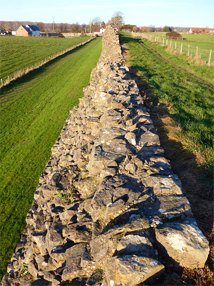
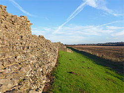
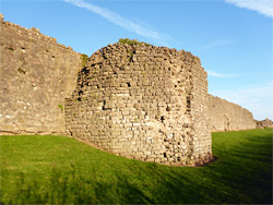
At its peak the town, originally named Venta Silurum, was a settlement of up to 3,000 people and several hundred buildings, covering an area of a quarter mile square and enclosed by thick walls up to 17 feet tall, and while a few dozen homes now occupy parts of the site, from the modern village of Caerwent, there are several large relics from Roman times including four main groups of wall foundations and, most spectacularly, the city walls. These are nearly complete along the south edge, where some parts rise almost to their original height, and are augmented by six polygonal towers. The walls date from the middle of the fourth century and are regarded as the best preserved example anywhere in Britain.
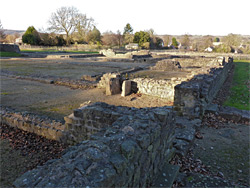
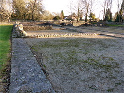
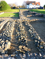
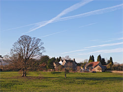
Besides their size, the good state of preservation and the colourful, aged masonry, the walls are made more impressive by their relative isolation, not near any modern development, looking south across a valley towards wooded hills. The building foundations towards the centre of the town are somewhat less spectacular, as they are low, and adjoin modern buildings, but the ruins are quite extensive, and varied: a temple, forum, basilica, a group of shops and a large dwelling, one room of which still has pillars from the hypocaust, an underfloor heating system.
Caerwent Roman Town is managed by Cadw, the Welsh heritage organisation, and entrance is free. The town lies just off the A48, which curves round the north side of the village, bypassing the original road through the middle. The settlement is centred on a north-south to east-west crossroads, with the old Roman townsite to the west, bisected by one of the roads, and most of the modern homes to the east. The designated parking area is near the west edge of town, from where all the ancient sites can be toured by a circular walk of about one mile, including all of the southern half of the city walls. Rather less of the northern walls remain though the course can also be followed, adding another half mile to the walk. Approximately half of the area of the original town is developed today; the remainder is farmland, with no trace of any ruins, though excavations have revealed that dozens of buildings one stood here.
Venta Silurum was built in a square, centred on the forum, and enclosed by the walls, beyond which were inner and outer ditches. The main entrances were through the east and west gates, along the modern day main road, while there was also a south gate and a smaller north gate. The Roman name of the town refers to the native Silures tribe that inhabited this region prior to the invasion in the first century. The town lies along the old Roman road between Glevum (Gloucester) and Isca (Caerleon), and was primarily a residential centre rather than a defensive position. The earliest structures include the basilica, forum and houses; the walls were added towards the end of the Roman period, in the fourth century, less than 100 years before all Roman legions left the country. Following the departure, the town was inhabited by the local Welsh population and became an administrative centre for the newly formed kingdom of Gwent, but the place remained small, with only limited later development.
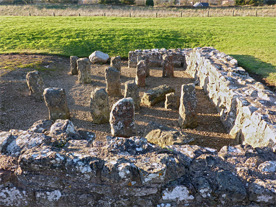
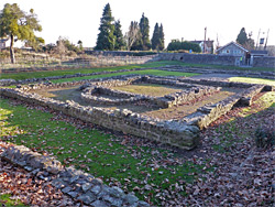
A short walk northeastwards from the parking area leads to the closest two Roman sites, the first a courtyard house of at least 16 rooms (one containing the hypocaust blocks, or pilae), arranged around two grassy courtyards. Like all the foundation sites, the walls were uncovered only by recent excavations, and the tallest wall is about two feet. The dwelling was probably a farm, built early in the fourth century, replacing an existing residence. Some parts of the site are buried under adjacent gardens, though the majority borders open grassland. One hundred feet south is another group of walls, remains of a row of fourth century shops and houses. About 12 rooms can be identified, and again the structure extends below modern buildings, to the east. Another path from the carpark heads north then east, following the city walls, while the other two main building sites are a little further east, on the far side of School Lane, a residential street. The largest is the forum-basilica; the former was the main administrative centre of the town and the latter was an assembly hall, or court. Most of the walls of the basilica are visible, including several rectangular rooms of different sizes, and some adjoin the west edge of the forum, though most of this structure is buried beneath a large house, currently unoccupied. A short distance southeast is the final site, the temple, constructed around 330 AD. Its foundations are complete, and include a cella, the innermost and most sacred enclosure, complete with semi-circular alcove. This was enclosed by a walkway (ambulatory), which was in turn surrounded by the temenos, or outer enclosure.
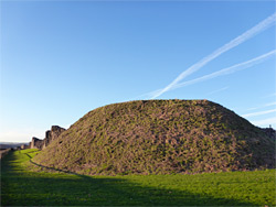
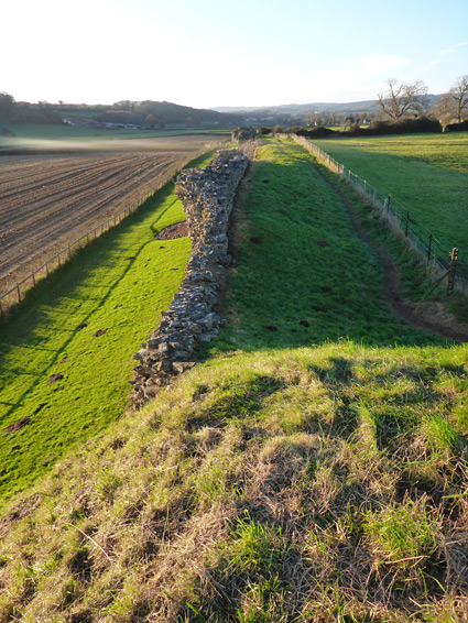
About half of the north wall remains, including three of the original five support towers, along with all of the eastern wall, however the best sections are to the west and particularly to the south; visited by walking westwards from the car park along the road for a short distance, to the site of the west gate, and then south, east and north, returning via the road. The wall can be followed either above or below; the best views are on top though the lower route gives a better perspective of the size and intricacy of the structure. The six south-facing towers have varying states of completeness, and at least one is still as high as the walls, around 15 feet. There is one incongruous feature at the southeast corner, where the two perpendicular walls lead into a motte, a circular, earthen mound that was built by the Normans sometime before 1100, once supporting a small wooden fort.