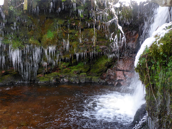
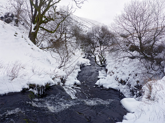
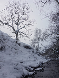
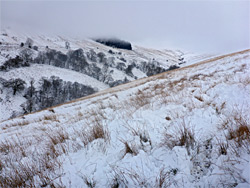
Nant Ddu is one of numerous streams that flow down the wide, U-shaped valleys that surround the hills of Brecon Beacons National Park, and like most of the others it contains a number of small waterfalls, separated by open or tree-lined stretches of water containing boulders, pools and lesser cascades. The falls in these upper valleys tend to be smaller than those of Waterfall Country on the south side of the park - generally in the range 5 to 15 feet tall, but they are still pretty, especially in winter when the higher elevations make the scenery more likely to include icicles and frozen pools. Nant Ddu has at least five significant waterfalls, over a distance of a little more than one mile, and is quite easy to explore even though there is no path along the valley, and the stream needs to be crossed several times. Snowfall can make winter visits more challenging, since the valley sides are fairly steep, and the stream sometimes flows through shallow enclosed channels, harder to negotiate in icy conditions.
The Nant Ddu is a tributary of the Taf Fawr, the main river through the central Brecon Beacons, followed by the A470; it flows through the second valley south of Blaen Taf Fawr, the somewhat smaller stream that runs alongside the busy path to Pen Y Fan. The one-way distance to the upper end of the waterfall section is 2.5 miles, though the valley could also be explored as part of a longer loop hike incorporating one of the adjacent drainages, both of which also contain waterfalls - Nant Crew to the north and Nant Llysiog to the south, also involving a brief walk along the ridgeline to the east, the top of which gives spectacular views of the high peaks, and of the Taf Fechan valley further the east.
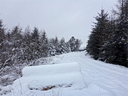
The lower end of the Nant Ddu valley, around the Coed Owen bunkhouse, seems to be privately owned, and the closest parking area is 0.7 miles south (5 miles north of Merthyr Tydfil) along a side road to the east, once part of the main highway before construction of a bypass and new bridge over a stream, the Nant Llysiog. The side road goes only a short distance, to a gate, beyond which is a farm track leading uphill, through two more gates, while rising above the Nant Llysiog valley, then curving back west and entering a conifer plantation. It continues another 0.8 miles, past walls of closely-spaced trees, before degenerating to a path, which descends slightly to a fence that marks the start of open land, now on the eastern side of the valley of the Nant Ddu. A fainter heads up the valley, staying about 350 feet from the stream, and another route follows the ridgeline to the east, while the valley floor can be reached by a short walk downhill.
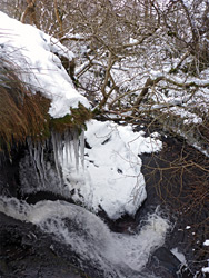
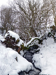
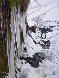
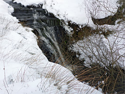
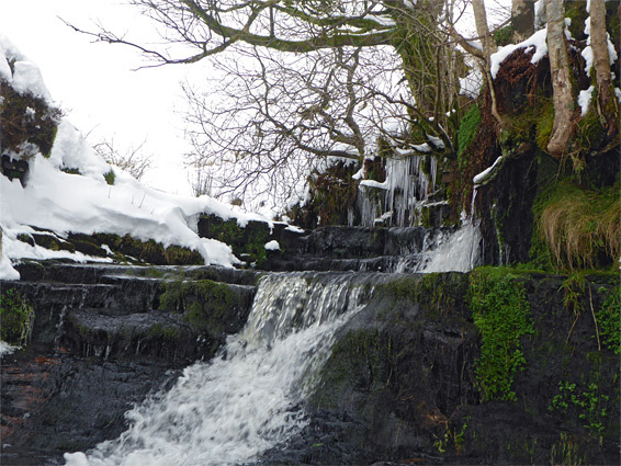
There is no trail by the stream, but following the drainage is generally straightforward, crossing where necessary to avoid some steeper slopes. The first waterfall, reached after a few minutes, is perhaps the best, a drop of around 15 feet into a pool, enclosed by reddish, moss-covered rocks, at the head of a short cliff-bound section. The next, a quarter of a mile beyond, is similar in size and appearance, situated on a slight bend in the creek. In between the two are the low walls from an old sheepfold. The second waterfall marks the approximate edge of the belt of trees along the stream; the other, somewhat smaller falls are in more open terrain, and the drainage is no longer entrenched. One of the upper falls has a sizeable overhanging ledge on the west side, dotted with many icicles in freezing weather.