The Nant Llech is a short river along the south edge of Brecon Beacons National Park, flowing westwards from the hills of Forest Fawr and joining the River Tawe after about five miles. Most of the upper reaches cross open slopes and grassland, but the lower section is confined within a thickly wooded, steep-sided valley, formed as the stream tumbles over a ledge formed by a resistant band of sandstone known as Farewell Rock, and has eroded deep into the softer sedimentary layers beneath.
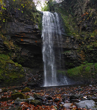
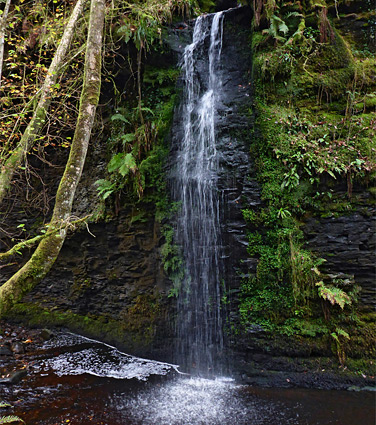
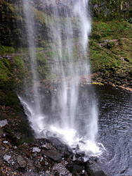
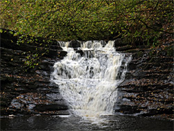
Farewell Rock is exposed at this location due to a geological fault, and at the head of the valley the river drops vertically by 90 feet, creating the highest waterfall in south Wales; Sgwd Henrhyd, or Henrhyd Falls. Upstream, the drainage basin is relatively small so in drier periods the waterfall is reduced to a few thin trickles, but for most of the year it is a broad, continuous, whitewater column.
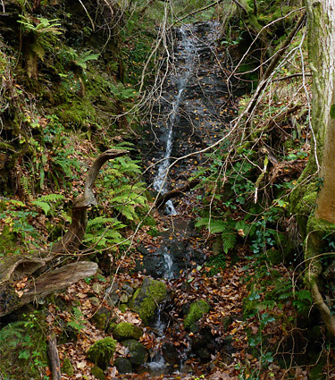
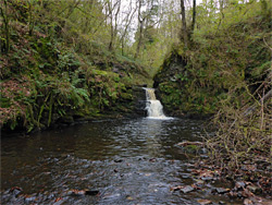
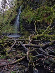
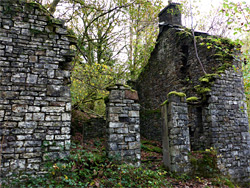
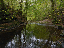
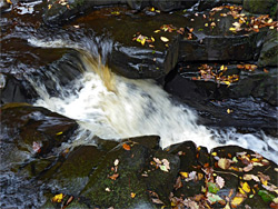
Henrhyd Falls are quickly reached, by a 0.2 mile path that descends 150 feet and heads upstream a short distance to the pool at the base. The cliff is undercut, allowing visitors to walk along ledges right behind the waterfall, similar to the better known Sgwd yr Eira, near Ystradfellte. Most people see only the waterfall, but the valley below can also be explored, along a 1.5 mile trail that leads to the River Tawe. For about half of the way the path stays some way above the valley floor - up to 150 feet - while the reminder runs close to the waters. The river flows over at least four other significant falls, all pretty though much less tall than Henrhyd, and there is another, higher drop formed by an unnamed tributary on the south side. Between the falls are cascades, pools and short cliff-lined channels, all enclosed by overgrown, forested slopes, the stream often partially blocked by boulders and fallen tree branches. Also of interest is a ruined stone building from an ancient watermill, Melin Llech.
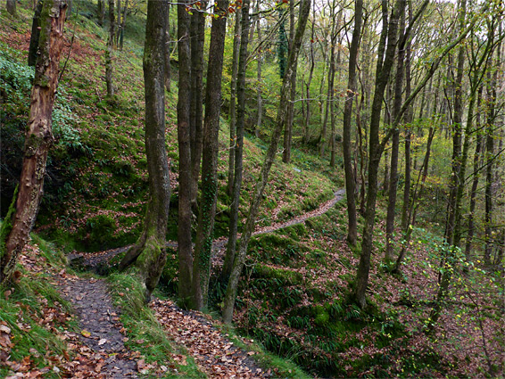
The path is quite steep in a few places and usually muddy since the soil is clayish and the tall trees block most sunlight, so any rain that falls on the slopes evaporates only very slowly. The round-trip distance to Henrhyd Falls and downstream to the River Tawe is 3.4 miles.
Henrhyd Falls is signposted from the nearby A4109, reached by two narrow lanes, from Coelbren and Dyffryn Cellwen. A small, free parking area managed by the National Trust is located on the north side of the river, which in the vicinity of the road crossing is still flowing across farmland; the sudden drop into the wooded gorge is 300 feet downstream.
Henrhyd Falls
The path from the carpark soon reaches the brink of the valley and descends steeply to the floor, crossing to the south side on a footbridge, climbing again via a flight of steps to pass a brief cliff-lined section and dropping back down to the boulder-strewn basin below the falls. Ledges allow access to the cavity behind the water, and there are plenty of vantage points offering views of the waterfall from different angles. A steep gully can be used as a route up to the southern rim of the gorge, though it is not possible to see the waterfall from above as the adjacent land is privately owned and fenced off, on both sides of the river.
The path along the valley is all along the north side of the river, initially quite close to the water level, alongside one stretch where the stream flows beneath a vertical, moss-covered cliff and over a six foot cascade into a large pool. The valley then narrows somewhat and the trail rises, through tall trees of oak and ash, and in another few minutes passes high above a 30 foot waterfall (informally named Needle Falls) formed by the tributary on the south side, dropping over a black cliff. There is no designated route though the falls can be reached by scrambling down the steep, slippery, overgrown slope. The river hereabouts flows over boulders and through pools, lined by many tangled, fallen branches.
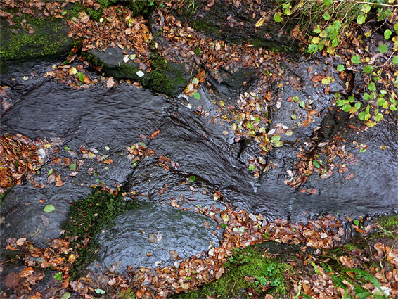
The trail stays far above the river for a while longer, passing a gate that marks the boundary of National Trust land, soon followed by a bridge over a minor tributary stream, and then an old landslip area, beyond which the track angles downwards, back towards the valley floor, coming right beside the stream next to the ruins of the Melin Llech watermill, where the principal relic is a roofless stone house. Just upstream is a pretty cascade over a curving, thin-layered sandstone exposure, with several other small falls a little way below. A bridge crosses the river at Melin Llech but does not seem to lead anywhere. The path continues, rising slightly to a junction, where the right fork climbs to a minor road and the left branch drops back down, past one final waterfall then also reaches the road, which can be used as a return route; this leads to the parking area in 1.3 miles. The final section of the path, beyond the road, moves away from the stream and soon arrives at the River Tawe, where a footbridge leads to other paths on the far side.