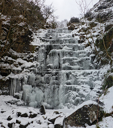
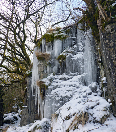
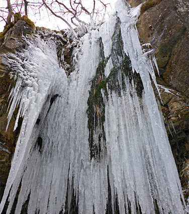
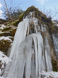
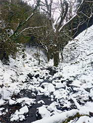
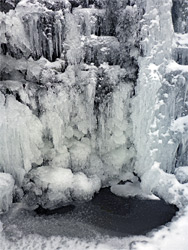
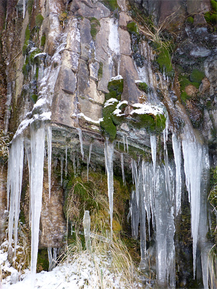
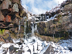
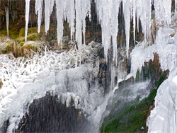
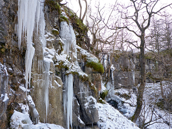
Away from the most spectacular cascades, in Waterfall Country around Pontneddfechan, Brecon Beacons National Park contains many smaller, less well-known waterfalls, still pretty, such as two at the upper end of the Afon Crawnon, a short tributary of the River Usk southwest of Llangynidr. The Crawnon flows through a straight valley on the east edge of the central Beacons, ending in a wooded basin where the land slopes steeply on three sides, up to the grassy plateau above. The hillsides are thickly wooded, part of a conifer plantation, and conceal one waterfall, Pistyll Crawnon (an unofficial name), at the upper end of the main river, and a second along a south side tributary, the Nant Pyrgad. The former is a single drop, of around 30 feet, while the latter is a series of stair-like cascades; neither are especially dramatic, but quite impressive after wet weather, and like all such falls, they are very pretty when frozen in the winter. There are also several smaller cascades in the vicinity.
The two falls can be approached either from the north, via the narrow road up the Afon Crawnon valley, or from the south, along a road from Trefil. The round-trip walk is between three and six miles, depending on the route. Off-trail scrambling is needed, for both the main waterfalls, as although various paths and tracks across the hills, they do not come within sight of the sections of the streams where the falls are located.
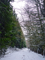
The northern approach is along a narrow lane southwest of Llangynidr - after 4.5 miles, shortly before the road ends at a farm, it crosses the Nant Pyrgad close to the Afon Crawnon confluence, and the edge of the adjacent field has parking space for perhaps a couple of vehicles. From here a track heads southeast close to the stream, rising to the plateau above, and coming close to the waterfall near the upper end, while the lane leads to a path that ascends the slope at the west end of the valley and can be used to reach Pistyll Crawnon. The southern approach, described below, starts from the road north of Trefil, 1.5 miles from the Heads of the Valleys Road (A465) near Tredegar. The Trefil road leads all the way to the plateau above the Crawnon valley, though just beyond the village it is closed to public vehicles, instead open only to trucks serving a nearby quarry, hence the approach has to be on foot, parking just before a barrier at the start of the private section.
Beyond the barrier, Trefil Road is paved for another mile, up to a turning on the right used by most of the quarry trucks, and then unpaved. After 1.4 miles it reaches a second junction (marked by a stone obelisk), with a lesser track, the route that descends into the valley of Nant Pyrgad and meets the road from Llangynidr, after 1 mile. In about half a mile it crosses a small tributary that forms a little waterfall, but stays mostly out of sight of the main drainage, of which the most interesting section is the upper quarter of a mile, where the stream is enclosed within a steep-sided gorge below an escarpment known as Darren Ddu. The easiest way to see this is to leave the track as it enters the upper edge of the forestry plantation, following a minor gully down to the stream and heading up the gorge, past a few cascades, through one narrow place and up to the base of the main Nant Pyrgad waterfall; an enchanting series of falls and pools, between quite steep slopes. Scrambling up the bushy hillside, on the north side, leads to the uppermost section of the gorge, containing two minor falls, before the stream is crossed by a fence and a path, which leads back towards the forest track.
The main track, from Trefil, veers west then southwest, close to the rim of the Crawnon valley, and eventually enters another quarry. It is paralleled by a path, formerly a tramway, which, one mile from the junction with the Nant Pyrgad track and after passing a few old limekilns, crosses the very upper end of the Afon Crawnon, directly above the waterfall, though this is largely out of sight owing to a line of low cliffs with bushes on top. There is no marked path, but the falls can be reached by a short climb down, starting about 300 feet back, followed by a traverse at the base of the cliffs, a route that is more obvious from below than above. Alternatively, a longer though perhaps easier approach is to continue along the path for a few minutes and descend an old track into the forest, later walking across the hillside to the stream, and climbing back up to the falls. Below the cliffs, the drainage flows down a boulder-covered slope without forming any other significant waterfalls.