Narrow, cliff-lined limestone peninsula at the northern tip of the Somerset coast, home to a few rare plant species and site of several historical relics, most visibly a 19th century fort
Location
North end of Warren Road, 8 miles from Burnham-on-Sea; TA8 2RS
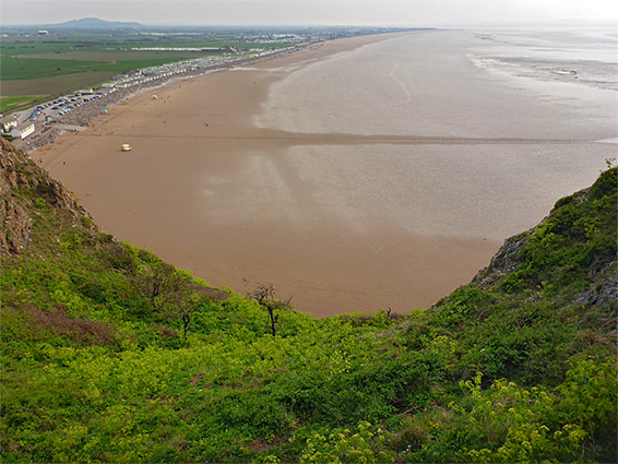
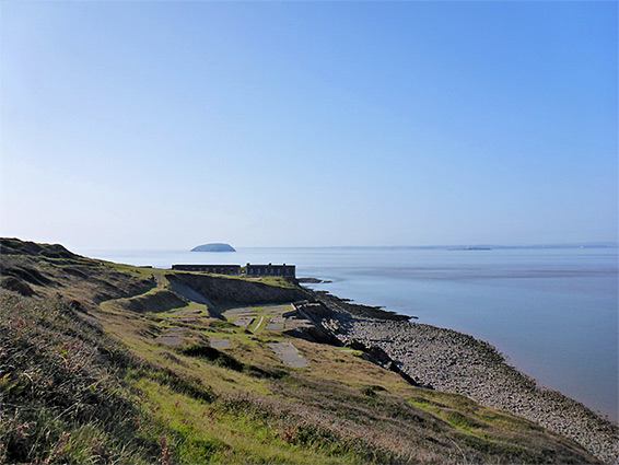
Like Middle Hope, a few miles north on the far side of Weston-super-Mare, Brean Down is a tall, narrow, flat-topped peninsula, projecting seawards by 1.5 miles, formed of the same limestone bedrock visible most prominently in the nearby Mendip Hills, and it is the most scenic part of the eastern coastline of the Bristol Channel, the majority of which is formed of mud and sand, lined by grassy flats.
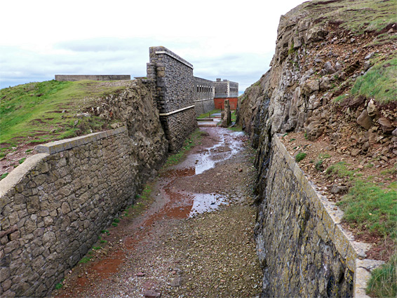
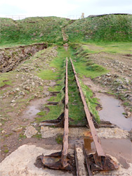
The prominence, and the commanding views over the estuary, has resulted in a long history of use as shown by such archaelogical sites as the foundations of an Iron Age fort, relics from a Roman temple, ditches from a prehistoric field system, several ancient cairns and tumuli, and, most visibly and recently, the ruins of a fort; a sturdy set of buildings right at the tip of the peninsula, constructed in 1865 to counter the supposed threat of Napoleonic invasion, then expanded and reinforced during World War II.
The limestone cliffs are rich in fossils, the pebble beaches at their base provide many peaceful fishing places, and the grassy hills are home to a wide range of plants including a few rare species like dwarf sedge, white rock-rose and Somerset hair grass. About two hours is needed to walk the main path and see the fort, but all day could be spent exploring along the base of the cliffs, or just relaxing on the sandy beach to the south.
Although just one mile from the popular beach at Weston-super-Mare, the parking area on the south side of the down is nine miles away by road, since this part of the coast is cut off by the River Axe, which is not bridged for several miles inland. The one road approaches from the south, from Burnham-on-Sea and Brean, passing holiday homes and caravan sites, and ending beside a cafe and carpark at the foot of the cliffs. Like all other beaches along this part of the coast, the closest 300 feet or so is formed of firm sand but beyond all is sticky mud, extending another a mile or more at low tide.
The Shoreline
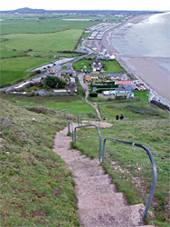
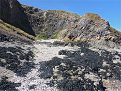
Along the south side of the peninsula, closest to the road, the cliffs form a number of little inlets and gullies, with pebble beaches beneath, but further west the ground becomes muddier and rockier, and the cliffs are replaced by steep slopes, so the shoreline is not so scenic. The north side has more rock formations but is generally less accessible, while also on the south side are several short rock climbing routes, but most visitors just see the top of the peninsula, which is accessed via a set of steps from the parking place at the end of the road, or less steeply by a wide track a short distance east, the original road to the fort.
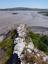
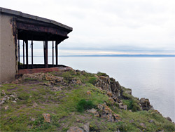
After climbing the steps, a 2.3 mile loop can be made by walking west along a path that runs right on the ridgeline, returning along the parallel old road, a little way downhill on the north side. The path rises gradually to an intermediate summit (250 feet) then dips and ascends again to the actual highpoint, 318 feet. Around here are a few grassy ditches from the ancient field system. The views extend north not too far, only to the similarly-shaped peninsula of Middle Point, but much further to the south, along the north Somerset coast, and west to Wales. The last section of the path descends steeply to the fort, which is quite an extensive complex that includes various emplacements to the north and south, and the main section right at the far end of the peninsula, separated from the rest of the land by a cliff-lined ditch, and entered only via a bridge. At low tide, the limestone bedrock extends for another quarter of a mile but re-emerges above the water 3 miles west to form the isolated island of Steep Holm. The eastern end of the peninsula is also scenic; from the top of the steps, a path follows the ridgeline for 0.4 miles, ending above a rocky spur and a hidden, pebble beach, overlooking the mouth of the River Axe. Close by, to the north, is another secluded, pebble-lined inlet, and various inclined limestone formations.
Brean Down Fort was one of series built along the south coast of Britain following an 1860 parliamentary report headed by the Prime Minister Lord Palmerston, which identified a growing threat posed by the expansion of the French Navy. The threat did not materialise, and none of the forts saw any action, but the structure at Brean was kept in good condition, though it did sustain damage following a gunpowder explosion in 1900. The fort was occupied for a while as a private residence, then reclaimed by the military at the start of World War II. Guns were installed in the existing emplacements, and several outlying defences were added. The site was decommissioned soon after the war and transferred to National Trust ownership in 2007 along with all of the peninsula, the bulk of which was acquired in 1954.