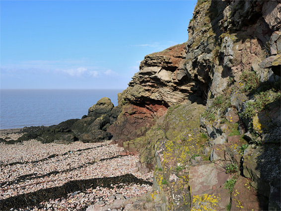
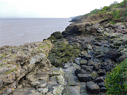
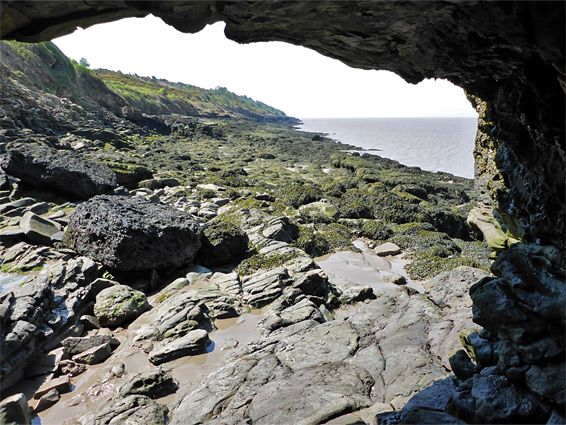
Apart from a short line of cliffs near Aust, the four miles between Clevedon and Portishead is the northernmost rocky section of the eastern Bristol Channel coastline, a mix of low cliffs, wave-cut terraces and pebble beaches, formed of sandstone and mudstone coloured muted shades of grey, red and green. Further south, the land beside the channel is a less-interesting stretch of mud flats, dunes and fields; the next rocky outcrop is at Middle Point, five miles from Clevedon. The Portishead shoreline is still not especially scenic, as the cliffs are no more than about 30 feet high and the intertidal area is narrow, mostly filled with jumbles of muddy, seaweed-covered boulders, but there are still some photogenic locations including a lighthouse, several rock-lined inlets, and patches of ancient woodland.
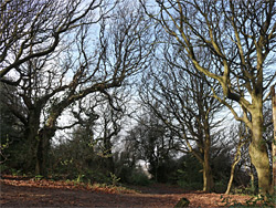
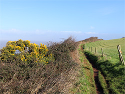
The northern half of this stretch of coast is part of a developed neighbourhood, of houses and parkland, while the southern two miles is rural, adjoining grassy fields. All is followed by the Coast Path, the majority of which runs right at the brink of the cliffs, and the best section can be viewed on a hike of 3.5 miles, from Nichols Road on the west side of Portishead, to Ladye Bay at the north edge of Clevedon. The coast can also be explored below the cliffs, though extended walks here are not particularly easy, owing to lengthy expanses of slippery boulders; better is to stay on the path, climbing down if desired to see particular areas. An intermediate destination is Charlcombe Bay, 1.5 miles from Portishead, the largest inlet along this part of the coast; a sloping beach of light-coloured pebbles between jagged, quite colourful rocks.
The walk can begin in Portishead town centre, alongside the muddy expenses of Woodhill Bay and Kilkenny Bay, or a little further west, as here the shoreline is rockier and slightly more scenic, and a suitable parking place is along the unpaved north end of Nichols Road, a residential street off Nore Road. The coast path hereabouts, between Portishead and Clevedon, is part of the Gordano Round, a 27 mile circuit that also crosses the hills around Clapton in Gordano, south of the M5.
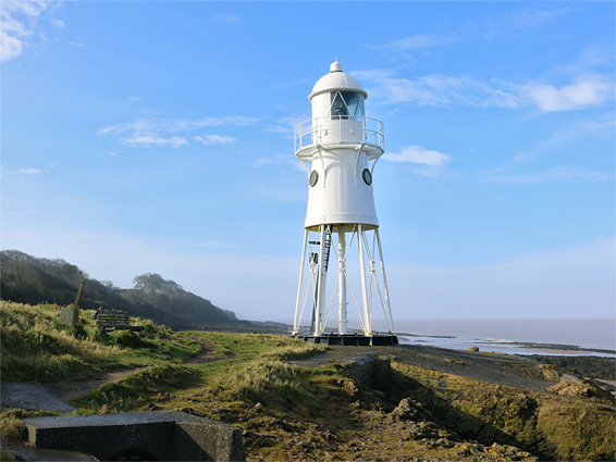
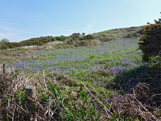
The westwards path from Nichols Road runs along a narrow strip of land between the coast and the lower edges of the adjacent gardens, initially round a little bay and past a few tiny ravines then out to Black Nore Lighthouse, a handsome, white-painted structure constructed in 1894 and disused since 2010. After here the coast bends southwestwards and the path leads through more wooded surroundings for half a mile to the narrow inlet of Redcliffe Bay, part of a short section of the coast managed by the National Trust. Just beyond is the edge of the suburbs, followed by an underground fuel storage depot and finally open countryside, and the path continues to Chalcombe Bay, the most scenic part, surrounded by slightly taller cliffs, though still only about 30 feet. Next is Walton Bay, beside a caravan park, and then Pigeon House Bay, as the coast becomes straighter, the cliffs lower and the intertidal zone narrower. Ladye Bay at the edge of Clevedon is one mile further, along a little-changing stretch where the path runs just above a narrow, lichen-covered rocky terrace that provides an alternative walking route, though this is interrupted a few places by little ravines.