The coastline around Barry - Jackson's Bay, Whitmore Bay, Watch House Bay and Pebble Beach - a mix of golden sand, grey limestone terraces and red mudstone cliffs
Parking
Barry Island carpark; CF62 5AH, or (free) Redbrink Crescent; CF62 5TU
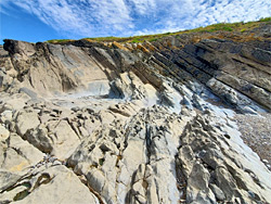
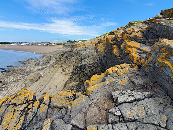
Although mostly famous for its pleasure park and sandy beaches, Barry on the Vale of Glamorgan coast is also notable for the varied rock formations along the shoreline, a mix of grey limestone and red mudstone. The limestone forms most of the intertidal zone, and is eroded into terraces, pinnacles and innumerable rock pools, while the mudstone is exposed as a line of layered cliffs above the easternmost of the town's four beaches, Jackson's Bay.
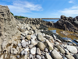
To the west, the broad peninsula of Nell's Point separates this from the most popular beach, Whitmore Bay, overlooked by the pleasure park and bordered to the west by the similar Friars Point, on the far side of which is the muddier Watch House Bay and then Cold Knap Point, another limestone headland. Beyond this is the westernmost beach - Pebble Beach, which has no sand, only light grey pebbles, typical of the coast for several miles further (see Barry to Aberthaw).
The walk from Jackson's Bay to the near edge of Pebble Beach is 2.5 miles, mostly along the coast path, with the option of returning along roads, to make a round trip of just less than 4 miles.
Friars Point and the area just inland ('Little Island') is mostly undeveloped, as are the tips of Nell's Point and Cold Knap Point, otherwise all the land is built up, as residential suburbs, constructed in the early and middle 20th century; before this nearly all lay empty, albeit with a number of ancient sites, not all of which are still visible. In less than a mile, from Jackson's Bay to Friars Point were two chapels, a well, several tumuli and an abbey (Peiro's Abbey), indicating a very long history of habitation at this location.
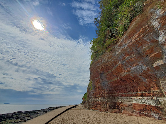
The port of Barry and its associated industrial sites extends over 2 miles west to east, necessitating a lengthy diversion if walking along the coast. To the east, the accessible section ends at one of the two breakwaters at the entrance to the port (see Sully Bay to Barry), then resumes on the far side at Jackson's Bay, the eastern edge of which is bordered by the other breakwater. This bay is reachable by a short path down from Redbrink Crescent, site of the 14th century St Baruc's Chapel, one of the ancient structures that once overlooked the sea. The bay is backed by red cliffs of Mercia mudstone, up to 70 feet high, crossed by lighter-coloured strata and partially covered by bright green vegetation; all very photogenic. The beach is sandy and well sheltered by the cliffs; it straddles the border between the mudstone and the limestone, this latter exposed to the west as a band of terraces that form the edge of Nell's Point, the promontory that separates the bay from the next beach (Whitmore Bay).
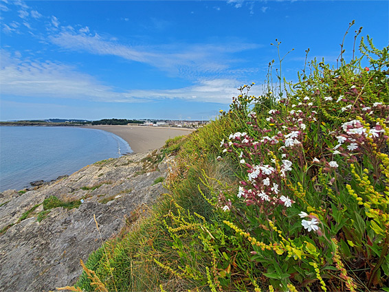
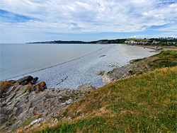
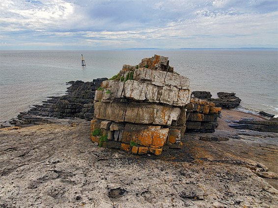
Whitmore Bay, also known Wickmoor Bay, is the most popular beach at Barry, and is entirely sand, sometimes attracting many hundreds of people on busy summer afternoons. The narrower headline to the west, Friars Point, is named after the old abbey that once stood above the bay; other evidence of its ancient occupation are a series of Bronze Age burial mounds at the southern tip. Like Nell's Point, Friars Point is lined by a sloping band of exposed limestone, with some higher cliffs along the west side, made more colourful by a covering of bright orange lichen, and home to abundant wildflowers including sea thrift, silver ragwort, rock samphire and rock sea lavender.
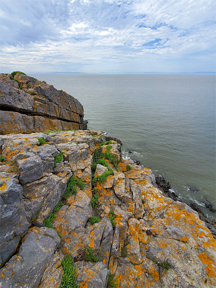
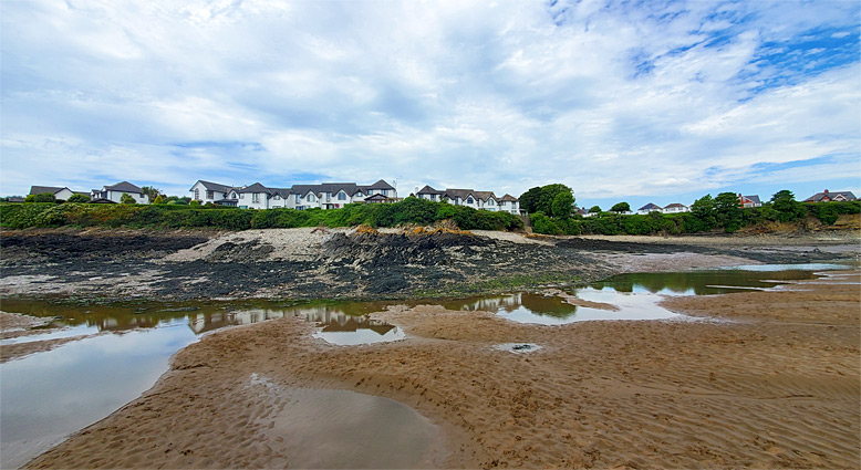
The beach on the west side of Friars Point, Watch House Bay (or Barry Harbour), is partially divided by a breakwater; its upper reaches transition to muddy salt marsh, while the remainder is mostly sand, crossed by a small stream along its west edge, overlooked by a line of houses. The north side of the bay has some low red cliffs, formed of siltstones and marls. The headland nearby, Cold Knap Point, is also surrounded by blue lias (limestone) formations, not as extensive, and giving way abruptly to the rounded cobbles of Pebble Beach, start of a largely sandless stretch of the coast that extends for many miles.