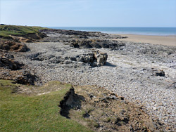
Ogmore-by-Sea is a quiet village at the west end of the Glamorgan Heritage Coast, at the mouth of the River Ogmore, on land which slopes down moderately steeply to a sizeable sandy beach, up to 700 feet wide at low tide, bordered by a narrower strip of low limestone terraces. More extensive sands continue northwestwards on the far side of the river, merging with the grassy dunes of Merthyr Mawr National Nature Refuge. The beach is popular, due to the clean sand, the easy access and the proximity to Bridgend, five miles away on the B4524, and while not particularly photogenic, the coastline does become more interesting to the east. The sands extend for one mile, interrupted in a few places by successively wider limestone outcrops, and then stop as the band of rocks becomes narrower but higher, forming a line of medium-height cliffs interrupted by several deep and narrow fissures, eroded inwards to form caves. These in turn lead to a region of higher cliffs, also containing a few caves, below which, close to water level, are more eroded platforms, a few sandy coves and occasional sea stacks.
At low tide, 1.7 miles of the shore can be explored, from the River Ogmore to a section where the base of the cliffs is permanently below the water, a point which can be approached from the far side by walking west from Dunraven Bay, the next easily-accessible place along the coast. The best features in the vicinity of Ogmore-by-Sea are the caves and the terraces, some of which are deeply eroded into an array of jagged shapes.
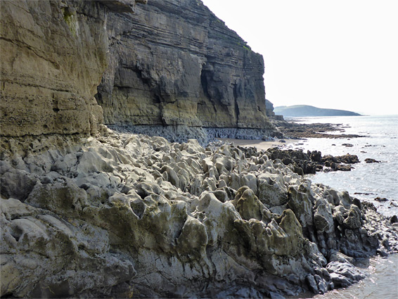
The oldest of the sedimentary rocks along this part of the Vale of Glamorgan coast is greyish carboniferous limestone, which contains many tiny fossils. Above this, after an unconformity representing around 80 million years, is the yellowish Sutton stone (another variety of limestone), somewhat less resistant. The carboniferous limestone accounts for the low rocks towards the river, the cliffs just beyond containing the fissures, and the wave-cut terraces further east, while the Sutton stone forms the taller cliffs above this section. In some westerly locations the limestone is overlaid by a layer of reddish, coarse-grained conglomerate, from the Triassic era. To the east, the Sutton stone gives way to the thinner strata of the Southerndown beds, seen more readily in the vicinity of Dunraven Bay.
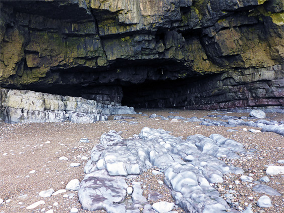
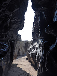
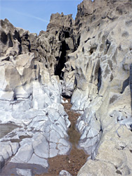
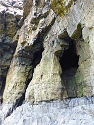
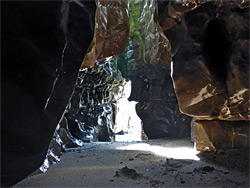
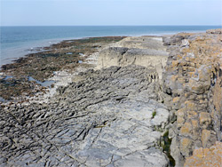
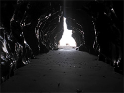
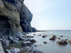
Metered parking is available on the northwest side of town, overlooking the lower end of the River Ogmore. From here, the main beach, bordered inland by flattish limestone exposures, stretches a mile southeast, before the sands fade away as the low tide line moves closer to shore, and the coastline is formed by the band of limestone cliffs up to 30 feet tall, with, for the next quarter of a mile, a mix of boulders, pebbles and small sandy beaches along the base, much of which are only visible at the lowest tides. The top of the exposure is a flat and unvegetated plateau up to a hundred feet wide, partly covered with lichen. The coast path runs over grassy slopes a little way above, across the overlying Sutton stone. The plateau is split by at least six major fissures, eroded at sea level to form caves, one of which divides and links with an adjacent fissure. All the caves have smooth sandy floors and wave-polished sides, in places coloured reddish or greenish. The plateau ends quite abruptly as the exposed rocks drop steeply down to water level, and the land above rises quickly, creating cliffs (of Sutton stone) up to 100 feet high. From here on, the sea level rocks are only accessible for a few hours either side of low tide.
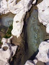
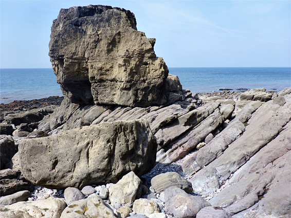
Features just beyond the end of the plateau include a cave, a small beach, and a pretty, transverse fissure between sheer, barnacle-covered walls, always containing water. Over the next half mile are a few more sandy or pebbly areas, between larger limestone platforms, their surface heavily eroded into jagged, sharp-edged fins and pinnacles, very different to the sheer, homogenous cliffs that rise vertically above. Some of the grey limestone is crossed by thin reddish veins. Along the cliffs are a large arch, a few major cavities and several more caves, one splitting into two openings, and another (Fairy Cave) especially wide and deep, extending back around 200 feet. East of here is a wide area filled with jumbled boulders, and an isolated sea stack, before the site where the base of the cliffs is permanently submerged, beyond which the coast can be followed no further.