Old Sarum was the original settlement of Salisbury, in Wiltshire, occupied for many centuries until the city moved to its present location in the early 13th century, being known officially as New Sarum until as recently as 2009. The old city is just 2 miles north of the modern centre, in rural surroundings close to the River Avon, and is set on a broad hill that affords long distance views over grassy fields and patches of woodland.
Sarum has a long history of use, starting in prehistoric times (around 3000 BC, contemporary with nearby Stonehenge and Avebury) and successively occupied by Iron Age peoples, the Saxons, the Romans and the Normans, culminating, at the end of the 12th century, in a flourishing, walled city centred on a castle, and also incorporating a fine cathedral. The place declined rapidly following the decision in 1218 to build a new cathedral to the south, due to disagreements between the bishop running the church and the sheriff in charge of the town; many of the residents swiftly moved to the new site, dismantling the majority of the old structures for use in the new town, and Old Sarum was mostly abandoned by the late 1200s.
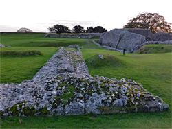
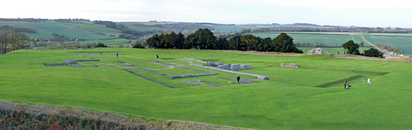
Today, the two main visible remains are the castle and the cathedral, however the position of the latter is shown only by foundations, and the former is also much degraded though the walls are still substantial. The castle lies at the centre of the site, surrounded by an inner wall, moat and ditch, while outside and somewhat lower is the main townsite, where only the cathedral walls remain. All this is enclosed by an outer wall and ditch, which was in turn, yet further from the centre, surrounded by a turreted city wall, of which a few low ridges remain. The whole townsite is large, around 45 acres, yet there is perhaps less to see than might be expected, given its long and varied history.
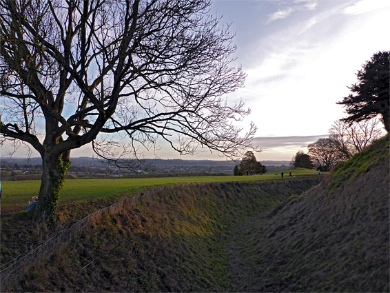
Old Sarum is reached by a short road off the A345, here known as Castle Street, a five minute drive from Salisbury city centre; the road climbs a slope, passes a small parking area, crosses the outer moat and the high mound beyond then ends just after at a larger carpark. This last section is closed by a gate outside of the visitor hours, which in winter are 10 am to 4 pm. The outer moat is nearly one mile in circumference, and inside the mound is a sizeable ring of flat, grassy land, the outer bailey, which is centred around the inner moat (a quarter of a mile in circumference) that protects the castle. The outer bailey is accessible on foot at all times, while the castle area is fenced off and only viewable during the regular opening hours.
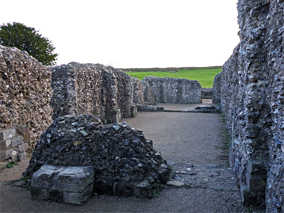
The extensive chalk flats of the outer bailey are interrupted by several ancient banks and ditches, some along the site of former entrances, but the only visible relics of the old town are the cathedral and its cloister, in the northwest corner. Just the foundations of the cathedral walls and columns are visible, having been excavated early in the 20th century, and the tallest are only about three feet. The church had the familiar cruciform design with a nave, two aisles, two transepts, a choir, presbytery, and four small chapels. The cloisters are adjacent to the northeast, their position now evident from a square-shaped depression, plus just one short section of surviving wall. Of the once substantial bishop's hall on the far side of the cloisters, there is no visible trace. The only other stone relics are the base of a watchtower, just north of the cathedral's north transept, and some parts of the enclosing walls, above the outer moat. One path runs all around the bailey perimeter while another circles the outside of the site, next to the grassy moat; the two are linked at several points in addition to the main entrance to the east and the secondary gate to the west.
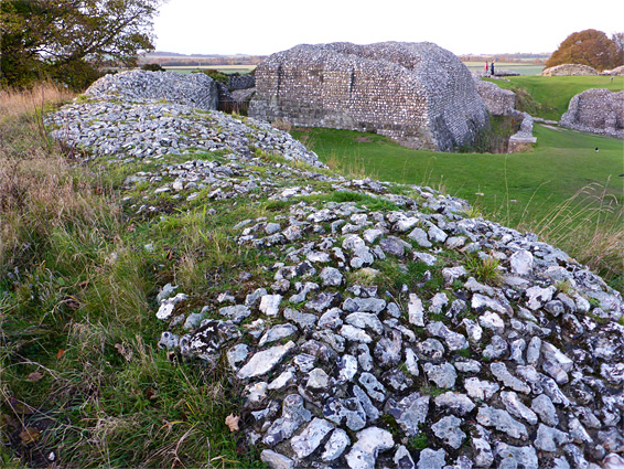
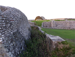
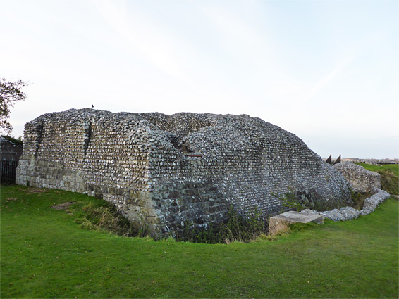
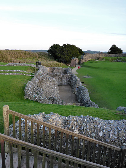
Entry to the central area of Old Sarum is along a path through the narrow but steep-sided earthwork above the enclosing moat, past the remains of the gatehouse which, like all structures hereabouts, was constructed using irregularly-shaped flint nodules, mostly white, fixed by grey mortar, giving the walls an unusual appearance and texture. All such walls would originally have had a cladding of regular stones, but this is almost all gone; viewable in just a few small areas. On the far side of the castle wall is the English Heritage administration building, containing a small gift shop, while ahead is a near-circular grassy enclosure, all surrounded by thick, low walls. The two main structures here are the great tower, or keep, on the east side, and the courtyard house (the principal residential building) to the north, which contained over a dozen rooms and a two story chapel, arranged in four ranges on all sides of a central courtyard. Other wall fragments are from the new hall beside the keep, a bakehouse near the main gate and three towers along the edge, incorporated into the wall. Wooden steps have been installed to access the high point of the keep and the adjacent tower, though all other areas may be entered at ground level, the only exceptions being some of the tower foundations which are quite deep, and have been fenced-off for safety.
Pottery and other artifacts indicate the site of Old Sarum was inhabited in Neolithic times, but the earliest identifiable structure is the Iron Age hill fort, built around 400 AD, evident from the outer moat and the two adjacent earthen banks that are still prominent today, mostly following the outline of the natural hill at this site. The Romans later occupied the fort for around a hundred years and are believed to have built some structures though no sites have been positively identified. The Saxons also used the fort, but it was the Normans who greatly added to the defenses, by constructing a motte and bailey castle, starting about 1070. The stone wall and cathedral followed early in the 12th century; the latter replaced an earlier, smaller church that was greatly damaged only five days after completion, by a thunderstorm. The new cathedral was used for over a century, until services were transferred to the current building 2 miles south, and the town was almost empty by the time the castle was partly demolished, in 1322, by order of Edward II. The final residents, however, are believed not to have left until around two centuries later.