The visible remains of Dinefwr Castle in Carmarthenshire are mostly from the 13th and 14th centuries, though the fortification was established towards the end of the 12th century, by nobleman Rhys ap Gruffudd ('The Lord Rhys'), and acted as the main defensive centre for the ancient kingdom of Deheubarth, stretching across much of southwest Wales.
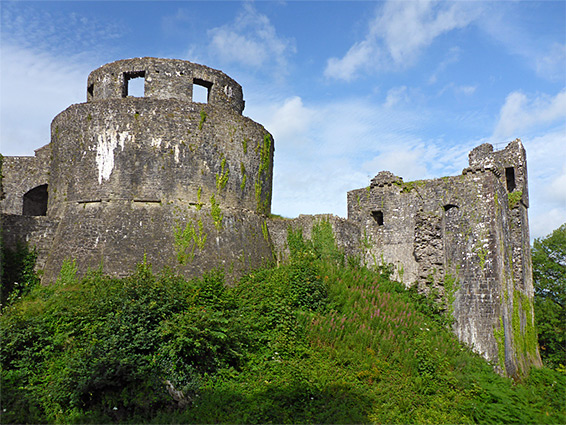
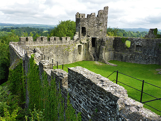
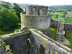
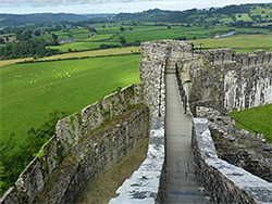
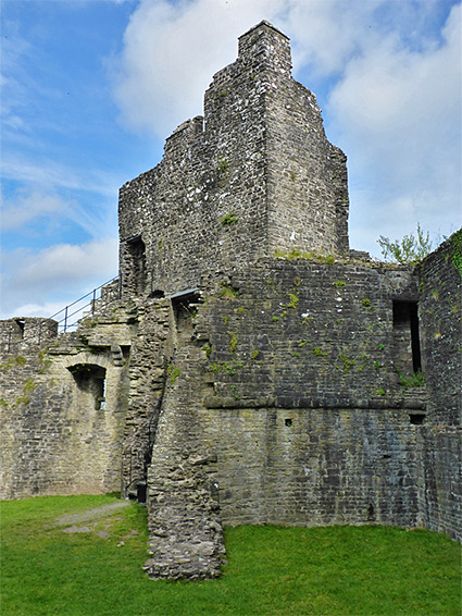
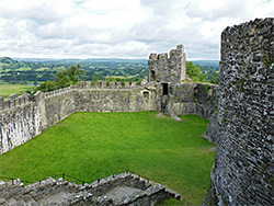
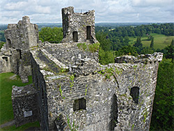
The castle has been ruinous for at least the last 300 years, yet although never particularly large, it retains a good amount of its structure, principally a circular keep, a three floor residential block, a corner tower and a nearly complete curtain wall. It has a particularly dramatic setting on a high point at the west end of a narrow sedimentary ridge overlooking the valley of the River Towy (Afon Tywi), and the upper levels have panoramic views for many miles in all directions.
The ridge was originally treeless but is now covered by mature woodland, preserved as a nature reserve (Dinefwr Castle Woods), managed by the Wildlife Trust of South & West Wales, who also partially own the castle, which is maintained by Cadw. Entry to the reserve and the castle is free though the usual access is from the north through the adjacent Dinefwr Park, and this is owned by the National Trust who charge a fee of Ł5 for vehicular entrance. The park is centred on Newton House, a mansion built in 1660, and it has also recently been designated a (national) nature reserve, on account of its ancient trees and pastureland. National Trust visitors reach the castle via a half mile walk from the car park beside the house, while others can park (free) in the nearby town of Llandeilo and take public paths to the castle, the shortest distance one mile. One suitable parking place is in front of Llandeilo Rugby Ground on Carmarthen Road, from where a path crosses a field to one of the park roads, while another starting point is along a short side street west of the A483 just north of the River Towy bridge.
Dinefwr is sometimes anglicised to Dynevor, and has over the centuries been spelt in many different ways including Denefawr and Dynefwr.
The site of the Dinefwr Castle, with its commanding position above the strategically important River Towy, is thought to have been first fortified by the Romans and later by Rhodri the Great in the ninth century, though no remains have been found from these times. The present structure was established in the 12th century while the earliest surviving components are about 100 years later - the curtain wall and the circular keep. A smaller circular tower was added around 1260 at the north corner, followed by the barbican, a fortified area in front of the gateway, on the south side, together with a hall and residential block inside the northeast wall. The final major modification, around 1330, was enlargement of this block, to link with the north tower. These latter phases were under English control after the castle was captured by Edward I, in 1277. There were various changes of ownership over the next three centuries and the structure remained occupied until at least the end of the 16th century. Around 1660 a circular gazebo with conical roof and rectangular windows was added to the top of the keep, and this was in use around 100 years until being partially destroyed by fire, after which the remainder of the complex was abandoned.
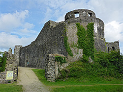
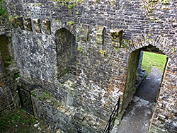
Dinefwr Castle is approached by three paths, two from the north, from Newton House and a nearby pond, and one from the east; this is the most used route, through Castle Wood. This path, after climbing gradually through the trees, crosses what once was the outer bailey, which contained a group of service buildings protected only by wooden defences, then reaches the entrance, a narrow corridor (the late 13th century barbican) below the south curtain wall, leading to the original gateway, beyond which is a grassy courtyard. Rising above the barbican is the circular keep, visible from the path right down to ground level since the adjacent section of the curtain wall, incorporating the east corner, is missing, seemingly collapsed sometime in the mid 1700s, replaced by much thinner walls connecting directly to the keep. Just inside the gateway is a flight of stone steps leading to the top of the curtain wall, and another stairway climbs to the upper level of the keep, both these also being 18th-century additions, giving access to the gazebo, which is intact apart from its floor and roof. The original keep entrance was via a door in the basement. The south and west wall walk is still accessible, and leads to the middle level of the north tower, where more steps climb to a viewing area on top, and go down to the courtyard. A third elevated viewpoint is from the top of a smaller, square tower within the hall/residential block, also accessible by a narrow staircase.