Narrow strip of ancient woodland at the foot of limestone cliffs which contain several short caves; part of the hill of Great Doward, at the edge of the Wye Valley
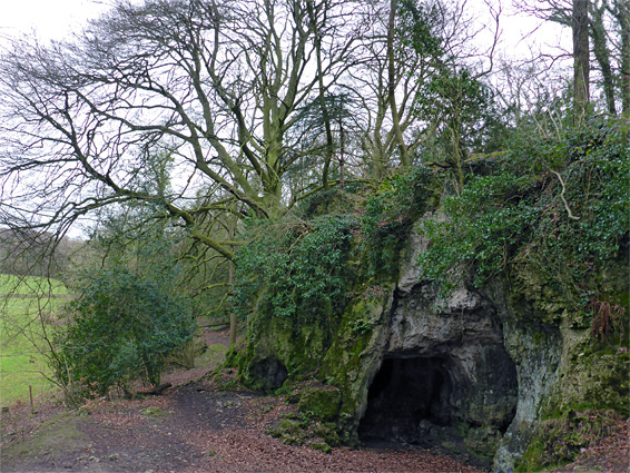
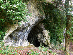
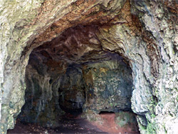
King Arthur's Cave is one of seven closely-spaced nature reserves on the top of Great Doward, a broad limestone hill overlooking the River Wye a few miles north of Monmouth, near the south edge of Herefordshire. All contain forested terrain sprinkled with rocky outcrops, and are reached by narrow lanes starting from two exits along the dual carriageway A40. The cave is the largest of several openings at the base of an 800 foot-long cliff and is associated, in legend, with the fifth century British King Vortigern, a contemporary of King Alfred, though the only definite historical use is much earlier, in Paleolithic and Neolithic times, as shown by animal bones, pottery fragments and stone tools, unearthed during archaeological excavations in the 1870s and 1920s.
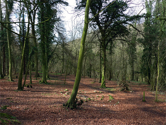
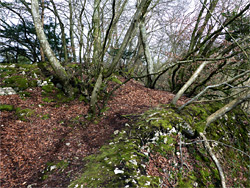
The cliffs form part of the eastern boundary of the small (3.7 acre) reserve, which does not actually contain the caves; instead it consists of a narrow strip of mostly ancient woodland, bordered on the other side by a field, and is a generally moist and shady place, good for spring wildflowers and autumn fungi. Flower species found here are all generally common, including dog's mercury, bluebell, snowdrop, wood anemone and lesser celandine.
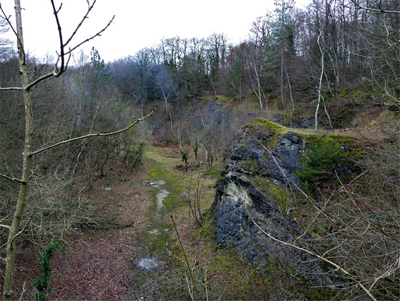
A quarter mile track runs through the reserve, linking at the south end with other paths into the surrounding Lord's Wood, one descending to the floor of the Wye Valley. A slightly different selection of plants is found on the sunnier cliffs of an adjacent quarry, also not part of the reserve though accessed from the same track.
Parking for a couple of vehicles is available at the start of the track into the reserve, off a woodland road one mile from the A40, just before the turning for the Doward Park and Biblins campsites. The track runs southwest and is bordered for the first few hundred feet by woodland on both sides, with the older trees to the west; the land to the east was largely cleared in the 19th century, when a small cottage was constructed. This has long since been removed but there is still one building here, a small structure associated with the (20th century) quarry. Most of the trees on this side of the track are recent, a mix of birch and willow, and they extend up to the entrance to the quarry, where the line of limestone cliffs begin. The path follows along the base, past several smaller caves and then the main one, at the southern tip - this is King Arthur's Cave, which has two openings and two chambers, and extends back about 100 feet.