Minor ruins of an ancient castle; a tall tower and a short wall section, all quite overgrown, and fenced off for safety
Entry
Free
Location
On the south side of Llantrisant; CF72 8EB
Not much is known with certainty about Llantrisant Castle, formerly in Glamorgan and now part of Rhondda Cynon Taf - when it was built and by whom, its appearance, its purpose and its fate are all somewhat unclear. The structure has certainly been ruined for many centuries, perhaps ever since the early 1300s, one theory being that it was significantly damaged by Llewellyn Bren during his rebellion against Edward II, when this part of Glamorgan was under English control.
The castle was recorded as belonging to Richard de Clare in 1250, and a few distinctive masonry elements seen to date from this period, but it is likely that some kind of fortification existed at least in the previous century if not earlier. An adjacent church was founded by the Normans around 1096, so it is quite possible that a motte and bailey castle was established around the same time.
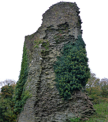
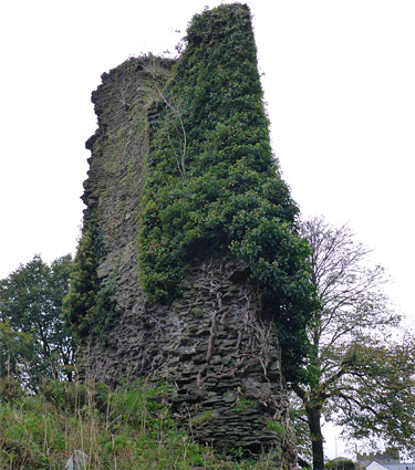
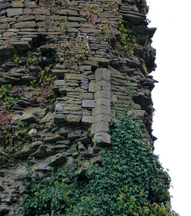
The castle is now a minor, overgrown ruin, not obviously signposted and not much visited; it consists only of a large (north) tower, around 40 feet high, a short section of wall and a small fragment of another, southern tower, all somewhat unstable and therefore fenced off for safety. Ivy grows on the north tower and the whole site is partly covered by bushes and trees, doubtless concealing other, unexcavated remains. Most of the tower retains its original outer masonry, but about the only identifiable feature is a polygonal column from one side of a doorway, about 30 feet above the ground - once opening to the top of the curtain walls, and indicating that the castle was in medieval times a tall and formidable fortification.
The castle has a commanding position in Llantrisant - though this may not be so obvious today because of the trees growing all around - on a sandstone outcrop at the rim of a hill overlooking the valley of the Ely River, a natural trade route from coastal areas of south Wales into the mountains to the north. On clear days the views extend to the hills of north Devon. The steep slopes afford natural protection to the south, while earthworks originally guarded the approaches from other directions.
Limited parking is available along the nearby residential streets. The front and sides of the north tower can be viewed from a small grassy area below, presumably once part of a fortified outer bailey, but the rest of the site is overgrown. A path circles all around the fenced ruin, though most runs a little way below, winding through the trees, and so views of the site are rather limited.