Waverley Abbey is the only significant ancient, ruined abbey in Surrey, located near the west edge of the county, 2 miles from Farnham, beside the slow-moving River Wey. The ruins have a peaceful, rural setting surrounded by fields and woodland, not near any modern development, and are reached by a quarter mile walk across the fields. The site is managed by English Heritage, is open all the time, and there is no entry fee.
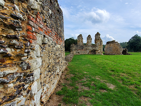
The abbey was a Cistercian institution, the first of its kind in the country, founded in 1128 by William Giffard, Bishop of Winchester, and closed in 1536 during the Dissolution of the Monasteries, after which most of the church and subsidiary buildings were dismantled. The remains visible today are fragmentary but impressive, and include three large structures; half of the undercroft of the lay brothers' residence, complete with vaulted ceiling and elegant fluted pillars, the monks' dormitory, and part of the chapter house. The precinct now is 350 by 500 feet in area though was originally much greater, extending for a quarter of a mile or more; various earthworks and buried foundations have been identified in the fields either side of the current, fenced enclosure.
Waverley Abbey was built on flat, low-lying land within the floodplain of the River Way, inside a wide bend. Its founder, William Giffard, became Bishop of Winchester in 1100, and the first monks were brought over from L'Aumône Abbey in France in 1128, the year before his death, to manage the new abbey, which initially was not well endowed, yet money was found to start construction of church, cloisters and several other buildings, all complete around 1150. The abbey was granted substantial lands, including woods, and slowly grew in importance, acting as the mother house for several other Cistercian institutions, including Forde Abbey, founded around 1135, and Thame Abbey in 1137. Early success was short lived, however, as a huge flood in 1201 destroyed much of the buildings, along with all the crops. Reconstruction began in 1204 on a larger scale than before, and lasted over 70 years; the new church was twice as long and three times as wide as the earlier version, and was accompanied by significant expansion of the grounds and the subsidiary buildings. Several other floods occurred over the next 250 years though damage was not so great, and the monastery survived without much incident until the 1536 Dissolution, at which time it was again relatively poor, and housed a community of only 13 monks, compared with over 200 at its peak. After the closure, much of the material was removed for other building projects, including Loseley Park (complete in 1568), and a mansion a short distance north of the abbey, part of which is incorporated into Waverley Abbey House, a Georgian residence completed in 1725.
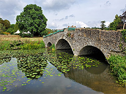
The ruins are provided with a small parking area beside the entrance of the driveway to Waverley Abbey House - along Waverley Lane (B3001), 1.5 miles from the A31 at Farnham. The path runs through a patch of trees and along the south bank of Waverley Lake, an artificial pond in the grounds of the house, which sits on a low hill to the north. After passing a gate, and a disused bridge over the lake, the path curves to the south and enters the abbey precinct.
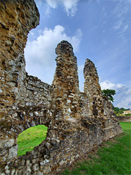
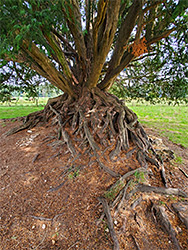
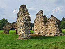
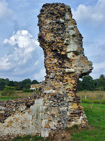
Like nearly all monasteries, the site was based around a large church with the nave to the west and the presbytery to the east, with the cloisters south of the nave, linked on the other three sides to the subsidiary buildings. The church had north and south transepts, each containing three chapels along their eastern walls, while another five chapels were positioned at the east end of the church, beyond the presbytery. The path enters the northwest corner of the abbey grounds, site of the church, of which little remains - just a low wall to the south, a fraction of the west front, higher walls from the south transept and a few sections of the north transept, plus some stones from the walls at the east end of the building. Some of these latter stones are buried beneath a huge, ancient yew tree, growing here since soon after the Dissolution and so nearly 500 years old. The tree is quite well-known and was awarded the Woodland Trust's 'tree of the year' in 2022. The south transept adjoined the chapter house, and its south wall also survives, together with a vaulted passageway (the slype) beyond, and some low walls to the east, from the infirmary chapel; this was part of a sizable group of buildings that once included the infirmary itself, and the abbot's lodging.
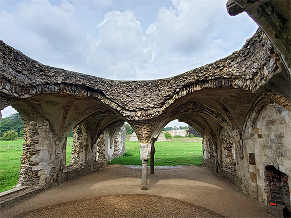
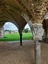
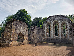
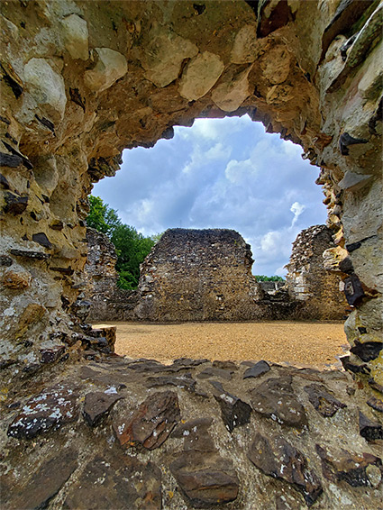
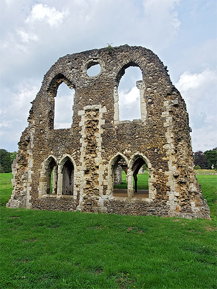
The other visible ruins are little further south. Most impressive is the undercroft of the west range, the lay brothers' accommodation, which incorporates various pillars and ribbed vaults. The south wall of the actual lodging survives to roof height, and this contains a pair of narrow double windows at undercroft level, two wider windows above, plus a circular window near the apex. Close by is the south wall of the monks' refectory, linking to part of the monks' dormitory, in the east range, three walls of which are also largely complete to gable level; the south wall is the tallest, incorporating three narrow windows. Of incidental interest, a little way southeast of the monks' dormitory, is a group of 'dragons teeth', concrete defences installed during World War II to guard a crossing point of the River Wey - this was part of the GHQ line, a linear defensive installation intended to delay enemy advances following a potential German invasion. Elsewhere in the grounds are other wartime relics such as pillboxes and gun emplacements.