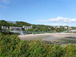
Caswell Bay and Langland Bay are two sandy coves near the southeast corner of the Gower Peninsula, just a few miles from Swansea on the far side of the Mumbles headland. Both are very popular, especially Caswell since the beach here is entirely formed of golden sand, not muddy even at low tide, and enclosed by quite tall cliffs of inclined limestone strata, sheltering many tiny inlets and rock pools. Langland Bay is not as scenic since parts are pebbly, rocky or muddy, and the limestone bedrock along the edge is generally lower and less photogenic.
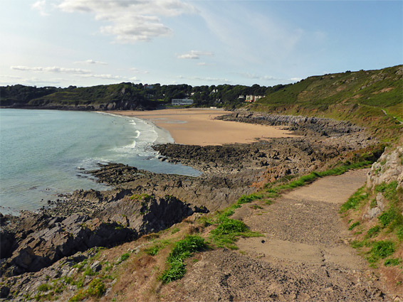
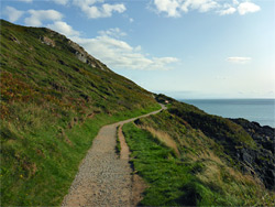
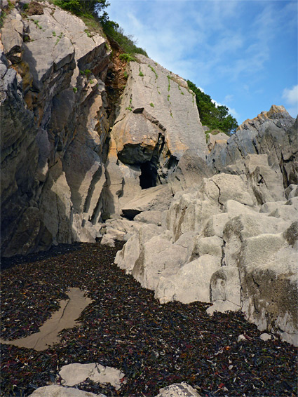
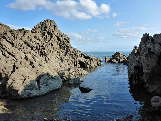
The two bays are linked by a 1.2 mile section of the coast path, which passes two minor promontories, Whiteshell Point and Snaple Point, while staying around 50 feet above sea level, the intervening land being all sloping grey rocks, split by gullies and fissures, heavily eroded though not as spectacular as many places further west, which have higher cliffs and more dramatic formations.
Both beaches are served by car parks, relatively expensive, charging £5 for stays longer than two hours. They have good facilities, including several cafes and shops, and free outdoor showers. The walk between the coves takes only about half an hour, and a loop can be made by returning along a parallel path higher up the cliffs, along the south edge of Langland Bay Golf Course.
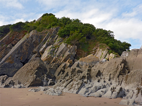
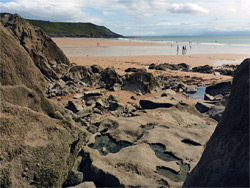
Parking for Caswell Bay is along the flat floor of a dry valley at the foot of Bishop's Wood, a local nature reserve and site of special scientific interest, this being a rare example of coastal limestone woodland. At busy times of the year all spaces may be taken by mid morning. This location is along Caswell Road, six miles southwest of Swansea city centre. The upper edge of the bay has two sandy stretches, split by a short line of cliffs; the east section is the public access point, while the western part is private, adjacent to a block of apartments. The east edge of the sands is also lined by sheer, jagged cliffs, though the best section is on the far side, where the land breaks up into a series of bigger blocks, separated by sheltered, sandy channels and rock pools, plus at least one short cave, accessible at both ends. The rocks hereabouts extend out to sea beyond the low tide mark, forming an abrupt end to the beach, but on the opposite side, more clean sand is uncovered for a few hours around low tide, extending another thousand feet east, and also bordered by the eroded rocks.
The eastwards coast path from Caswell Bay starts beside the short row of shops opposite the carpark, initially heading south, rising slowly, above the sandy extension to the beach and past a junction with the upper-level path, then on to a viewing area above Whiteshell Point. It continues east along the foot of Newton Cliff, a grass-covered slope below the golf course, and above a broad band of exposed rocks, which are steep but not generally not sheer, and it is easy enough to climb down to sea level at several places, perhaps exploring some of the gullies and sea caves. The path soon passes Snaple Point, a promontory with equally extensive views along the coast, before bending north and descending gently through bushier surroundings, down to the parking area and shops at Langland Bay.