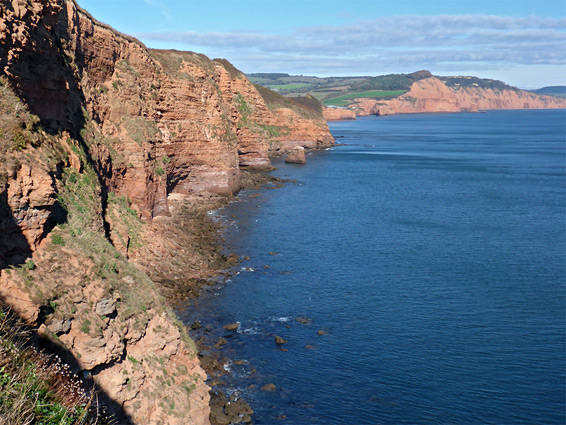
Red-rock coastline east of the River Otter; sheer cliffs above narrow, inaccessible beaches and marine terraces, viewable from above along the coast path
Location
Parking along South Farm Road, on the east side of Budleigh Salterton; EX9 7AY
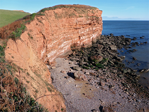
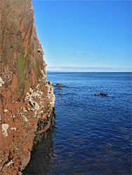
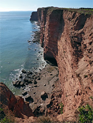
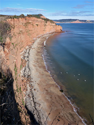
The 2.5 miles of the Jurassic Coast between the River Otter near Budleigh Salterton and the sheltered inlet of Ladram Bay is characterised by vertical cliffs of red sandstone, up to 200 feet high, above narrow, quite steeply sloping beaches of shingle or sand, exposed only at low tide. The coast path runs mostly right at the edge of the cliffs, and the vegetation is limited, so the majority of the shoreline is in full view, but unlike many other sections of the coast the cliffs are not really explorable from below since two points at either end have sheer rock faces that are submerged at the base except perhaps for a very short time at low tide - these are Smallstones Point, at the edge of Ladram Bay, and Danger Point to the southwest.
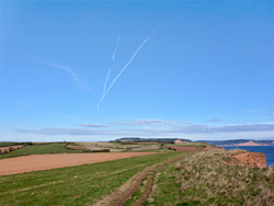
The short (third of a mile) section from the River Otter to Danger Point is more accessible, however, reached by wading the lower end of the river, and includes a couple of small bays, with much jumbled, eroded rock, leading to the impassable cliff. Inland, the coast path runs past fields and small patches of bushes, not near any roads, and is infrequently walked, with the exception of the northern reaches, close to the year-round holiday camp at Ladram Bay. About half of the path is bordered on the seaward side by low hedges, the remainder just by grass, and the scenery is impressive all the way. Northeast of Ladram Bay the coastline becomes even more spectacular, with taller cliffs and several large sea stacks.
Most of the rocks in the cliffs are red, Triassic-era Otter Sandstone (part of the Sherwood Sandstone group), and the layers are nearly flat, just dipping gently down to the east, though in the west, beside the River Otter, the upper edge of the underlying Budleigh Salterton Pebble Beds are exposed, also predominantly red in colour.
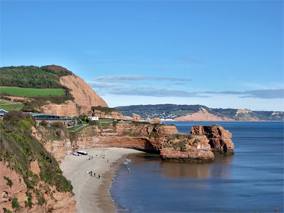
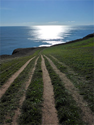
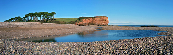
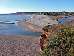
A walk along the coast can begin in the north from Ladram Bay, using the paid public car park, or in the south along a narrow lane off the B3178, that crosses to the east side of the River Otter; vehicles can be left just before the road ends, at the entrance to South Farm. From here, a path heads south for 0.7 miles to the edge of the cliffs at Otterton Point, overlooking the estuarine mouth of the river (a Site of Special Scientific Interest), then swings round to the northeast on route to Ladram Bay. The mouth of the river is bordered by a short cliff, which has water several feet deep at its base, and this generally prevents easy access to the inter-tidal rocks beyond; instead these are easier to reach if starting from Budleigh Salterton on the far side, since south of the cliff the water spreads out as it flows over a wide band of pebbles, and becomes just a few inches deep.
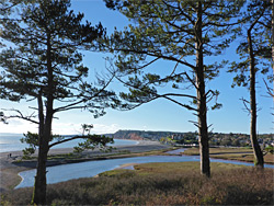
From the parking place along South Farm Road, the coast path heads due south along the edge of a field, across a tiny stream then over a minor ridge, descending to a grassy area beside the mouth of the river, here lined by an isolated belt of Scots pine trees growing on a bluff about 40 feet above the water. Steps lead down to a sheltered pebble beach backed to the south by the red cliffs of Otterton Point, with a smaller red rock outcrop on the north side. Another, overgrown, spur path climbs to the very top of the point and gives good views up and down the coast, unlike along the main path which stays out of sight of the sea for a little while, hidden by a thick hedgerow. The extensive rocks south of the point, exposed at low tide, include a slightly elevated plateau named Otterton Ledge, reached either by wading across the river, starting from the pebble beach, or from Budleigh Salterton. The ledge is split by little channels and contains innumerable rock pools. Walking northeast, the coast curves round a small bay below Otterton Point, then past two minor headlands to a slightly larger bay, partly sandy, on the far side of which are some bigger boulders and then the sheer cliff of Danger Point, beyond which travel is not recommended.
From Otterton Point, the coast path turns east then northeast, soon passing above Danger Point and then a longer straight line of cliffs up to the next minor promontory, Black Head, named, like Coal Beach to the south, for the darker colour of the rocks. The cliffs become higher as the land rises steadily, up to a highpoint of 210 feet just beyond Brandy Head, a protruding point at the north end of Poolness Beach, a narrow strip of sand and pebbles. The next section, similar in appearance, includes the only significant sea stack hereabouts, a red outcrop known as Twopenny Loaf Rock, at the centre of a generally rockier band that extends north to Chiselbury Beach, a more extensive sandy bay that like all beaches along this stretch, is completely unreachable from above owing to the tall, crumbling cliffs. North of the beach are more jumbled rocks, leading to Smallstones Point, followed by the sheltered inlet of Ladram Bay, accessible from the road to the holiday camp. One other point of interest, about halfway along the path (right opposite Twopenny Loaf Rock), is the ruin of the Brandy Head observation hut, a concrete structure built during World War II, used by the RAF for testing cannons and gun sights.