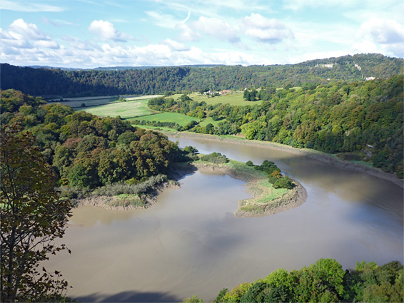
North of Chepstow, the River Wye soon becomes enclosed in a deep, winding valley, and a ridge above one tight bend, two miles from town, has been inhabited for many centuries on account of its important defensive location, and the commanding views up and down the river. A fort was built here in the Iron Age, the great earthwork of Offa's Dyke (once the boundary between England and Wales) passed close by to the east, and a small village was established sometime before the ninth century, named Lancaut.
The population peaked around the 15th and 16th centuries but later declined, mostly due to the difficulties of living in this rather remote, difficult-to-reach location, and today the only habited part is a farm of relatively recent construction, on grassy land towards the outside of the bend, encircled on three sides by the river. Access is from the high, forested, steep-sided ridge to the east.
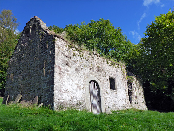
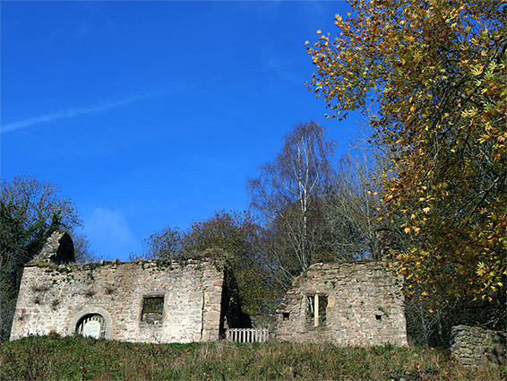
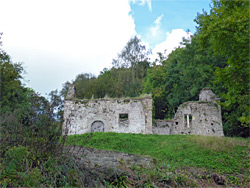
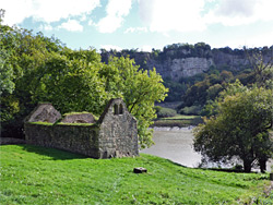
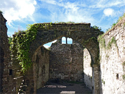
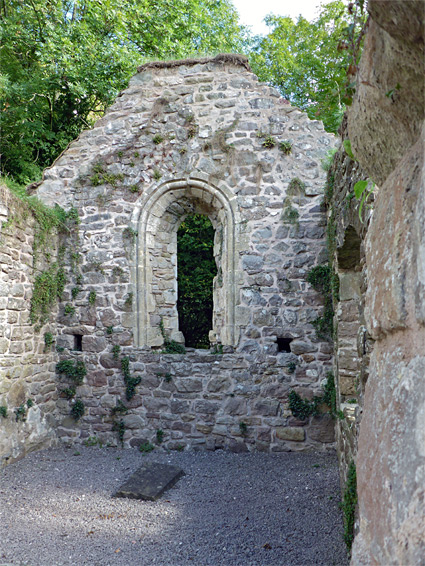
The only visible relic from olden times is the 12th century Saint James's Church, situated close to river level at the foot of a steep hillside, reachable only by trail. The church is roofless but otherwise quite well preserved, given its great age, and the place is very atmospheric, due to the combination of the evocative, weathered ruins and the peaceful, rural setting. The houses of the medieval village of Lancaut were close by to the west and north, but no trace remains.
The road to Lancaut forks westwards off the B4228, 2.4 miles from Chepstow town centre. Visitors can drive about a third of a mile, leaving vehicles in a small, free parking area. The surroundings are thickly forested, and most falls within Lancaut Nature Reserve, which is crossed by various paths and contains several other places of interest including two disused quarries, several stone lime kilns, and the site of the Iron Age fort, known as Spital Meend. Over 350 plant species have been recorded in the vicinity. The signed path to St James's Church leaves the road a little further along, dropping down through the woods and later across open ground towards the entrance on the west side of the building, which is only about 100 feet from the river banks, enclosed by a low wall. Another path goes northwest to Lancaut Farm, while a third follows the river valley southwards, later climbing to the village of Woodruff, after passing below a dramatic, sheer section of cliffs, known as Wintour's Leap.
The church was modified at various times over the centuries, and saw near-continual use until its abandonment in 1860, due to the decline in the population of the village, though official deconsecration was not until 1987. Over the next hundred years the place gradually decayed; the roof was removed and the brickwork became overgrown with weeds. Restoration has happened in several phases, most recently following the 2013 purchase by the Forest of Dean Buildings Preservation Trust. A few parts remain from the 12th century, most visibly the chancel arch, which spans the middle of the building, separating the nave on the west side from the chancel to the east. Other features include several differently shaped windows, a piscina (basin for washing religious vessels), a plinth for the font, and a row of tombstones. The lead font from the church, dating from around 1140, is now on display at Gloucester Cathedral.