Site of a Roman city, abandoned around the 6th century, still surrounded by walls up to 15 feet tall; also contains the remains of a large amphitheatre
The walls of most Roman towns in the UK have long since disappeared, or are visible only as short, isolated fragments, but in a very few places they survive for a substantial distance, in locations where the town was completely abandoned, and not incorporated into later settlements; notable examples include Verulamium in Herefordshire, Caerwent in Monmouthshire and Silchester, in Hampshire. The town (original Roman name Calleva Atrebatum), was based around an earlier Iron Age village, and flourished for around 500 years; established soon after the AD 43 invasion and abandoned sometime between the fifth and seventh centuries.
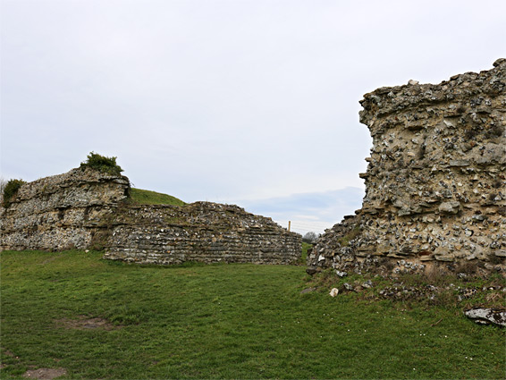
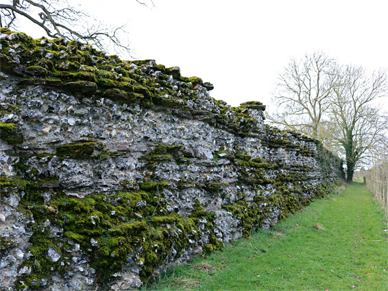
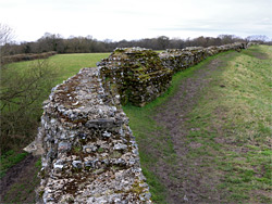
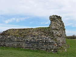
Within the walls, covering an area of 100 acres, was a grid-like network of streets and many buildings including a hospital, forum, basilica and several temples, yet no trace of any are visible above the ground, though extensive, buried foundations remain beneath the grassy fields. The perimeter walls however are fairly complete in length though somewhat less high, and lacking all of their decorative flint facing stones, and they can be viewed on a circuit of 1.5 miles, following a path mostly below the exterior and sometimes also along the inside.
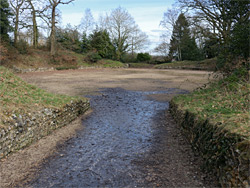
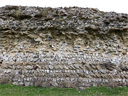
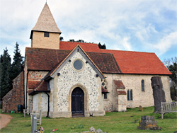
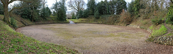
Some sections of the walls are overgrown, and buried by rubble, but about half is out in the open, not obscured by vegetation, and rising up to 15 feet tall. They were built around 270 AD, replacing earlier earth banks, and rose to a height of 25 feet. Today, the masonry is rather dull and the walls incorporate no recognisable structures apart from some transverse sections at several of the surviving gateways, so the ruins are not quite as photogenic as those of the similar Caerwent, which have a richer colour and include a number of well preserved towers. Nevertheless, at least two hours could be spent exploring the site, also incorporating a visit to the adjacent medieval St Mary's Church, which is partly built from Roman bricks. There is one additional Roman feature at Silchester, the remains of an oval-shaped amphitheatre, situated, as was the custom, just outside the town boundary.
The iron age settlement of Calleva was founded around 50 BC by the Atrebates tribe, who had emigrated from Gaul; it occupied an oval-shaped area of about 70 acres, approximately within the western two thirds of the subsequent Roman town, and was protected by two sets of earthworks; an inner embankment, mostly replaced by the Roman walls, and an outer embankment, about 500 feet beyond, and traces of this can still be seen, to the north and southwest. This town was relatively sophisticated for its time, with metalled streets and several substantial buildings, though was significantly enhanced once taken over by the Romans. They added many more buildings, and additional roads; the main route connected the east and west gates, where roads went respectively to London (via the Devil's Highway) and to several westerly cities including Bath, Salisbury and Gloucester. The largest buildings were the basilica and forum towards the centre, the hospital or mansio near the south gate, and the town baths to the southwest, fed by a spring which still produces water. The town was probably occupied right up to the last phase of the Roman withdrawal from Britain, in the late 6th century, after which the site seems to have been left to become ruinous, with material removed over the next few centuries for use in other settlements, including a medieval village that was established just east of the town. This too was later abandoned, probably soon after the Black Death of 1349, and the only surviving building from this era is St Mary's Church, built in the 12th century. The modern town of Silchester, one mile west, was founded much later, around the 16th century.
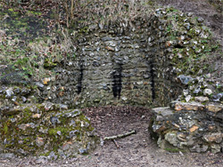
About half of the perimeter walls are followed by country lanes but there are no parking places along here, and instead all visitors have to use a dedicated parking area on the west side, along a road from modern Silchester, from where the near edge of the Roman town is a quarter mile walk away, initially alongside a wooded section of the old outer embankment from the Iron Age settlement. Three paths continue from a junction just outside the walls; two around the outside of the town to the north and south and another across the centre, this is a modern road, not following one of the Roman streets, and entering through a recent breach in the walls. The shorter northern route passes the north gate, perhaps the best preserved entrance, and continues towards the amphitheatre in northeast, near another, smaller gate, while the longer southern route passes the overgrown west and southwest gates, the better condition south gate followed by the smaller southeast (postern) gate before leading back northwards to the site of the east gate, now lost amongst several more recent buildings. Just within the eastern wall is St Mary's Church, still in regular use, and attractively constructed out of a mixture of a Roman red bricks, Norman red bricks, flint and sandstone. Inside are some 13th? century wall paintings and at least one medieval tomb. The amphitheatre, a little way north, is not so remarkable to look at since the enclosing walls are just a few feet tall, set beneath wooded banks and contain no particular features apart from a pair of square recesses, in the middle of the west and east sides.