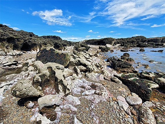
The Sker Rocks are an expanse of pinkish strata from the Mercia Mudstone Group, mostly within the intertidal zone, along the otherwise sandy coastline just south of Kenfig National Nature Reserve in Bridgend, south Wales. They are half a mile long and, at low tide, up to 1,200 feet wide, split by two gullies named Pwll Dafan and Gwter y Cwm.
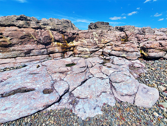
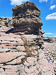
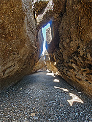
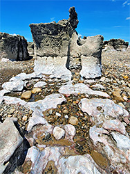
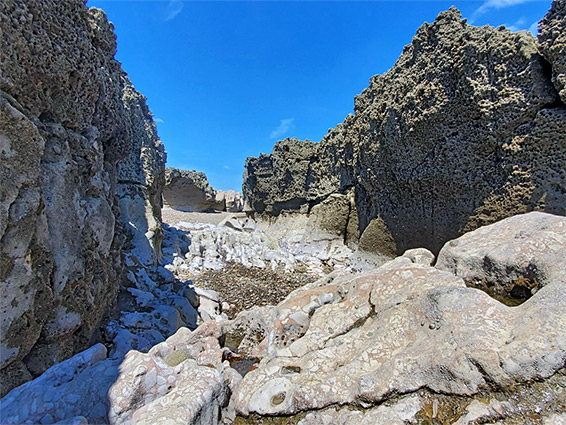
Although of low relief overall, the rocks contain narrow crevices and channels up to ten feet deep, and the surfaces are eroded into innumerable tidepools, pinnacles, and other wave-carved formations. The rocks are mainly conglomerate and breccia, and the erosion has created sharp, small-scale ridges, similar to the blue lias limestone that is exposed along much of the coast to the south, beyond Ogmore.
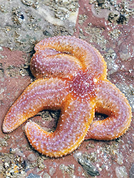
The rock pools contain the usual variety of sea life; some are plenty deep enough to trap fish for several hours until the tide returns, and the whole place is quite photogenic, well worth exploring for an hour or so. In some place the seawards edge of the rocks falls away abruptly as a line of low cliffs, and the plateau rim is an ideal location from which to fish.
Sker Rocks can be reached by a 1.2 mile walk from the free car park at Kenfig NNR, or a slightly longer walk from the paid parking at Rest Bay, north of Porthcawl.
The walking route from the Kenfig parking area is along the main southwestwards path, winding through bushy sand dunes; a pleasant route, that emerges to the beach at the south edge of the reserve, just south of a smaller, detached area of intertidal rocks, also Mercia mudstone, known as Gwely'r Misgl. The tidepools here are filled with thousands of mussels, in some places forming an unbroken array several metres across. These rocks are only visible around low tide. A short patch of sand separates them from the Sker Rocks, the near promontory of which is Sker Point. The northern edge is split by narrow channels, then above is a nearly level plateau extending to Pwll Dafan, beyond which is a larger plateau, also lined by low cliffs along the seaward edge. This gradually breaks up into little sandy inlets and eventually gives way to the pure sand of the beach at Porthcawl. Set into the rocks just above the high water mark is a memorial to the SS Samtampa, a steamship wrecked here in 1947, resulting in the loss of 47 people, eight of whom were volunteers from the local lifeboat station.