Southern section of a path along the valley of the River Frome, here mostly thickly wooded and steep-sided - from Eastville Park to Hambrook, past Snuff Mills, Oldbury Court and Frenchay
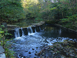
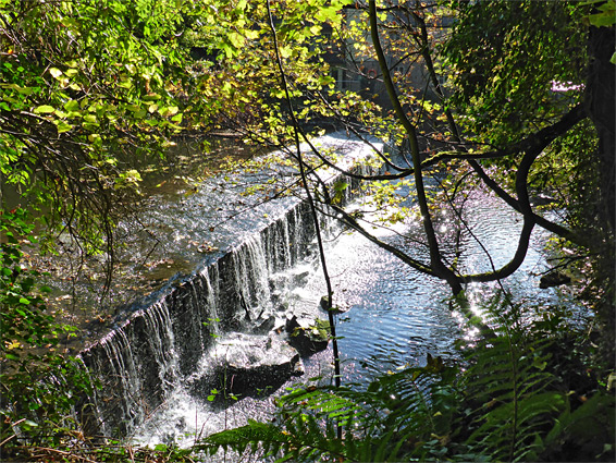
The most interesting part of the 18 mile Frome Valley Walkway is the four miles towards the southern end, from Eastville Park northwards to Hambrook, since here the river flows through a sheltered, densely wooded valley, often quite deep and steep-sided, giving the impression at least of a secluded rural waterway, even though the Bristol suburbs are never very far away. The river drops around 50 feet over this distance, mostly via a series of weirs constructed in the 18th and 19th centuries to provide deep water to power water wheels for mills, all of which have long since been closed, though some of the buildings do survive, most notably Stapleton Mill, now known as Snuff Mills.
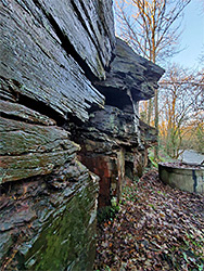
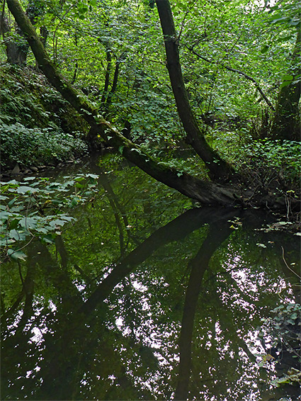
Some sections of the river are bordered by low cliffs and rocky outcrops, all of the dark-coloured pennant sandstone, but most flows between sloping, earthen sides, always thickly wooded, and up to 100 feet high. Most of the walkway stays right beside the river, moving away in just a few places to pass private property, and the path is in general suitable for cycling as well as walking, with just a couple of short steep, rockier sections, and a few styles. There are many connecting paths to other roads. The busiest three areas are those near designated car parks, in Eastville Park, Snuff Mills and Oldbury Court; the path further north is much less used.
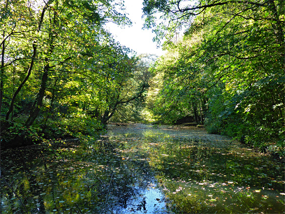
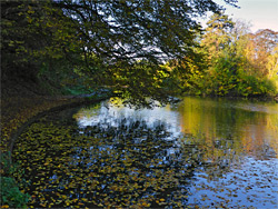
The south end of the riverside section of the Frome Valley Walkway is in Eastville Park, an urban park established in the 1890s; south of here the path mostly follows roads since the river runs underground, through culverts. In the park, one section of the river adjoins a serpentine lake containing two tiny islands, designed at the start of the 20th century for boating and swimming, now used for fishing, and also acting as an important wildlife habitat. The walkway runs past the lake, along the south bank of the river and crosses via a footbridge near Wickham, just upstream of the first of eight weirs. Immediately beyond, the south side of the river is bordered by a line of dark cliffs, one of the more enclosed sections of the valley.
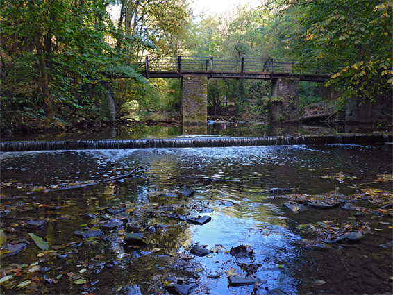
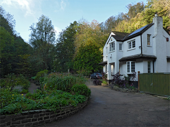
The walkway soon crosses the river again at Wickham Bridge and runs through an elongated patch of grassland, still close to but mostly out of sight of the water. It then meets a road (BlackBerry Hill), follows this a short distance, over Frome Bridge (below which is another weir) then turns right into the short River Walk street to a parking area, where a path resumes. This is a popular place since it is close to Snuff Mills, formerly Stapleton Mill, the best preserved of the riverside milling operations, and is also a favoured dog walking location. The name refers to one of the workers in the 19th century, 'Snuffy Jack', so=called since his clothing was always covered in tobacco flakes. The waterwheel from the mill is preserved within its original building, opposite another weir and also adjoining former millworker cottages, now a private residence, complete with well maintained garden.
Past Snuff Mills, the path divides, one branch following close to the water, the other staying a little higher up the valley sides, which were extensively quarried in Victorian times. The paths rejoin and cross to the south bank via Halfpenny Bridge just upstream of another weir, and the walkway then enters land of the Oldbury Court estate. The next weir is passed after a few hundred feet, near Glenfrome, then soon after is the junction with the path from the main part of the estate, following the overgrown valley of tributary brook. Just opposite the junction the river briefly splits into two channels, creating a inaccessible, thickly wooded island.
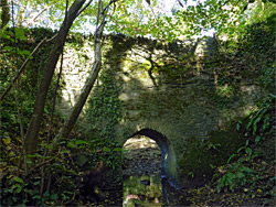
The path curves southeastwards through more thick woodland, past the next weir, formerly of Frenchay Mill, and crosses to the north side of the river via Frenchay Bridge (a narrow lane), just downstream of an entrenched section of the river lined by a particularly tall wall, which leads to the next mill, now converted to a residence. The walkway stays briefly on roads before crossing grassland for a quarter of a mile and meeting Cleeve Road. The next few hundred feet of the river is inaccessible to the public, overlooked by another residence that occupies the former Cleeve Mill (17th century), beside its weir, so the walkway turns north, following the road a little way, and then Grange Park, a residential side street, before turning off on a path, back into woodland, down a slope to the river, now still wooded but bordered by flattish land rather than the steep slopes of downstream. This path, not much used, stays on the northwest side of the river, later passing under the A4174, through more trees and under the M4, finally ending at a minor road off the B4058, near Hambrook. One other feature of interest along the latter stretch is a 17th-century pack bridge over a narrow, westerly tributary of the river (Ham Brook, or Stoke Brook), reached by a short side path. The bridge has an narrow path across the top, a thick span beneath and small arch at the base, through which the seasonal stream flows.