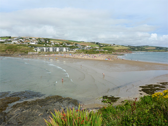
Burgh Island is a relatively rare example of a tidal island - a rocky area which is connected to the mainland only around low tide, being cut off at high water levels. There are approximately 42 others in the British Isles. Like some similar locations it was originally known as Saint Michaels Island, the name later changed to Borough Island and subsequently shortened; it lies opposite Bigbury-on-Sea in the South Hams district along the south Devon coast, separated by an 800 foot-wide strip of sand which extends eastwards to the mouth of the River Avon.
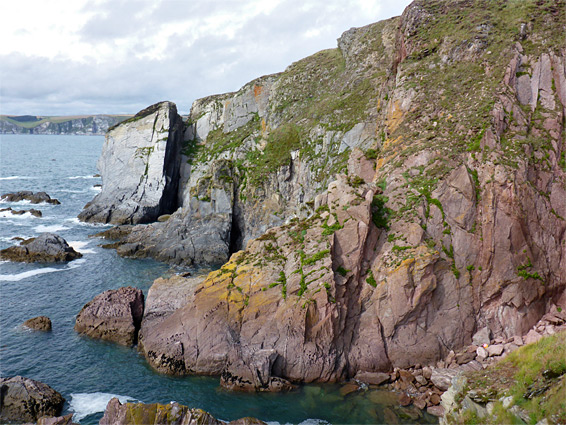
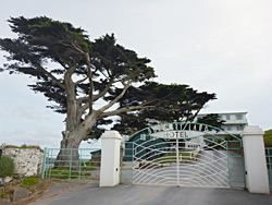
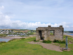
The beach is very popular since the sands are clean, fine-grained and slope very gently either side of the central ridge, while the island is compact and pretty, crossed by a few paths, and bordered on three sides by steep, jagged rocky slopes of grey slate and reddish sandstone. About a third of the island is contained within the grounds of the Burgh Island Hotel, which occupies an Art Deco building constructed in 1929, offering picturesque but expensive accommodation, and not particularly welcoming for non-residents. All of the island is owned by the same group, but the section outside the hotel grounds is freely accessible to the public. On the north side of the island are several other buildings including the 14th century Pilchard Inn, but other parts are undeveloped, save for a stone ruin on the high point, originally a huer's hut, once used by lookouts to alert fishermen of approaching shoals of fish. The hut was constructed on the site of the 14th century chapel of Saint Michael. The round trip walk from the car park in Bigbury, across to the island and around the accessible part of the perimeter is about one mile.
The village of Bigbury-on-Sea is reached by just one road, the B3392, which ends at a metered parking area, on top of low cliffs overlooking the beach. Hotel-authorised vehicles sometimes drive over the sands, taking guests to and from the island, while other people may pay a small fee for a ride on the sea tractor, an elevated vehicle capable of driving there at all times, unless the sea is particularly rough; the maximum water depth at high tide is round five feet.
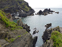
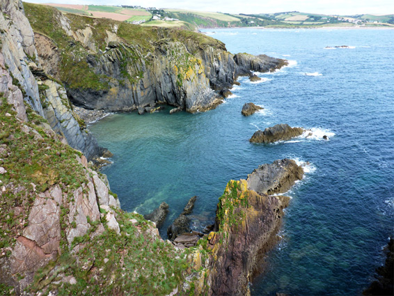
At low tide, Bigbury Beach stretches 800 feet west, to the impassable cliffs of Warren Point, and at least twice as far east, towards the estuary of the River Avon. A low ridge (Murray's Rock), reachable by wading, is exposed to the southeast, a continuation of a peninsula at the edge of the island, within the hotel grounds. Once on the island, a very short road, past the inn, leads to a path across to the northwest tip, the promontory of Herringcove Point, beside the small, rocky inlet of Herring Cove. The path continues close to the western shore, climbing gradually, before turning east at the brink of the highest section of the cliffs, where below, the land falls away very steeply to a series of inaccessible inlets, lined by grey and red rocks, inclined by about 70 degrees. Another path crosses a narrow strip of land to the Little Island, a slightly lower flat above more vertical cliffs on all sides. The southern tip is Burgh Point. The route back runs across the centre of the island, beside a fence at the edge of the private, hotel section. The stone hut is at the summit (161 feet); a fine vantage point looking across many miles of the south coast. There is no visible trace of the former chapel which once stood on this site, part of an ancient monastery.