Remote, rocky, four-mile section of the south Devon coastline, explorable from the coast path or by walking down to sea level; many narrow inlets, tiny beaches and grassy promontories, and much colourful, jagged, eroded rock
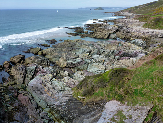
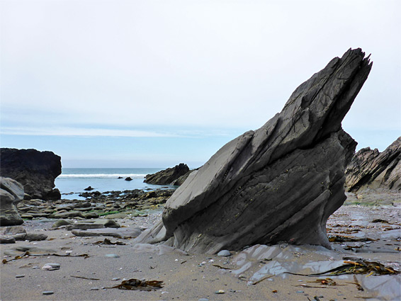
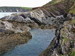
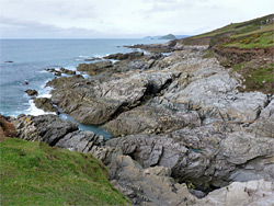
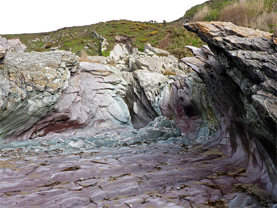
The four mile stretch of land between Stoke Point and the village of Noss Mayo near Newton Ferrers is typical of much of the south Devon coast, as it is wild, rugged and little visited; around sea level the terrain is mostly rocky, formed of upturned, thin-layered slates in shades of grey, green and purple, eroded into pinnacles, promontories, terraces and cliffs, with just a few small sandy beaches in between. All this section is owned by the National Trust and can be seen from quite high above via the coast path, this part of which runs along a former carriage road - Revelstoke Drive, which was constructed in the 1880s by local landowner Edward Baring of Membland Hall in order to impress guests, and so is unusually wide and level.
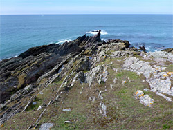
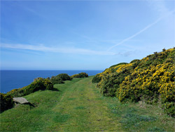
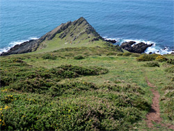
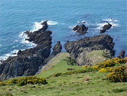
The old road stays around 200 feet above sea level, but as there are no trees or hedges, the views are spectacular all the way, and the shoreline can be easily reached in many places since the land slopes down fairly gently, covered only by short grass or low bushes, and extends all the way to the narrow, rocky peninsulas. In between are a sequence of cliff-lined bays, some having eroded quite far inland, and there are plenty of places where sheer cliffs extend down to deep water even at low tide, so following the coast at sea level is not possible, nevertheless much can be seen by walking down from the path to visit specific locations. Over 20 of the rocky coves bear a recognised name, and the best is probably West Hollicombes, which has a sandy beach and extensive, particularly colourful rock formations.
In the west, the coast path curves round a broad peninsula at the mouth of the River Yealm then follows the estuary to Noss Mayo; the distance from the village to Stoke Point in the east, at the far end of the National trust land, is 4.6 miles. A link path to the access road allows a loop walk of 6 miles, including 1.4 miles along the road, which sees very little traffic. The walk can start from either of two (free) parking areas along the road - Warren in the west or Stoke in the east, and this latter option is described below. Shorter loops are possible from Warren towards Noss Mayo (3.2 miles) or between the two car parks (3 miles).
From the Stoke carpark, the westwards road passes a cluster of buildings at Newton Farm, where another road leads further inland to Noss Mayo, and continues pass the Warren carpark, the alternative start point for the circular walk, before ending soon afterwards at Worswell, a farm, bed-and-breakfast and wedding venue. A public path forks off just before, following a track a short distance before bearing left along the edge of a small wood (Piece Plantation) and across a field, descending a steep hillside with views of the Yealm estuary, down to a narrow lane (Passage Road), through the more extensive trees of Passage Wood, which spread across the lower slopes. To the right, this road reaches Newton Ferrers in 0.8 miles, while to the left it leads to a few isolated residences before narrowing to a track, the former carriage ride, which forms all of the next 6 miles of the coast path.
The road stays in the woods for half a mile; just before the far edge is a short spur, descending through scrub and trees to Cellar Beach, a northwest-facing, pebble and sand bay, bordered by low cliffs that conceal a few short sea caves. A tiny, moss-lined waterfall trickles down at one point, and the whole place is secluded and scenic. It was named for vaults once used by the local farmers to store fishing equipment. Passage Road extends a little further, to the most distant group of houses (built for fishermen in the late 19th century), then becomes a track, entering more trees, Brakehill Plantation, before emerging to grassy, rocky land at the mouth of the Yealm estuary, past Mouthstone Point and on to Gara Point, which affords the first views of the rugged coast to the east. A narrow side path descends to near sea level at Greylake Cove, a cliff-lined inlet between projecting spurs of rock.
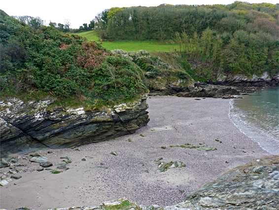
At Gara Point, the path swings round to the east, traversing the short grass slopes of The Warren, below which are a series of little inlets - Quarry Cove (named after a small excavation beside the path), Eden's Cove, Long Cove and Searush Cove, all reachable by descending about 200 feet on smoothly sloping ground in between the occasional vertical-walled ravines that cut inland. The one recognised path off the main route starts in the vicinity of Searush Cove, dropping down diagonally across the slopes towards West Hollicombes, the largest inlet along this section of the coast, and the most photogenic, with a sizeable sandy area below dramatic cliffs, and extensive formations of greenish purple slate. The side trail climbs back up and rejoins the main path in front of Warren Cottage, an isolated residence built in the 1880s for the warrener (rabbit warden) of the Membland Estate; not far beyond, another track joins from the north, from the Warren car park. Below the junction are Blackstone Point, a rocky promontory named for a dark rock just offshore, and East Hollicombes, another isolated sandy beach, a little harder to reach than West Hollicombes.
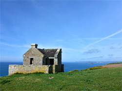
The path continues, above Saddle Cove and the rocky Hilsea Point, then past a series of narrow, parallel ridges separated by watery channels, one named Bridge Cove since it has a natural arch at one side. Near here are the remains of another historic building, the Gunrow Signal Station, built as a lookout post during the Napoleonic Wars. The land to the south (Snellings Down and Netton Down) becomes a little more bushy and less grassy so the shoreline is somewhat harder to reach, but along here are more coves including Dunny, Withie and Pilot, and also a group of three long, thin, closely-spaced rocks, the furthest of which (Netton Island) is permanently surrounded by the sea. At the eastern end of Netton Down, a side path climbs up a low ridge and leads alongside a field back to the Stoke carpark, but it is worth continuing a short distance on the main route, to the next major headland of Stoke Point, beneath Stoke Down. The point gives grand views back west, across another group of large, semi-submerged rocks bordering a sandy beach, Swale Cove. Beyond the point, the coast path curves round to the north, giving long-distance views eastwards, over Westcliff Cove, above which is a small caravan park, across more rocks and sand beneath Beacon Hill and on towards the distant Erme estuary.