The southernmost tip of the Isle of Portland; flat land ringed by low cliffs of limestone and chert, formerly quarried. Site of a lighthouse and 19th century obelisk
Location
Portland Bill Car Park, at the end of the road from Weymouth; DT5 2JT
Walk
3.2 miles, loop, along the coast path and across the interior near Southwell village
Portland Bill, or the Bill of Portland, is the southernmost tip of the four mile-long Isle of Portland, a raised area of limestone connected to the Dorset mainland by the pebbles of Chesil Beach. The limestone, from the Lulworth Formation, occupies most of the isle, including layers of chert exposed in the north and around the perimeter to the south, and is also known as Portland Stone, much in demand by the construction industry; the area has been extensively quarried for several hundred years. The north part of the isle is relatively high, up to 468 feet, while the south, around the Bill, is lower, 200 feet or less, and fairly flat, sloping gently down to the southeast.
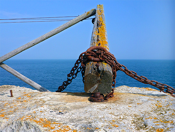
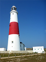
There were once two lighthouses on Portland Bill, Higher and Lower; these were decommissioned in 1906, replaced by a new structure right at the southern end of the isle, near the Trinity Head Obelisk, a 7 metre-tall spire that was erected in 1844, also as a warning device, positioned above a shallowly-submerged shelf extending some 30 metres out to sea. Obelisk and lighthouse are two of the most photographed landmarks, along with an isolated limestone stack, Pulpit Rock, a relic of quarrying in the 1870s.
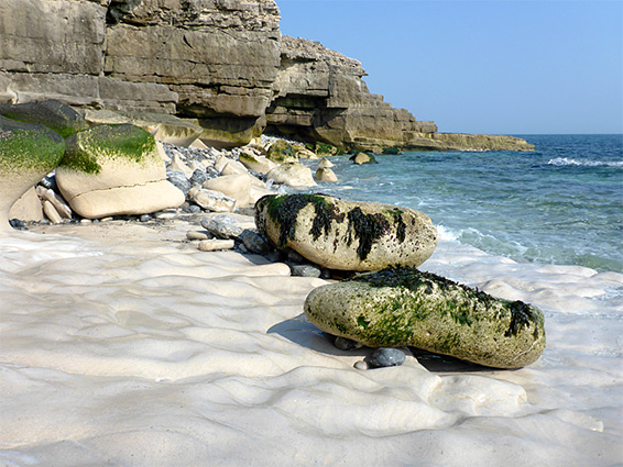
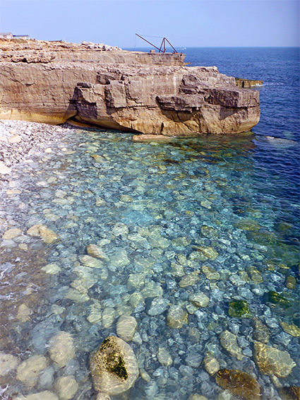
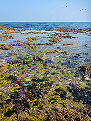
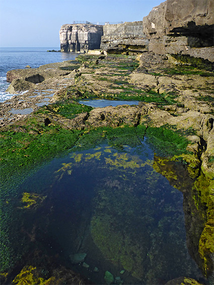
The coast along the southern portion of the isle is lined by low cliffs, narrow terraces and other wave-eroded formations, together with blocks and excavations from the old quarries, and there are plenty of rock pools exposed around low tide. Portland Bill can be explored via a loop walk of 3.2 miles, mostly along the coast but veering inland for a while on the west side, to avoid an MOD base, and crossing the interior, alongside fields, on the south side of Southwell village.
The road to Portland Bill, from Weymouth and Southwell, ends at the lighthouse, just before which is a large (paid) car park. The MOD base is to the west, and there is a seasonal cafe overlooking the sea to the east. The lighthouse is accompanied by a visitor centre that includes exhibits about the older pair of lighthouses (built in 1716), while a short path leads to the obelisk. To the northeast, the main coast path runs right along the edge of the low limestone cliffs, below which is the narrow intertidal zone, at most 100 feet across. The path passes above a stony bay and a couple of sheer-sided inlets, to a promontory where quarried stone was once loaded onto boats; a relic from this time is the Red Crane, an iron structure still in operation, now occasionally used to lower fishing boats into the sea. Beyond are a succession of little bays and promontories, then one of the former stone excavation sites, Butts Quarries, followed by a series of straighter cliffs which become gradually higher, and lead to another site, Longstone Ope Quarries, and a second old crane. A third, wooden crane is found a little further, at the Breston Quarries, near a small beach, Sand Holes. The cliffs are now 100 feet high, not especially photogenic, above a thin line of jumbled, tidal boulders.
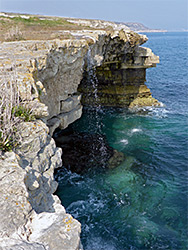
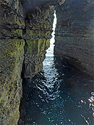
The coast path continues north, while the Portland Bill loop turns inland, the route running beside a field, briefly along the road then up a bridleway across to the west side of the isle, intersecting the coast path again. Turning south, this runs near the edge of tall cliffs, 200 feet above only a very narrow intertidal zone with more terraces and rocks, completely inaccessible from above. The path moves inland to bypass the MOD facility, returning to the cliff edge in the vicinity of the lighthouse at the disused Bill Quarries, a series of shelves, pits and cliffs. Hidden beneath a projecting spur is a sizeable sea cave, or arch, the White Hole. Above this is Pulpit Rock, a flat-topped peak once also part of a natural arch, left standing after the rest of the feature was removed by quarrying. The rock is a popular location for fishing, though climbing to the top is not straightforward. Beyond the rock, the last, boulder-strewn section of coastline leads to the obelisk, at the very tip of Portland Bill.