Black Hill, or Cat's Back, is the easternmost ridge of the Black Mountains, Herefordshire/Monmouthshire, and can be explored via a spectacular five mile loop, descending along the secluded upper reaches of Olchon Valley to the west
Parking
3.5 miles north of Longtown, along an unnamed road; HR2 0NL
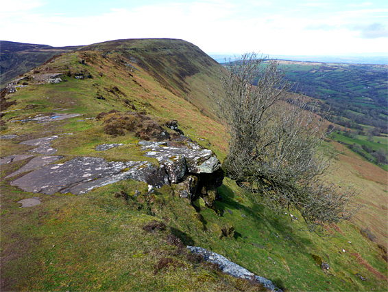
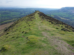
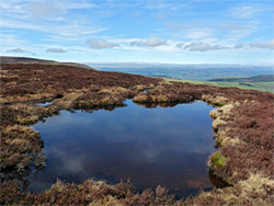
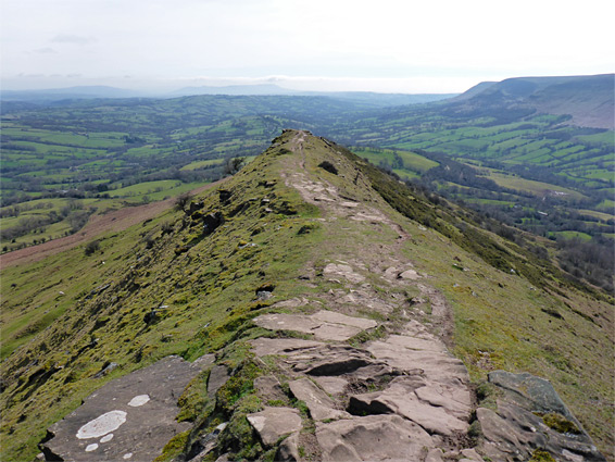
Nearly all the Black Mountains are within Brecon Beacons National Park, in Powys and Monmouthshire, the exception being the easternmost peak, Black Hill, since this lies over the country border in Herefordshire, together with the secluded Olchon Valley, just below the hill to the west. Like other peaks of the mountains, Black Hill is formed by a narrow ridge extending southwards, but only for 2 miles, in contrast to the other ridges, within the national park, which are up 10 miles long, but although short the hill is particularly photogenic due to its narrowness - a rock-lined crest flanked by steep slopes, offering fantastic views in all directions. Ridges to the west are much broader so the foreground is not as interesting and the views more limited. The ridge south of Black Hill, known as Cat's Back, climbs in a series of flatter parts and short steeper sections up to the summit, beside which are several shallow pools, right on the brink of the northern rim of the Black Mountains escarpment.
A five mile loop can be made by walking up the ridge to the summit then northwest a way along the high ground before returning via the adjacent Olchon Valley, by a path that follows a small stream past a sequence of cascades and pools. All this region is very lightly visited, since it is accessed only by several long, winding, mostly singletrack roads - the nearest major town is Hay-on-Wye, 13 miles north.
The usual approach to Black Hill is from the south, starting at a parking place at the end of a country lane 3.5 miles northwest of Longtown, after several junctions; at the last two the destination is indicated by a picnic area sign. The road climbs steadily over the final couple of miles to a parking place at elevation 1,250 feet, at the edge of open access land below the south end of the ridge that leads to the summit. Narrow Olchon Valley lies off to the west, while to the east is a wide expanse of rolling farmland, extending towards Golden Valley along the River Dore.
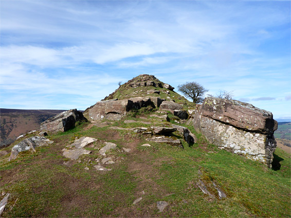
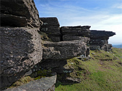
The path starts by heading up a grassy slope for a third of a mile to the first of the rocky outcrops that are scattered all along the crest of the ridge - formed of the Senni Formation member of the Old Red Sandstone, here dull grey in colour. The rocky and narrow section of the ridge extends for 0.6 miles then continues as a band of cliffs off to the east as the land widens, becoming densely covered by heather, and the path reaches the summit in another half a mile. The rocky crest has a number of level sections followed by short rises leading to intermediate summits, affording ever grander views of the lowlands to the south. In spring the rocks are liberally covered with common whitlowgrass, a small, white-flowered species of the mustard family, as well as clumps of bright green moss. Occasional lonely trees cling to the rocks, projecting at odd angles, and there are also several alcoves and niches, formed by larger rock exposures.
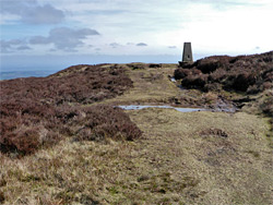
The flat summit, barely distinguishable from its surroundings, is marked by a concrete obelisk, beyond which the path continues northwest along the nearly flat ridge that connects to the next segment of the Black Mountains; its northern face is known as Crib y Garth. Once at the high point all the land to the north comes properly into view from the first time, including the Wye valley, the hills of mid Wales and the Malverns in the northeast; on a clear day even the high peaks of Snowdonia can be seen. There are several shallow pools close by, filled with dark, tannin-stained water, one right on the edge of the steep northern slope. The path runs close to the rim for 0.8 miles to a junction with the southwards route down Olchon Valley; ahead it continues to Hay Bluff (2.2 miles) and then Gospel Pass (3.3 miles).
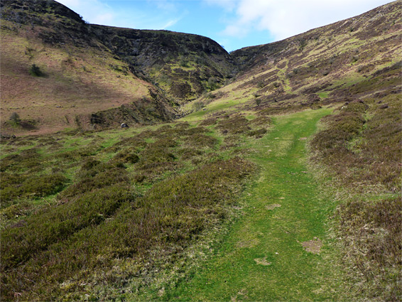
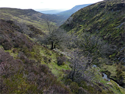
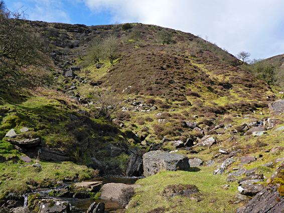
The path to Olchon Valley descends gently over the heather to the head of the ravine then drops down quite steeply, staying just to the east of a small stream, and meeting a road after 1.2 miles from the junction. The waterfalls and pools along the drainage can be seen by walking off trail a way then directly down the streambed; there are no significant obstacles, though also no especially big falls. One tributary joins from the west, then the gradient lessens and the creek flows towards a sparsely wooded area further down the valley. From the end of the path it is 1.4 miles back along roads to the start point, but perhaps a better alternative is to walk cross-country or along sheep trails over the hillside to the east, across a number of tiny drainages before rising slightly to pass along the upper edge of a patch of woods, over more rough grassland and finally round below the lower end of the ridge, meeting the initial path just below the southernmost rocky exposures.