The highest road in Wales (1,801 feet, 549 metres); in the Black Mountains of Brecon Beacons National Park, between the narrow Vale of Ewyas to the south and the lowlands of the River Wye to the north
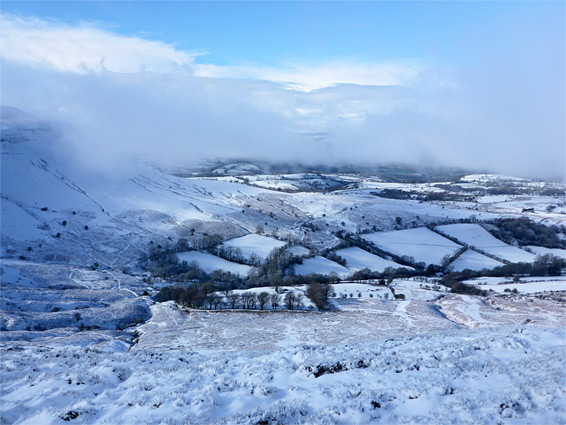
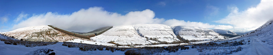
The Vale of Ewyas is a long, narrow, steep-sided valley in the Black Mountains, towards the eastern edge of Brecon Beacons National Park, and is followed by a winding, mostly single track road that to the north climbs steadily to a high point of 1,801 feet (549 metres) at Gospel Pass, the highest paved road in Wales. Beyond, the land slopes steeply down to the rolling farmland of the Wye Valley, while at either side rise the adjacent, flat-topped peaks of Hay Bluff (formerly known as Pen y Beacon) to the northeast and Twmpa to the southwest. Most of the valley is part of Monmouthshire but the northern few miles, including the pass, are in Powys, and the ridgeline to the east, extending south from Hay Bluff, marks the boundary between Wales and England.
One tradition holds that name of the pass is a reference to a visit over 2000 years ago by Saint Paul, who crossed this part of Wales whilst preaching the gospel, however it is more likely to derive from a band of Crusaders who visited this location in the 12th century.
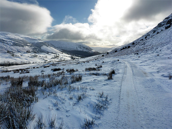
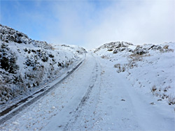
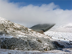
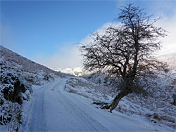
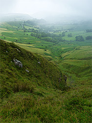
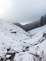
Because of the high elevation, the road receives a fair amount of snow in winter, and can become impassable for several days at a time. The views are of course very spectacular, and contrasting, with the confined, sinuous, secluded valley to one side and the much broader landscape to the other. The pass is also the start point for walks into the mountains, to Twmpa and other peaks beyond (including Waun Fach), or to Hay Bluff, perhaps making a loop via the valley immediately south, which contains a stream, the Afon Honddu, flowing partly through a forest plantation. This walk is described below.
The seemingly unnamed road up the Vale of Ewyas branches off the A465 five miles north of Abergavenny at Llanvihangel Crucorney and heads north along the valley floor close to the Afon Honddu, here a small river. After 6 miles it passes the evocative ruin of Llanthony Priory, beyond which the road is a little less used, and narrower, nearly all single lane, albeit with regular passing places, so at popular times of the year, in weekends during the summer, the journey can be slow. After ten miles it reaches a junction at Capel-y-ffin, at the mouth of a little side valley to the west, then after 11.6 miles, as the gradient increases, the road leaves the woods and farm fields beside the river and enters open moorland, climbing another 300 feet over the next half mile to the pass. The land is much steeper beyond so the downwards road takes a slanting course, cutting across the slope to the north then descending more gently towards Hay-on-Wye.
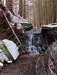
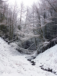
The two shortest walks from Gospel Pass are there-and-back routes, to the neighbouring summits of Hay Bluff (1 mile) or Twmpa (0.8 miles) but one option for a loop hike, partly cross-country, of 3 miles, is to reach the former peak via the partly wooded valley to the south, then return along the official path. A suitable parking place for this walk is at the junction with the track to Parc Bach farm, half a mile south of the main parking area just below the actual pass. From here, the summit of Hay Bluff is 1.4 miles away, above the uppermost reaches of the Afon Honddu, the stream/river that flows all along the Valley of Ewyas. The stream can be reached after about ten minutes by walking along the side track briefly then heading cross-country, across a little tributary drainage and over the bracken-covered hillside on the far side, perhaps following a sheep path, down to the floor of the valley just as the stream emerges from a dense conifer plantation. The stream is within the trees for half a mile, flowing over a few minor waterfalls and crossed by many fallen trees, but the walk is easy enough, all through the plantation and then over the steepening ground beyond, up to the tussocky plateau that leads to the actual highpoint of Hay Bluff, beyond which the ground falls sharply away to the north and east. The loop is completed by walking along the wide path over the ridge known as Ffynnon y Parc, which extends southwest from the peak, then down the far side to the pass, and finally back along the road to the start point.