Sizeable area of limestone uplands edged by a steep escarpment of cliffs and scree slopes, above the Taf Fawr valley at the southern edge of the Brecon Beacons
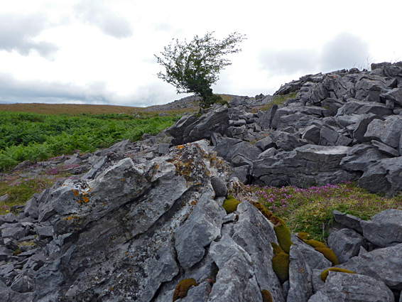
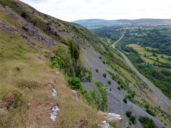
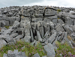
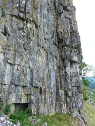
Darren Fawr ('large scarp') is a west-facing escarpment along the southern edge of the Brecon Beacons, just north of Merthyr Tydfil, rising up to 500 feet above the Taf Fawr river - a line of sheer limestone cliffs atop steep scree slopes, while above is an extensive, gently undulating plateau, mostly grassy but sprinkled with flat outcrops of fractured, weathered rock, known as limestone pavement. Older maps name the escarpment as Graig Fawr ('large rock'), while the plateau is Cefn Cil Sanws.
The plateau and the upper section of the escarpment is contained within Darren Fawr Nature Reserve, a relatively large region, noted for the rock formations, the range of plants and animals, the good views, and the general remoteness, since despite the proximity to the city and the busy A407 below, the place is difficult to access and so little visited.
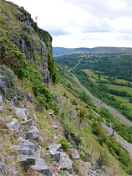
In addition to the limestone exposures and the high elevation calcareous grassland, the reserve also contains a small area of mixed ash woodland, towards the north. Although the west edge, below the cliffs, is just 100 feet from the A407, and could be reached by climbing over a low fence and walking uphill, parking is limited and there is no recognised entrance hereabouts. Instead, the recommended approach is from the south, starting at Merthyr Tydfil golf club, from where the southern boundary of the reserve is accessed by a walk of 0.8 miles, while the north edge is a mile further. One option to explore the area is to walk north across the plateau and return south along the base of the cliffs, above the scree slopes, though care is needed as there is no path, and some parts are very steep.
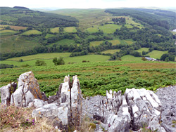
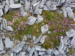
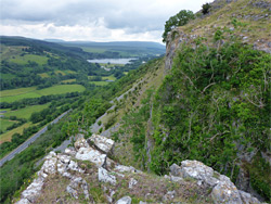
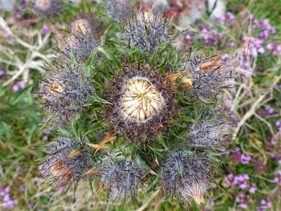
From Vaynor Road off the A4054, a steep and narrow street (Cloth Hall Lane, then Lon Maes Du) climbs through a residential area to the good-sized carpark in front of the clubhouse for the Merthyr Tydfil golf course. There is no charge for parking, and the place is also open to non-golfers. The route to the nature reserve is not obvious and not signed; it starts along the main track into the course, veers left after 800 feet then left again soon after, runs alongside one of the fairways, past the furthest tee and through a gate, continuing over open land covered by bracken and heather, to a sign marking the reserve boundary, close to the west edge of the plateau. The path proceeds along the top of the cliffs, eventually meeting a track near a belt of woodland, while other routes traverse parts of the plateau, and the short grass makes it easy to walk anywhere, cross-country. There are many patches of the limestone pavement, sheltering some of the rarer wildflowers, in crevices and potholes, plus just a few isolated, windswept trees. Views are extensive in all directions, and are most spectacular to the west and north, along the river valley, across Llwyn-on Reservoir towards the highest peaks of the Brecon Beacons.
The cliffs are sometimes visited by rock climbers, though much of the surface is weathered and unstable, and some of the upper sections are covered by ivy, so conditions are not ideal. The escarpment is split by a few gullies, at least one of which provides a route up and down, but the most is an unbroken line, of sheer, dark grey rocks up to 100 feet high. The base of the cliffs, above the scree, is moderately easy to follow, and along here are more of the notable plant species including hawkweed, rigid buckler fern and Ley's whitebeam. Lower down, the scree slopes merge with several ancient quarries, beside the road.