Blorenge, a name of uncertain origin, is a flat-topped summit, elevation 1,841 feet (561 metres), the tallest and most prominent section of the hills south of Abergavenny, west of the River Usk; its northern flank slopes steeply towards the town, while in the other direction the land forms a narrow ridge, angling down much more gently towards Pontypool, and to the west is the valley of the Afon Lwyd, with Blaenarvon at its upper end.
From Blaenarvon, a minor road climbs over a saddle and descends to Abergavenny, traversing the northern slopes of the hill, and at the high point is a parking area, start of a 5.5 mile path that loops all around the summit plateau. The actual summit is most easily reached by a shorter (0.8 mile) path starting along a side road, at the Foxhunter car park.
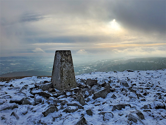
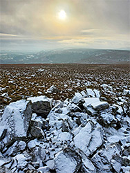
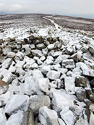
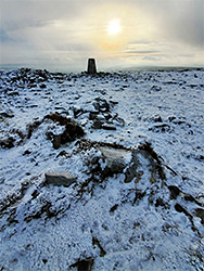
The actual high point, rising just a few feet above its surroundings, is marked by a rock pile and obelisk, and it has excellent views all around including south towards the Bristol Channel, northeast to the Forest of Dean and north to the Black Mountains. The peak forms the southeastern corner Brecon Beacons National Park, the boundary of which extends south to incorporate the ridge, almost to Pontypool.
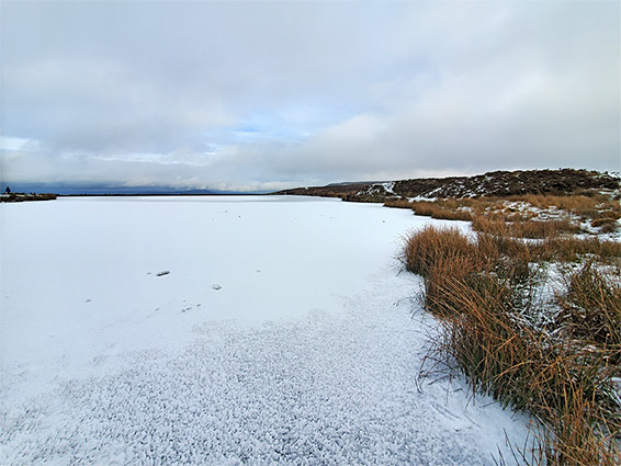
The lower slopes of Blorenge have been much affected by past industry; relics include sandstone and limestone quarries, disused mine shafts and old coal excavations, plus several former tramways, one forming a section of the loop path. Another relic is a pond, Pen-ffordd-goch ('pool of the head of the red road'), or Keeper's Pond, at the saddle on the road from Blaenarvon to Abergavenny - this was constructed in the late 18th century by diversion of several streams, used to supply water to an ironworks and forge at Garn-ddyrys, one mile north.
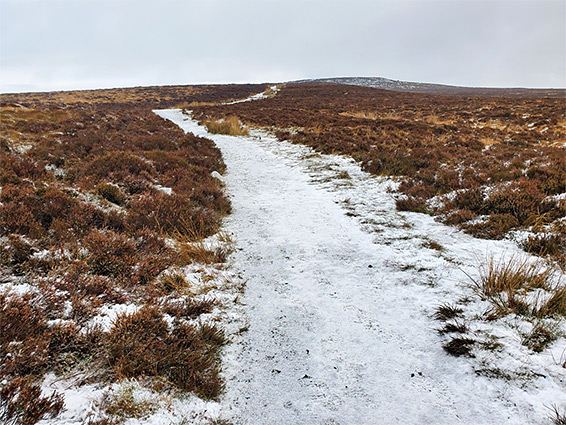
The shortest hike to the summit starts from the Foxhunter carpark along the side road east of the pond, opposite a pair of transmission towers. The parking place is named after a famous racehorse who won a Gold Medal at the 1952 Olympics, and is buried here. The path heads northwest for 0.8 miles, climbing only very gently, by 160 feet, passing a few rock outcrops shortly before arriving at the summit. Two paths continue, one northeast, linking with the loop path across the lower slopes, the other northwest also joining the loop. This loop can be started either beside the pond or from further east along the side road. Most of its route is across similar-looking, heather-clad slopes, somewhat featureless, but to the east it curves above and below a pair of rounded basins, Cwm Craf and the Punchbowl, both thought to be in former glacial cirques. The latter contains a small pond, partly surrounded by trees.