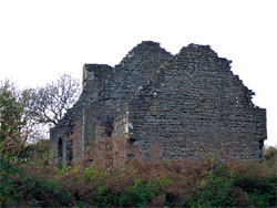
Roofless ruin of a small Norman chapel, built in the late 11th century; in a rural location southwest of Chepstow, the most visible part of an abandoned village
Along a lane on the east side of Crick Road, one mile from the A48
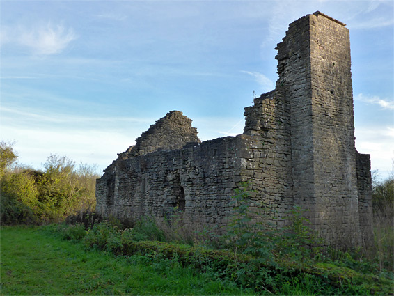
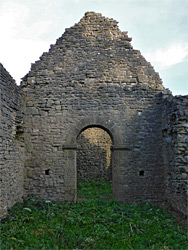
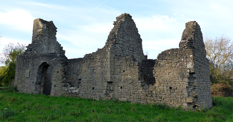
Runston was a small settlement in the ancient kingdom of Gwent, situated on top of a low limestone hill 2.5 miles southwest of Chepstow and one mile north of Crick, overlooking the Bristol Channel; at its peak in the late medieval period the village consisted of about 25 cottages plus a chapel and possibly a manor house. Occupancy declined gradually over the next few centuries, and the last residents are thought to have left sometime in the 1700s. All the houses are long gone, the only evidence being a few indistinct ridges where walls once stood, and spring snowdrops indicating the locations of gardens, but the chapel survives, missing its roof and some upper parts of the walls but otherwise in relatively good condition. The gable-roofed building dates from the late 11th century and contains a few architectural elements typical of the time including a semi-circular arch dividing the nave from the chancel, and two narrow, recessed lancet windows.
The surroundings are quite overgrown, with a mixture of long grass meadows and patches of woodland, and the trees obscure most of the views once enjoyed by the church. There is also a certain amount of farm debris in the vicinity which detracts from the overall appearance, but the ruin is certainly remote, peaceful and quite evocative.
Runston Chapel is managed by Cadw though is somewhat difficult to locate and is not signposted. The approach is along a narrow lane on the east side of Crick Road; this passes a few houses then crosses farmland for several miles. The original track to the village, latterly a footpath, used to leave this road just after the junction but the right-of-way appears to have been recently closed, and instead, a small 'Footpath' sign 500 feet east indicates the new access point. There is however little or no parking nearby so a better start point might be another thousand feet east, at a bend on the lane, where the verges are wider, and from here the chapel is 700 feet southwest, on the far side of an upwards-sloping field.
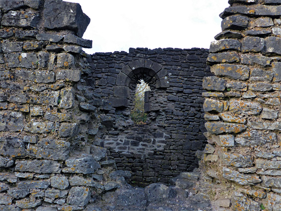
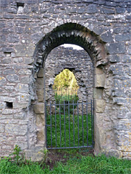
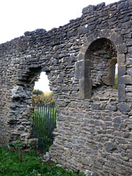
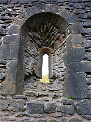
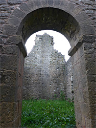
Traces of an enclosing wall are evident on the north side of the chapel, presumably defining the edge of the graveyard. The building consists of a rectangular nave on the west side, 27 feet long, and a chancel to the east, 13 feet square. Entrance is on the south side of the nave, through an arched doorway, opposite which is a ruined opening, probably once a window. The semi-circular lintel formerly positioned above the door is apparently incorporated into the entrance to Broadwell Farm, on the south side of the hill. There are definitely two windows in the nave, one, also ruined, in the south wall and the other to the north, complete and well constructed. This window is relatively broad on the inside but strongly splayed, narrowing to an exterior opening just 6 inches across. The chancel was lit by an opposite pair of similarly small windows, of which the one on the north side is mostly intact. A solid rectangular tower abuts the west end of the chapel, once supporting the belfry.