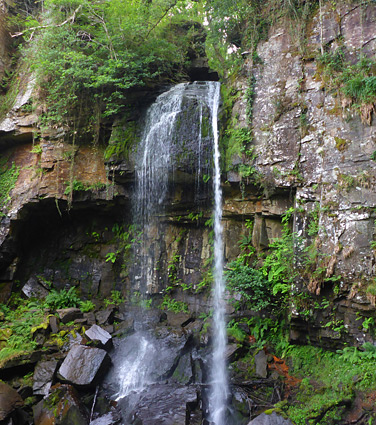
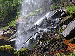
Melincourt Brook is a short, east-side tributary of the River Neath in Neath Port Talbot, originating on the slopes of Cefnmawr and flowing for less than 3 miles while descending 1,400 feet, before joining the river. There are several small waterfalls along its upper reaches, but the brook is most famous for the 80 foot-high Melincourt Falls towards the lower end, the third highest waterfall in south Wales after Henrhyd and Sgwd Einion Gam. The Welsh name of the falls is Sgwd Rhyd yr Hesg, meaning Ford of the Rushes Waterfall.
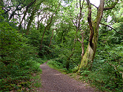
The falls and a third of a mile of the narrow, steep-sided valley downstream are contained within a 13 acre nature reserve, created mainly on account of the ancient oak woodland that covers the slopes. Besides the trees, the moist, sheltered gorge is also good habitat for ferns, with over 20 species recorded. Wildflowers are limited to a few common species, such as enchanter's nightshade, bluebell and tutsan. Within the reserve, one path leads alongside the brook to the base of the falls, while another climbs the slopes to the south and meets a narrow lane (Waterfall Road) just upstream.
The seemingly undisturbed valley at Melincourt (sometimes spelt Melin Court, or Melincwrt) was for over 200 years the site of various mining operations, for coal and iron ore; the few visible traces include the remains of ironworks and a blast furnace along the northern edge of the reserve, and tracks from ore tramways, one now used as the path to the falls. Visitor parking, in a tree-lined layby beside the B4434, is on the site of the old Glyn Merthyr Colliery, which operated for several decades in the 19th and 20th centuries.
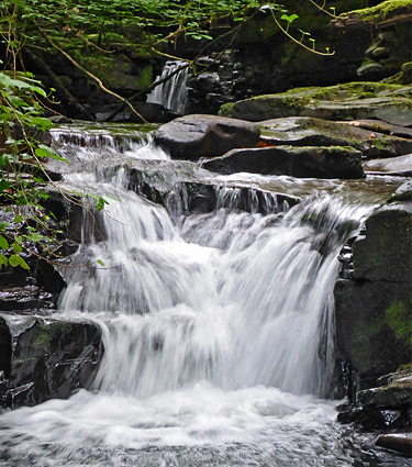
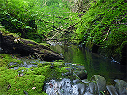
The (free) parking area for visitors to the nature reserve and the waterfall is 5 miles northeast of Neath, just south of the B4434 bridge over the brook, on the west side. The wide path starts directly opposite, ascending gradually while staying close to but generally a little way away above the stream, as it flows through several cascades and pretty pools. The path ends after 0.3 miles at a viewing area opposite the base of the falls, from where, during times of low flow, is easy enough to walk a short distance further, across boulders, to a ledge right behind the cascade. The falls occur where the brook crosses a ledge of Pennant sandstone, which forms vertical cliffs at either side, sprinkled with ferns and moss. Just behind the base of the falls are two tiny springs producing bright red water, draining one of the iron mines further upstream.
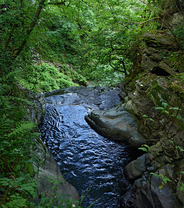
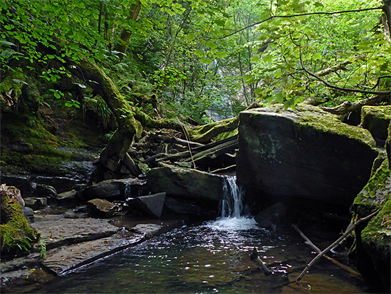
A narrower path forks off southwards about halfway along the main route, climbing more steeply through the oak woodland, and joining a wider track (another old tramway), which continues past a viewpoint of the falls and meets the lane that crosses the book about 100 feet upstream of the drop. Below the road ridge are pools, ledges and narrow channels, viewable, again only during low water levels, by carefully climbing down on the north side, while upstream of the bridge are remains of a sluice valve and aqueduct, and also another path that follows the brook further east, now outside the nature reserve.