4.5 mile-long river in the Cambrian Mountains, flowing through woods and moorland, with several pools and waterfalls including Pwll y March and Sgwd y Ffrwd
Afon Gwesyn is one of the many minor rivers that drain from the Cambrian Mountains of central Wales; it is located towards the south end of the range near the little settlement of Abergwesyn, at which it joins the larger Nant Irfon. The former river is 4.5 miles long, the lower portion partly wooded, the upper reaches contained within a relatively shallow grassy valley (Cwm Gwesyn), and it originates on the boggy slopes around 2,115 foot Drygarn Fawr, an elongated summit.
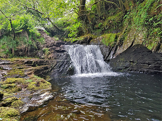
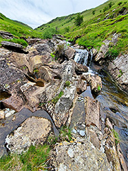
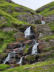
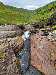
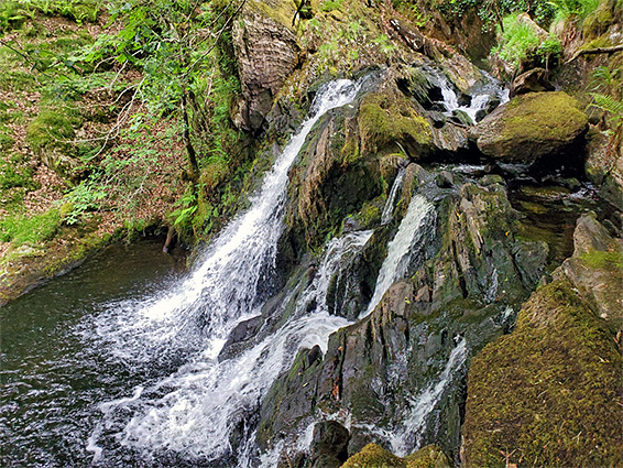
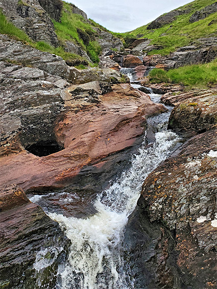
The valley, like the whole area, is quiet, peaceful and very little visited, although easy to explore, by a path that runs upstream most of the way to the head of the valley. Besides the solitude, and the general scenery, the river flows through two (named) features of note, a deep, enclosed, circular pool (Pwll y March, or 'horse's pool'), with waterfalls above and below - this in the wooded section - and a multi-tiered waterfall, Sgwd y Ffrwd, towards the upper end of the valley, where the waters flow over a sequence of ledges of colourful, red/orange mudstone, forming many pools and cascades. There is also another sizable pool and waterfall, unnamed, in the woods a third of a mile below Pwll y March.
The walk to the uppermost waterfall is 2.2 miles; above here, the final part of the drainage is less interesting though the hike could be extended all the way to the summit of Drygarn Fawr; another 1.4 miles, mostly off trail.
The path up the Afon Gwesyn valley starts near Ty-mawr farm, along an undesignated road half a mile northeast of Abergwesyn - parking is on a short side track at the farm entrance, beside a postbox. The route is up the farm access road a short distance then right on a path that crosses two fields and runs along the edge of another, descending gently through the corridor of trees enclosing the river, and crossing via a ford. The path, now on the east side of the river, passes through more woods and two open areas then enters a larger field below Trysgol farm, from where the route climbs the hillside, passes through the farm buildings and returns to the vicinity of the river in a quarter of a mile, a short distance above the Pwll y March pool/waterfall; this can be reached by a short diversion, approaching either from a little way above or below, as the river is lined by cliffs around the pool itself. An alternative plan is to leave the track at the base of the big field and simply follow the river all the way, across this field and the next, to Pwll y March. Near where the official path ascends the hill to Trysgol is another, unnamed, pool and waterfall, below a short enclosed section, also surrounded by trees, and reachable by climbing carefully down to the river.
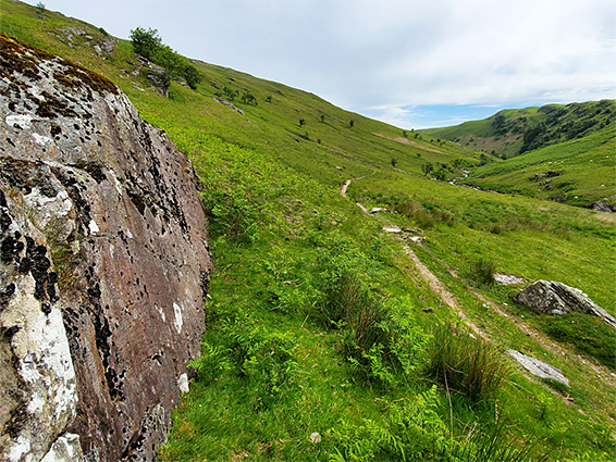
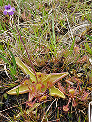
Above the Pwll y March, the river flows through a rock-lined channel, extending past the upper edge of the trees and into an open valley, where the drainage is no longer enclosed. The path, narrow and not much travelled, continues upstream for 1.2 miles, climbing steadily but never too steeply across one tributary (Nant y Fedwen) to the base of the Sgwd y Ffrwd waterfall, where it fades away. The surroundings along the path are typical moorland slopes, sprinkled with wildflowers such as heath spotted orchid, heath speedwell, round-leaved sundew and, most unusually, butterwort, a delicate bog plant with solitary, purple, spurred flowers. The waterfall extends for about 300 feet, over a quite steep slope, above which the land becomes much flatter, and there are no more significant cascades.