Dinas Castle, or Castell Dinas, is reputedly the highest castle in England and Wales, with an elevation of 1,476 feet, perched on a prominent hill that forms the westernmost section of the narrow ridge of Y Grib ('Dragon's Back'), a spur off a sizeable upland area centred on 2,600 foot Waun Fach, one of the main peaks of the Black Mountains towards the north side of Brecon Beacons National Park. This is a remote and isolated location, subject to rough weather much of the year, so construction of the stone castle was a major undertaking, all the more so given its early date - work is thought to have started just a few years after the Norman invasion, in the 1070s, to support campaigns led by William FitzOsbern and his son Roger, both Earls of Hereford. The castle incorporated the long-abandoned earthworks from a much earlier timber fortification, from the Iron Age.
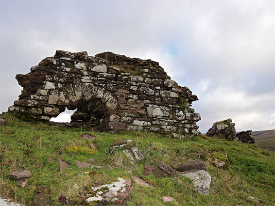
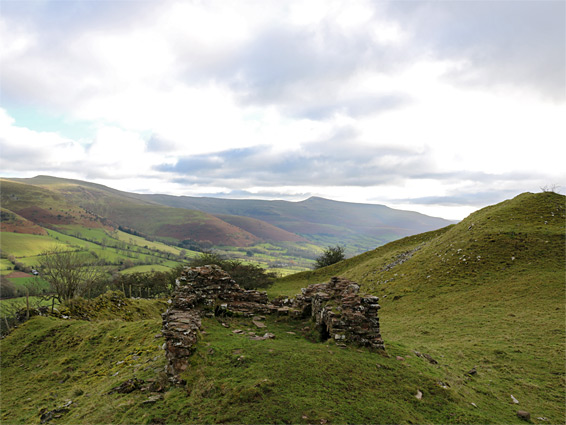
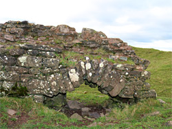
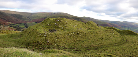
Castell Dinas declined in importance after just a few years, following opening of a larger, more easily accessible castle in Brecon, 8 miles west, but remained in near-continuous occupation until the early 15th century, when it was destroyed during the rebellion led by Owain Glyndwr, and never rebuilt. Prior to this it was held by the English apart from two brief periods of capture by the Welsh during the 13th century. Due to the isolated location and the long period of abandonment, very little remains today, and the only visible, unburied fragment is the base of a gate tower, though some large grassy mounds at the centre of the site indicate the position of the main part of the fortification, a rectangular, thick-walled keep.
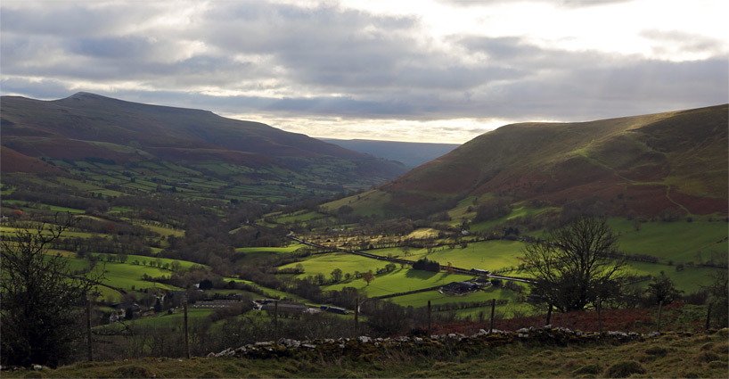
Dinas Castle overlooks the upper (north) end of the valley of the Rhiangoll River, which cuts through the Black Mountains near their western edge, and provides a course for the A479 between Talgarth and Tretower. Below is a minor pass, separating the river from a lesser drainage to the north. The hill on which the castle is built is half mile east of the road and 400 feet above, reached by a path starting from a parking area by the Dragon's Back pub, charged at £2 for non-customers. The trail descends briefly through a belt of woodland, crosses a small stream, climbs steeply across three fields then runs alongside a patch of conifer trees to the summit. An alternative approach is from the north, starting at the end of the narrow lane to Dinas farm, where parking is more limited. The walk from here is similar in distance but somewhat less steep. Either parking area is also used for trips up the Dragon's Back ridge, which provides a spectacular way to reach the high country around Waun Fach.
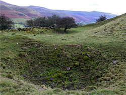
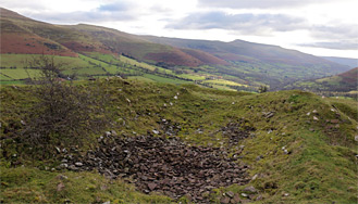
The Iron Age fort is recognisable as an oval-shaped enclosure about 500 by 250 feet in outline, aligned north-south. The castle consisted of a rectangular keep, 95 by 70 feet, roofed across the interior to form a hall, surrounded by a protected bailey enclosed by curtain walls, which had several towers at intervals. The keep is now a straight-sided mound with higher humps at the centre, all covered in grass, with a low embankment all around the perimeter, where the outer wall once stood. The only identifiable section is the lower few feet of the walls of a square tower which guarded the main (northern) entrance. A semi-circular arched opening is visible on the west side of the tower, partly buried at the base. The tower probably dates from the early 13th century, when the castle was rebuilt following temporary occupation by the Welsh prince Llywelyn the Great, and contemporary with a deep ditch below the curtain wall to the west, excavated to improve defences along the side most vulnerable to attack. Elsewhere on the site are various pits, mounds and piles of stones, presumably indicating other sections of the fortification, and there is also the remains of an ancient well 200 feet north of the tower, seemingly associated with the castle.