Loop hike in the Black Mountains; first to Table Mountain, site of an ancient fort, then across the higher summits of Pen Cerrig-calch and Pen Allt-mawr, returning via a ridge (Taf Trwynau) and part of the Grwyne Fechan valley
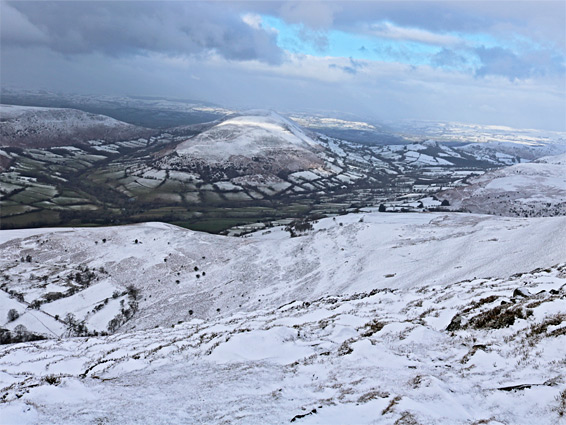
The Black Mountains are one of four high elevation regions within Brecon Beacons National Park, occupying an approximately trianglar area of land between Hay-on-Wye, Abergavenny and Talybont-on-Usk, along the border separating Powys and Monmouthshire. The highest section is at and around Waun Fach, while the second is a few miles south, where the land rises to a broad, flat-topped ridge between two peaks, Pen Cerrig-calch and Pen Allt-mawr. The former lies right at the south edge of the mountains, and beyond the land slopes steeply down to Crickhowell along the River Usk, forming several spurs including one prominent lesser peak named Table Mountain on account of its level summit, which is the site of the iron-age hill fort of Crug Hywel.
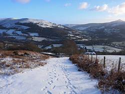
The fort is a popular location for short walks, usually starting in the centre of Crickhowell, but the higher peaks are more dramatic, and a hike here can be extended by walking a little further north, then returning along an adjacent ridge to the east, separated from the twin peaks by a roadless valley. The walk gives five views over the central Black Mountains to the north and west, and the River Usk and the Brecon Beacons to the southwest. The round trip distance is 9 miles, of which 2 miles is along country roads, and the elevation gain is 1,700 feet.
The recommended approach to Table Mountain is beside a wooded brook that leads north from Crickhowell, a walk of 1.2 miles, however the closest approach is from the east, along a narrow road north of Llanbedr. The distance from here is just half a mile from the road, though there is no parking in the vicinity; the nearest suitable place is 0.3 miles south, beside the junction with a road from Llanbedr, and 2 miles from Crickhowell.
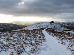
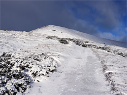
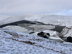
From the road junction, a short walk northwards, past Ty-mawr farm, reaches a vehicle track on the left, which leads steeply uphill to Perth-y-pia, an outdoor activity centre surrounded by fields. A path continues ascending, along a short line of trees and through a gate marking the start of open, public land, then up a little further, still steeply, to the flat top of Table Mountain, the far side of which is bordered by a line of stones from the hill fort, just above a ditch. The fort occupied all of the summit though the walls and ditch are less defined on the other sides. The trail continues north of the fort and soon forks; one branch curves down around the head of a valley then descends beside the stream to Crickhowell, while the other leads up the ridge connecting the fort to the main area of high ground; a steady rise, steepening around an intermediate promontory named Trwyn Ysgwrfa, then less steep again as it approaches the southernmost of the two summits, Pen Cerrig-calch (701 metres, 2,300 feet). The high point is marked by a concrete post, and although the land all around is fairly flat, the views are still good, in all directions. The rocks around the summit are limestone, and contain a few small sinkholes, unlike most of the Black Mountains, including the lower slopes of the peak, which are formed of Old Red Sandstone.
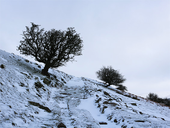
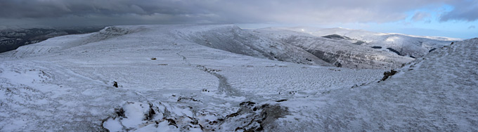
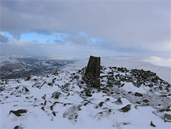
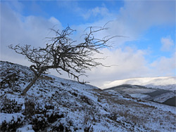
The trail continues north down a rockier area then levels out, following the east side of the broad ridge linking with the next, slightly higher summit, Pen Allt-mawr (719 metres, 2,360 feet), arriving there after a gentle climb. This summit is much better defined, as the ground drops steeply away on three sides and hence is a rather more dramatic location; views include the isolated hills of Pen Tir and Mynydd Troed to the west, and Waun Fach to the north. As before the summit is marked by a post, plus an cairn and a rough stone shelter. Another path joins here, from the opposite side of the ridge, leading to the lesser, westwards-projecting summit of Pen Gloch-y-pibwr, while the main route continues northwards, steeply down over a partly rocky section and then a more gentle slope as the land flattens out, and the ridge curves slightly eastwards around the upper end of a valley (Cwm Banw), and on to another minor peak, Pen Twyn Glas (646 metres), and a junction. One trail stays along the ridge to the north and eventually leads to Waun Fach (3.2 miles), while the other path follows a subsidiary ridge, Taf Trwynau, southwards, and this forms the return part of the loop hike. The trail descends slowly but consistently, giving fine views of the partly wooded valley of Grwyne Fechan to the east, and passes several shallow holes from disused quarries, plus a few stark, isolated trees, before arriving at a gate marking the beginning of farmland. The next section is along a track, followed by a stretch of sometimes muddy path through woods and finally down a grassy hillside, where the trail meets the road from Crickhowell, beside a bridge over the stream flowing from Cwm Banw. The parking area at the Llanbedr road junction is then 1.7 miles south.