Shady, thickly wooded valley below patches of heath and calcareous grassland. Most is a site of special scientific interest, while the middle section is a nature reserve
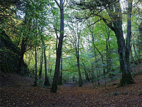
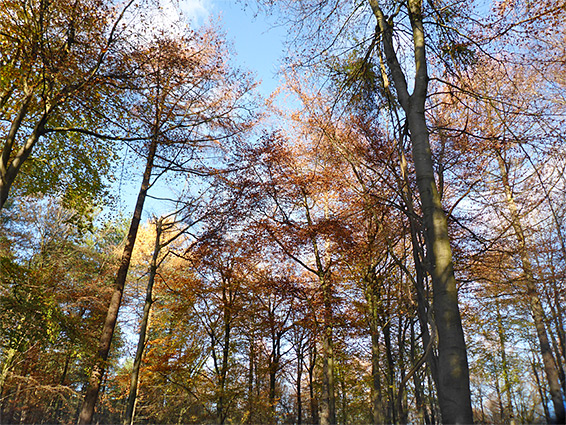
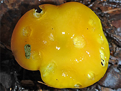
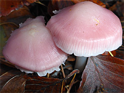
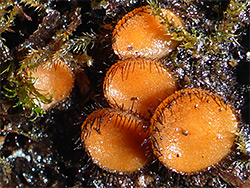
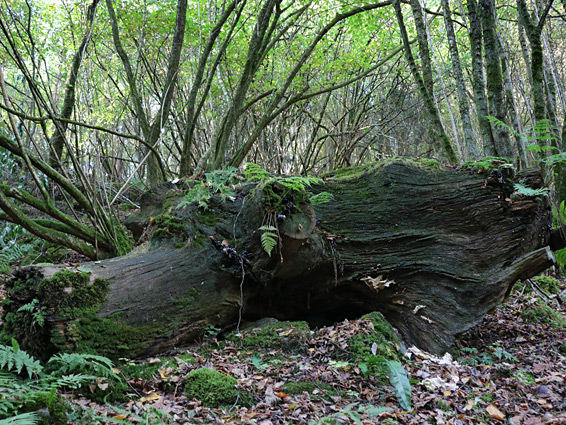
Goblin Combe is a shady, steep-sided dry valley cutting through a limestone plateau near Congresbury in northwest Somerset, extending nearly 3 miles, its upper end very close to Bristol Airport. The lower 2 miles are thickly wooded, a mix of ancient woodland (predominantly ash) and more recent plantations, and is home to a wide range of plants, including mosses, lichens, fungi and ferns along the moist valley floor, and wildflowers on exposed, rocky areas along the north rim, a mix of calcareous and heath species.
Most of the combe is protected as a site of special scientific interest (SSSI), while the middle part is also a nature reserve, managed by Avon Wildlife Trust, and the area of interest extends into more extensive woodland further north and east, owned either by the Goblin Combe Education Centre or the Woodland Trust. The woods are also notable for their large population of dormice, and for butterflies, with over 30 species recorded.
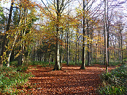
There are various paths through the woods and one all along the valley floor, and several hours could be spent exploring, but the best parts can be seen on a loop walk of 2.5 miles; along the valley, climbing to the rocky, treeless area along the north rim then continuing through the forest again to the site of an Iron Age hillfort above the mouth of the valley, an overgrown site known as Cleeve Toot. The combe is generelly peaceful and not much visited, though the tranquillity is often interrupted by planes taking off from the airport.
Parking is available in Cleeve, along Cleeve Hill Road near the junction with the A370, beside an old quarry. The track into the lower end of the combe starts a short distance north, at the end of Plunder Street, and is marked at its entrance with a sign stating that the initial section of the woods is private, part of the Congresbury Estate. The SSSI starts in around 600 feet, and the nature reserve after 0.7 miles.
Once past the edge of a narrow farm field, and a junction on the left with a path down from Cleeve Toot, the track enters thick woodland, permanently moist and usually dark and shady owing to the steep slopes above. The north side of the valley transitions from an earthen slope to a line of low, grey cliffs with overgrown scree at the base, but there is little change along the floor of the combe as it gains height gently, up to an old wall and gate, marking the edge of the nature reserve. A signed path ascends the yew-covered slope to the north towards the calcareous grassland on the rim, while the main route says along the floor of the combe, soon veering southeastwards slightly and on to another junction, also with a path up to the north rim. The east edge of the nature reserve is not much further, just beyond which the combe divides, the main branch, now quite shallow, to the east, and a tributary to the northeast, both also followed by paths. Some of the woodland beyond the wall is coniferous, supporting a different range of fungi to that in the broad-leaved forest that covers the majority of the combe.
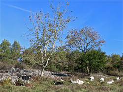
The second northwards path within the nature reserve winds up a steep slope and emerges from the woodland into a short-grass field, sometimes grazed by goats. The grassland lies at the south edge of Wrington Warren, originally open pastureland but now mostly wooded. On the far side of the field, at a junction marked by an Avon Wildlife Trust notice, the path veers west, over the field, through a patch of trees and then, for nearly 1,000 feet, right along the cliffs at the rim of the gorge, giving fine views towards the Bristol Channel. The rocks and the field are the best wildflower habitats in the reserve, and are notable for having plants favouring both basic and acidic soils. The former species, more widespread, are a result of the limestone bedrock, while the latter survive here due to pockets of windblown acidic sand. The trail divides soon after re-entering the forest, the left branch descending to the valley floor at the west edge of the reserve, and the latter continuing through more extensive forest where the trees are generally more separated than down in the combe, past several other junctions to Cleeve Toot, which is now merely a bushy clearing, not recognizable as a fort. The final section descends quite steeply back towards the track at the mouth of the valley.