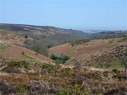
Wooded valley containing a stream, dividing to three upper tributaries, and a 1,018 foot summit overlooking the Bristol Channel; in the northern half of the Quantock Hills
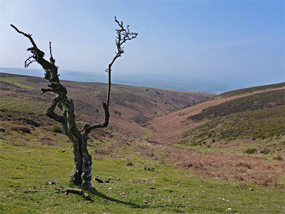
The Quantock Hills of north Somerset are characterised by moist, shady valleys (combes), containing ancient oak woodland - mostly along the eastern side of the range - and elongated, flattish summits, surrounded by rather featureless heath and moorland covered by grass, heather, bracken and gorse. Views from the upper reaches are extensive and the valleys quite atmospheric, though the hills as a whole are not especially photogenic and are crossed by a network of vehicle tracks allowing people to drive to many areas, so spoiling the peaceful atmosphere.
A good representative walk across the northern half of the Quantock Hills is to head up one of the longer valleys, Hodder's Combe, and its tributary Somerton Combe then climb further, above the trees to the extended ridge of Thorncombe Hill, and continuing north to the more prominent Beacon Hill (1,018 feet) overlooking the Bristol Channel. The return is via Sheppard's Combe, another tributary of Hodder's, to make a partial loop hike of 6.7 miles, round trip, gaining 600 feet in elevation.
The moorland is most colourful in late summer, when the heather is blooming, while the woodland and the combes, most of which contain permanent streams that form small pools and cascades, are pretty all year though especially so in spring and autumn.
The walk starts at the Holford Bowling Green car park, at the site of an old quarry; one of the main access points to the Quantock Hills, on the west side of Holford, just off the A39, along a narrow lane that continues a short distance to a row of houses. No parking fees are charged.
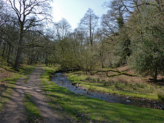
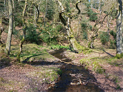
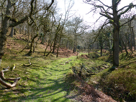
From the carpark, the westwards road leads past a village green and the houses then enters the woods and comes close to the stream flowing from Hodder's Combe. There is one junction, with a private track to a larger house on the opposite side of the stream, before a gate and noticeboard that mark the boundary of open access terrain, half a mile from the start. The land rises more steeply on either side as the path enters the mouth of the combe, which curves southwards and becomes gradually narrower. Fields continue along the opposite side of the stream for a while, used for sheep grazing, but eventually the trees cover all the valley floor, and the stream winds gently across the flat, grass- and moss-covered land between the more densely wooded hillsides.
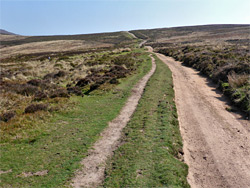
One mile from the start is a major junction (a popular location for bird-watching), where Hodder's Combe splits into three equally-sized tributaries, Sheppard's Combe to the west, Slaughterhouse Combe to the southwest and Somerton Combe to the south. All three are followed by wide paths. The route along the latter valley encounters similar scenery, of mossy trees (part of Adder Wood) and a tranquil stream, rising a little more steeply towards the upper end where it curves away up a short, unnamed, west-side tributary and emerges above the trees while following the rim of another valley, Stert Combe, through moorland to a junction with the main north-south vehicle route along the crest of the Quantocks. Turning north, this crosses Thorncombe Hill above Slaughterhouse Combe to the east and Bicknoller Combe to the west, past various side tracks, to another intersection beside Bicknoller Post, at the upper end of Sheppard's Combe. All this section has excellent long-distance views at either side, though ahead, the Bristol Channel is still mostly obscured by higher ground to the north.
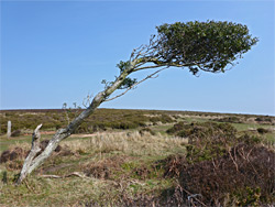
The track north from Bicknoller Post crosses the head of Weacombe Combe, a winding, mostly treeless valley to the west, then climbs across the flank of Beacon Hill, the top which is reached by another path. The high point is marked by an obelisk, beside a patch of scree, and from here several miles of the Somerset coast are in view, from Minehead and Watchet eastwards beyond Hinkley Point towards Burnham-on-Sea. The return route is back to Bicknoller Post, beside which is an oft-photographed wind-swept tree, leaning at an odd angle, and down Sheppard's Combe, following a tiny stream. This valley is open and treeless at first but quickly becomes wooded, descending below Black Ball Wood to the junction with Hodder's Combe, from where the parking area is one mile north.