Narrow promontory and elevated headland overlooking the Bristol Channel, lined by stony beaches and eroded rock formations; a remote, undeveloped location with fine views
Location
North end of Beach Road, 5 miles north of Weston-super-Mare; BS22 9UD
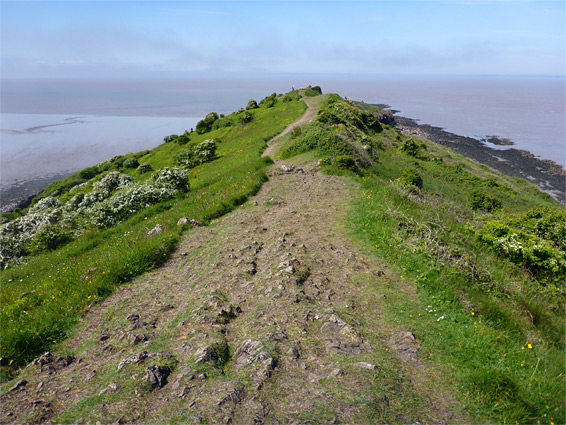
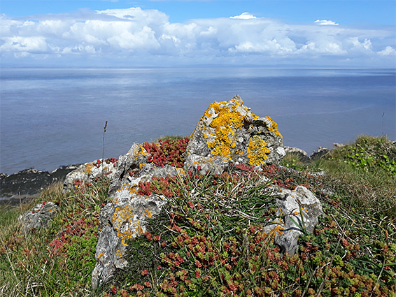
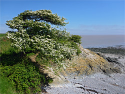
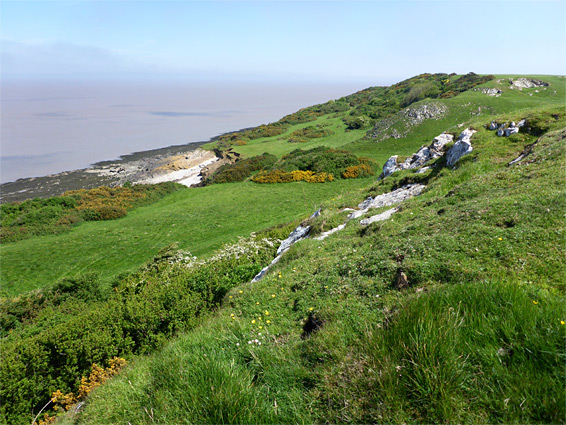
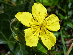
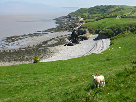
Sand Point is a narrow, westwards-projecting limestone peninsula along the north Somerset coast, while Middle Point is an adjacent ridge, and the two form an elevated promontory rising 158 feet above the surrounding flat lands - the shoreline to the north and south is low and rather featureless, characterised by extensive tidal mudflats bordered by saltmarsh. Like Brean Down, five miles south, the peninsula is managed by the National Trust, and is noted for the variety of wildflowers, the grand views across the Bristol Channel, the eroded rock formations along its edge (which include volcanic deposits and a fossil-bearing cliff), and for some archaeological features, principally two burial mounds and an ancient field system.
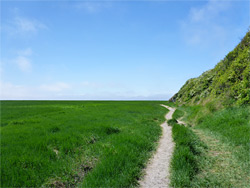
Also like Brean Down, the approach is limited to one road from the south, since to the east, beyond the far edge of the ridge at St Thomas's Point, access is impassable due to rivers and ditches. The place is not so well known, and has no facilities apart from a (sometimes free) car park, from where paths lead east, north and west; the whole peninsula is almost 2 miles long, and all can be seen on a loop hike of around 3.5 miles. The paths stay on top of the headland though it is easy enough to walk lower down along the beaches, especially on the north side where the best rock formations are found.
The Sand Point car park lies at the end of Beach Road from Weston-super-Mare, which runs through the developed neighbourhood of Sand Bay and ends with a short stretch alongside farmland. On the north side of the bay, the narrow sandy beach is replaced by grassy dunes and tidal flats, which merge with the quite gently-sloping south face of the Middle Hope peninsula - there are no dramatic cliffs, rock pools or sandy patches as are found on the south side of Brean Down.
Three paths depart from the car park, one to the west, crossing the grassy saltmarsh at the foot of the ridge to a small pebble beach near the high water mark, and another northeast through a patch of woodland, forming the return part of the loop, but the main route is northwest; steeply up a flight of steps, initially enclosed by trees, then out to open land on the ridgetop, continuing west and reaching the tip of Sand Point after 0.7 miles. The views are extensive, north along the estuary towards the two Severn bridges, west to the hills of Wales and south to the Somerset coast. Also visible are two islands (Steep Holm and Flat Holm) both formed of the same limestone bedrock, part of an extensive formation that can be seen most readily in the Mendip Hills a few miles inland.
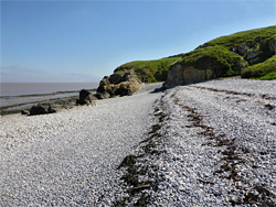
A lesser path runs close to the north edge of the peninsula; heading east from the tip this leads above a line of low cliffs and past a small pebble beach, where the bushy surroundings are replaced by a large expanse of short grass, site of the ancient field system. East of here are more cliffs for another half mile and then a larger pebble beach that has a few photogenic, isolated rock formations, some composed of volcanic tuff, and is lined by more jagged, dark strata. The land becomes partly bushy once more as the path passes two smaller beaches and finely a more overgrown stretch, ending beside a fence at the edge of an area of Ministry of Defence land that occupies St Thomas's Point, the eastern tip of the promontory; this is an abandoned facility that was used as recently as 2005 to test explosives and defuse bombs. The fence is partly damaged and it seems that visitors are now unofficially allowed in, though there is not much to see apart from a few derelict huts. From here it is one mile back to the car park, initially along a track from Woodspring Priory, and later on a path. The (Augustinian) priory was founded in 1210 and flourished for over 300 years until the Dissolution of the Monasteries as instigated by Henry VIII, after which the main building was converted to a manor house. The place is now owned by the Landmark Trust and operated as a guest house; the site includes an elegant church containing a small museum, open to the public a few days each year.