Like other nearby coastal reserves including Whiteford, Kenfig and Merthyr Mawr, Oxwich National Nature Reserve (NNR) contains a diverse mix of habitats, including sand, grassy dunes, saltmarsh, freshwater marsh, woodland, limestone cliffs, streams and ponds, together covering an area of 550 acres, on the south side of the Gower Peninsula, 11 miles southwest of Swansea.
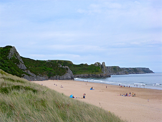
The reserve includes most of the beach on the western half of Oxwich Bay, and the adjacent intertidal zone, and while most people who visit stay only on the sands, the interior is also scenic, and easily accessed, crossed by many footpaths. Of the reminder, about a third is the dunes, another third marsh, lakes and ponds, and a third woodland and scrub. To the west, the coast becomes rockier and partly cliff-bound, for the three miles to Port Eynon Bay, while to the east, beyond a small headland, is Three Cliffs Bay.
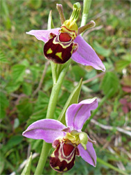
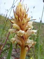
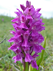
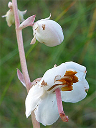
Wildflowers are found all across the reserve but are most abundant in the grassy dunes, which have calcareous soils, due partly to nearby limestone deposits, and partly to wind-blown shell fragments; some less common species are round-leaved wintergreen, dune gentian and several varieties of orchid. Across all the reserve over 600 plant species have been recorded. Animal life is concentrated in the moister areas, the woodland and marsh, and the place is especially noted for its birds, bats and insects, including at least 27 species of butterfly.
The usual access to Oxwich National Nature Reserve, and Oxwich Beach, is at the southwest corner, starting from a large carpark owned and operated by the Penrice Estate, which is centred on the (new) Penrice Castle a short distance north. The approach road is from the north, off the A4118; this descends a short, steep, wooded slope and enters the reserve, crossing the marshland, before reaching Oxwich village. There are no parking places along the road once south of the slope. The marsh is centred on the remains of a 1.4 mile long serpentine lake constructed in 1790 by the owners of the castle, and although most has long been filled in, some sections of open water remain. All the former lake is within the NNR, extending in a narrow band northwestwards, all the way to the upper end of the valley below Penrice Castle.
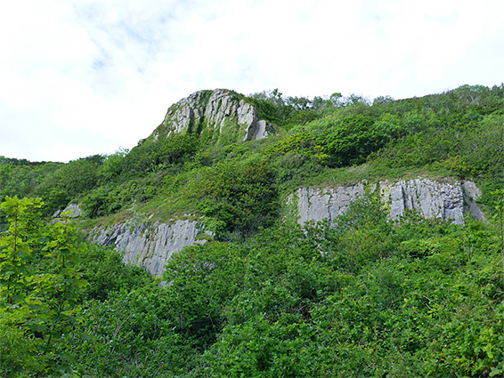
A boardwalk trail enters part of the freshwater marsh, starting on the opposite side of the road from the car park, though majority of this (western) region of the reserve is rather inaccessible. The two most visited sections are the dunes to the south and the woodland along the northern edge, most of which is part of Nicholaston Wood, classed as an ancient woodland since it has been established here for at least 400 years. Late spring is the best time to visit for wildflowers, when unusual species in bloom include stinking hellebore, butcher's broom, purple gromwell and herb paris. The woodland is relatively narrow, covering the steep slope that forms the southern edge of the peninsula; its east end contains a short array of limestone cliffs, and overlooks a smaller area of dunes (Nicholaston Burrows) just outside the NNR though also a good wildflower location. A loop hike of 2.5 miles through the woods can be accessed either from the main parking place after walking 1.4 miles through the dunes, or the approach road, starting along a little lane 1,000 feet south of the A4118 junction; there is very limited parking a short distance south.
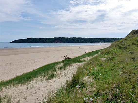
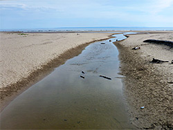
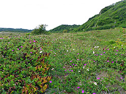
The dunes cover an area one mile long by about a quarter of a mile wide and are crossed by a network of paths, the main route running along the inner edge, overlooking scrub and marshlands to the north. On the far side is a shallow stream, Nicholaston Pill, flowing from the marshland, and then a narrower belt of dunes linking with Nicholaston Burrows. The most fruitful wildflower locations seem to be towards the north side of the dunes, on south-facing slopes with short grass cover. There are some areas of dune slacks - flat, moist depressions between the dunes harbouring some of the rarer plants - though in recent years they seem to have become generally drier. The adjacent beach, twice voted UK Beach of the Year, is entirely sandy and over 1,000 feet wide at low tide, with rock pools along its southern edge, extending towards Oxwich Point.