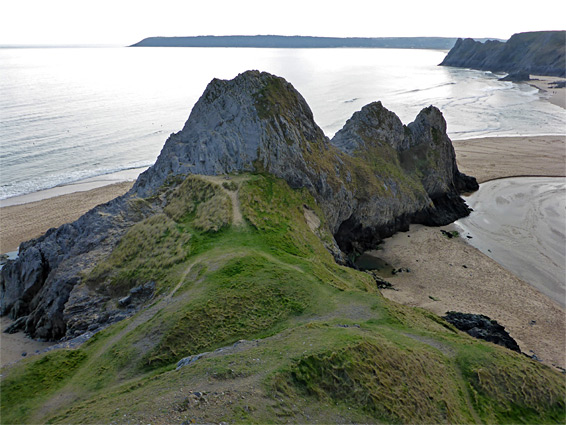
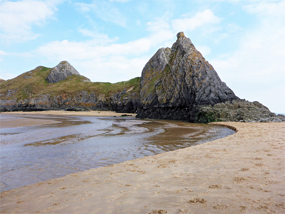
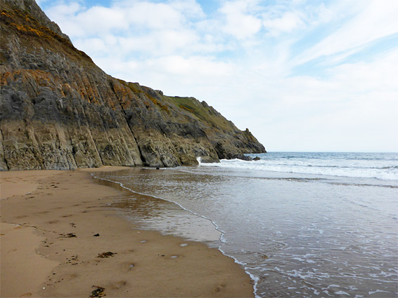
On the south side of the Gower Peninsula in Swansea, Three Cliffs Bay is one of the most scenic beaches in Wales, if not in the whole of the UK; a wide stretch of light-coloured sand bordered by impressive cliffs of inclined limestone strata, centered on a narrow promontory, which, along with the enclosing cliffs at either side, make up the three rock formations that give the bay its name.
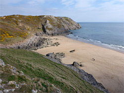
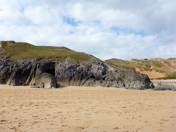
Inland are grassy bluffs, sand dunes, a ruined castle and a narrow valley, and the surroundings are mostly undeveloped; the main access is from the village of Southgate in the east, a walk of about one mile, and this relative remoteness helps limit visitor numbers. The north edge of the beach is lined by dunes, while the remainder is overlooked by the cliffs, which at the base form many little bays and crevices, weathered and eroded into interesting forms; several hours could be spent exploring.
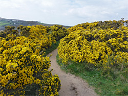
The easy walk to the bay starts at a parking area beside a roundabout on the south edge of Southgate, initially along a residential street, between a row of nice-looking houses to the north, and a strip of open land to the south, sprinkled with a few trees; the edge of the cliffs is visible beyond. A wide trail forks off after a quarter of a mile, later splitting into several parallel routes, all continuing westwards over gradually more exposed land where the trees are replaced by clumps of spiky gorse bushes, producing bright yellow flowers in the summer. The southernmost path runs closest to the rim of the cliffs and gives the first good views of Three Cliffs Bay, and beyond to the even more extensive sands of Tor Bay, the adjoining beach to the west. The path veers northwards a little, descending a sandy, grassy slope to the first beach access point, at the head of a small inlet with a narrow strip of pebbles at the upper edge, and extensive dunes just inland. The dunes are crossed by many little paths and one longer route which follows above the steep sided valley of Pennard Pill (the stream) and along the edge of a golf course to the small but picturesque ruins of Pennard Castle, which was established in this remote spot in the 1300s.
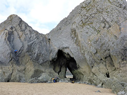
On the beach, the golden sands extend a quarter of a mile east, until replaced by rocks, though at low tide the coast can be followed much further; past the first rocky area are more sandy beaches, rarely visited. West of the access point, the land rises again and forms a narrow promontory - the middle of the three cliffs - composed of layered, dark grey limestone inclined at nearly 90 degrees. A sea cave (Threecliffs Passage) cuts through at beach level, beneath a sheer-sided section popular with rock climbers. The stream flows along the far side of the promontory, usually just a few inches deep, though wide enough to require wading, while beyond is a bigger area of sand bordered in part by dunes but mostly by more layered cliffs. For a few hours around low tide, this connects with Tor Bay beyond, a generally less scenic place since the cliffs soon fade away, and instead upper edge of the sands merges with grassy dunes.