Spectacular, lghtly-travelled, two mile section of the coast, with limestone hills sloping down to rocky inlets, sea caves and wave-cut terraces. Includes four nature reserves
Nearly all the south Gower coastline is formed of dramatic cliffs and slopes of light grey carboniferous limestone, angling steeply down to extensive, wave-cut terraces around sea level; only in two places is the limestone interrupted by a softer rock, old red sandstone, and here are found the sandy beaches of Oxwich Bay and Port Eynon Bay. The cliffs west of this latter location are as spectacular as any on the peninsula, and the two miles closest to the bay have additional interest, beyond the geology and scenery, since the land is within four adjacent nature reserves, containing contrasting habitats of heath, calcareous grassland, scrub, sea-cliffs and caves, all supporting interesting plant and animal life.
Despite the proximity to the village of Port Eynon, popular due to its accessible sandy beach, the westwards coast path is little travelled, perhaps because there are no more access points until Mewslade Bay near Rhossili, nearly five miles away, but the four mile round-trip walk through the nature reserves, continuing a short distance to a fine viewpoint atop Common Cliff, is a good shorter hike, taking just a couple of hours or so.
East of Port Eynon, the 3 miles of coast to Oxwich Point is similar in appearance, and equally little visited.
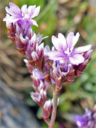
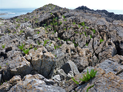
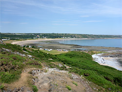
Port Eynon has a large, fee-paying car park, on a field at the south end of the one road into the village, the A4118, right next to the beach. The westwards coast path begins by following a private continuation of the road to the south, leading to a campsite and hostel, then soon branches off to the west, across a field and up through a patch of secondary ash woodland to the open, rocky terrain of Port Eynon Point, a high, narrow limestone headland extensively quarried in the 18th and 19th centuries. The residual rock faces and scree piles provide habitats for calcareous plants, such as white stonecrop and bird's-foot trefoil, while other parts have more acidic soils, and support heath-specific species including gorse and heather. All the point, including the woodland, is within the 33 acre Port Eynon Point Nature Reserve. Other plant species of note, generally found all along the coast, are sea campion, golden samphire, rock sea-lavender, wild clary, sea thrift and spring quill.
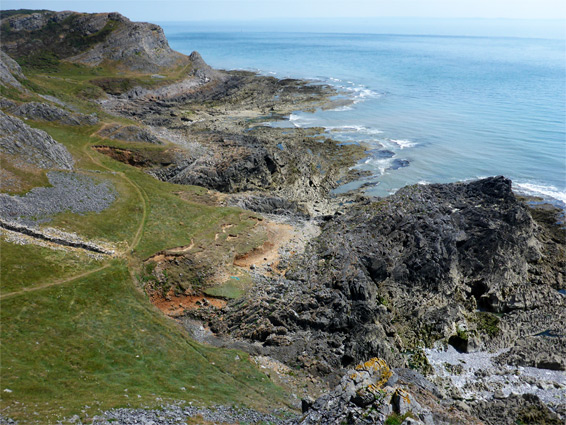
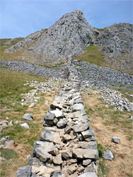
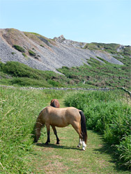
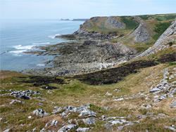
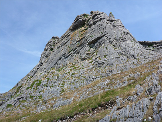
From the southern tip of Port Eynon Point, a path runs northwards along the rim of the cliffs then descends to Overton Mere, a broad, rock-lined inlet with a beach of white pebbles around the high water mark, opposite which are two junctions, one with a connecting path back towards Port Eynon, bypassing the point, another to the nearby village of Overton. This area, and the next half mile of shoreline, is within Overton Mere Nature Reserve, which contains habitats ranging from bare rock nearest the sea, through limestone grassland to heath and scrub at the higher elevations. The path runs along the edge of the beach, adjoining a grassy area often grazed by horses, then continues below a steep slope and around a promontory to another junction, where the main coast path moves inland, following the edge of fields for several miles, but the more interesting route is straight on, closer to the sea, and this now enters Overton Cliff and Royden's Corner Nature Reserve, 27 acres with a similar mix of habitats; the trail crosses undulating land of short grass and rock outcrops, later passing beneath a sizeable limestone peak, just beyond which is another connector to the inland coast path. Some plants here are carline thistle, bloody cranesbill and early purple orchid.
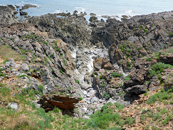
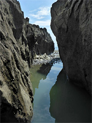
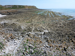
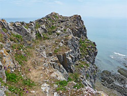
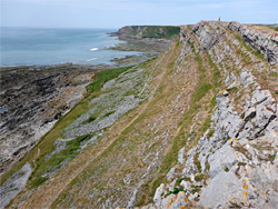
The westernmost of the four nature reserves is Long Hole Cliff, and here the lower path continues close to the sea, passing beneath another prominent rocky summit and past a narrow inlet, which has a hole on the far side, this the upper end of a 60 foot-long sea cave, explorable from below after carefully climbing down the jagged rocks. Nearby is a larger and higher cave, not visible from the path, and when excavated in 1861 this was found to contain many relics from Palaeolithic times. The path leads beneath another dramatic rocky peak and past an section of the intertidal zone with particularly intricate rock formations, all of the grey limestone, lined by a band of reddish conglomerate just above the high water mark, containing another short cave, Boundary Gut, named after a nearby dividing wall. This is at the far side of the nature reserve though it is worth walking at least another 700 feet, over a minor ridge and onto a higher divide which has far-reaching views both east towards Port Eynon, and west to Worm's Head, 3 miles distant.