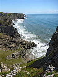
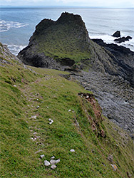
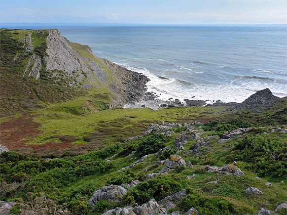
The three miles between Tears Point, south of Rhossili, eastwards to Common Cliff (and beyond) is the most rugged, wild, inaccessible and least-visited section of the Gower coastline, well away from roads or villages, though followed as always by the coast path, running generally around 200 feet above the sea. There are no trees or hedgerows hereabouts, so nothing to block the spectacular views, of layered limestone cliffs, isolated peaks, rock-lined inlets and hidden beaches; the path stays fairly close to the sea, just veering inland in a few places to bypass little valleys.
Further east, the coast continues in similar remote and rugged fashion for 2 miles to the next place with direct road access - see Common Cliff to Port Eynon, while to the west, just beyond Tears Point, is the popular tidal island of Worm's Head. Near the point are two big sandy beaches, Fall Bay and Mewslade Bay, both of which receive a fair few visitors, but once beyond, the shoreline is rarely explored.
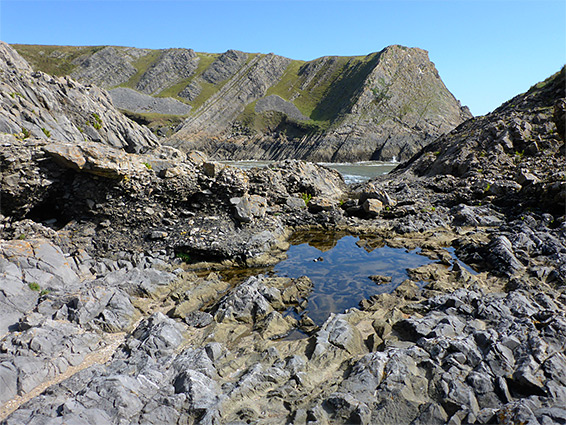
Although partially cliff-bound, with only small beaches, and limited sand, there are plenty of places where it is possible to reach the water, by walking down from the coast path, and one full day could be spent here, viewing all the various inlets and overlooks.
The usual parking place hereabouts is the large National Trust facility at Rhossili, from where Tears Point and Fall Bay are reached by a short walk south on paths between fields.
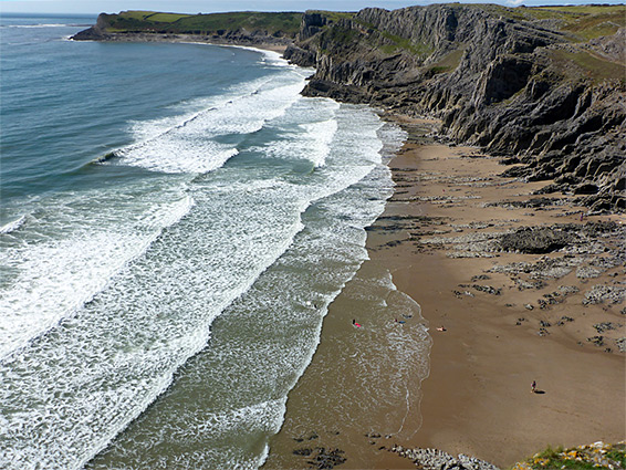
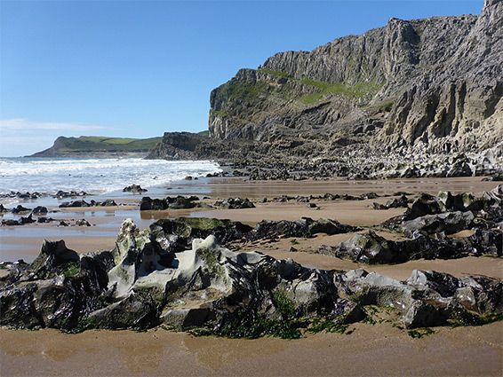
Tears Point is a fairly low promontory, at the east end of the broad band of flat rocks exposed at low tide, linking with Worm's Head. On the other side is Fall Bay, a strip of golden sand with rocks only around the edges, most dramatically to the east where the land rises abruptly to a sheer-walled formation known as Lewes Castle, a little-way off the coast path. Beyond are a tiny sand beach, a lower promontory leading to the semi-submerged rocks of Devil's Truck, then a larger beach of rock and sand, not readily accessible from above though reachable at low tide. After here are another headland, Jacky's Tor, and the beautiful beach of Mewslade Bay. This can be reached at its west end by climbing down rocks, but much easier is the official access point to the east. The beach has a photogenic mix of pure sand and little, wave-sculpted limestone outcrops, and the surrounding cliffs conceal many little caves and crevices that invite exploration.
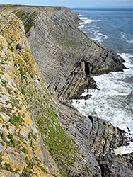
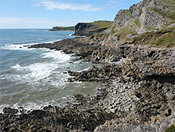
The land rises steeply again at the east side of Mewslade Bay, initially bypassed by the coast path - a steep-sided point named Thurba, on top of which are the earthworks from an ancient hillfort, partly lost due to erosion. After here, the terrain is more gently sloping, and the coast path stays some way above the water, though benches closer to the sea allow for lesser paths, with easy access to the rocky inlets below, the first of which is Butter Slade, a pebble and rock beach with a few sea caves and many shapely rock outcrops. The next half mile is all alongside rocky terraces, before a wider beach, also mainly pebbles, with some sand exposed at low tide - at the lower end of Ram Grove. More marine terraces lead to The Knave, a dramatic, isolated peak formed of limestone layers inclined at about 70 degrees, while on the seaward side are several sea stacks, The Combs, and nearby, a hard-to-find cave named Deborah's Hole. East of the Knave is a particularly dramatic bay, ringed by angled strata on three sides, and then another big headland, Horse Cliff, also topped by the remnants of an ancient fort.
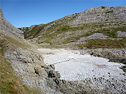
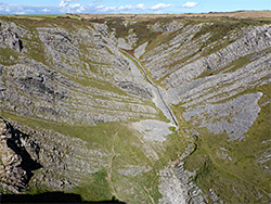
There are several small, vertical-walled inlets east of Horse Cliff, and also Paviland Cave in which (in the 1830s) were found varied relics including a human skeleton, from peoples who lived here in Palaeolithic times, 40,000 years ago, at which time the sea level was lower, the cave looking out across fertile plains. The cave is at the western edge of a broad, dry, V-shaped valley, Foxhole Slade, which has an old stone wall running down the middle, nearly all the way to the bouldery beach at its mouth. Beyond the next ridge is another sequence of more easily-reached bays, one (Yellow Top) named after a light-coloured rock outcrop. Once more, the coast path runs inland a little way though narrower, lower paths skirt the wave-cut terraces, winding round the inlets and later climbing to the top of Common Cliff, where the route continues to Port Eynon.