Along the western edge of the Gower Peninsula, three mile-long Rhossili Bay has been named the best beach in the UK on several occasions, and even one of the best in Europe, since it is clean, relatively remote so not that busy, and backed by scenic, undeveloped land - the high cliffs and sandstone grassland of Rhossili Down to the south and the low grassy dunes of Llangennith Burrows to the north.
At either end of the beach are two rocky headlands, Worm's Head on the south side, a narrow ridge partly submerged at high tide to form a tidal island, and the smaller Burry Holms on the north side, also a tidal island, and part of another line of limestone cliffs that extends a mile to the next broad sandy beach of Broughton Bay, beyond which are the rolling dunes of Whiteford.
The two bays can be explored via a loop walk of around 4 miles, also visiting Burry Holms, the Burrows, which contain a good variety of wildflowers, and the limestone cliffs, where the rocks are eroded into an array of photogenic formations including a natural swimming pool (Blue Hole) and an angular sea arch (Three Chimneys).
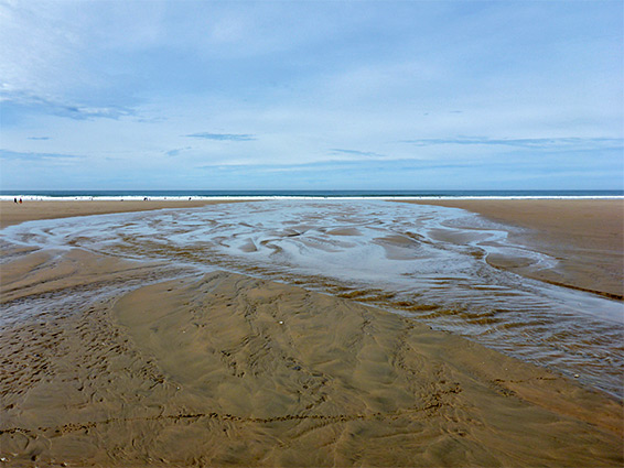
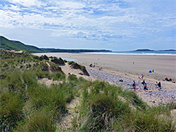
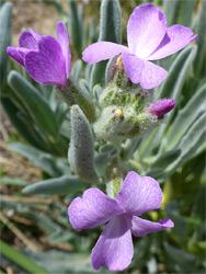
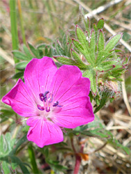
Broughton Bay is served by a small public carpark, owned by the Broughton Farm caravan site, but the usual start point if visiting this area of the Gower Peninsula is halfway along Rhossili Bay at Hill End, also part of a caravan centre; both parking areas charge Ł3 per vehicle. From the Hill End car park, several short paths wind through a narrow strip of dunes to the bay, when the sands - sometimes known as Llangennith Beach - are a quarter of a mile wide at low tide, uniformly smooth and evenly coloured, lacking any exposed rocks, and crossed by one stream, just north of the car park, originating not far inland at Llangennith Moors, a small wetland area. To the south is a small patch of dunes, Hillend Burrows, partly occupied by the caravan park, while to the north is the much more expansive and unspoilt Llangennith Burrows, a 300 acre triangle of mostly grass-covered dunes traversed by one main path, towards the north, and various lesser routes. Another path follows the inner boundary of the dunes, along the edge of the wetlands, towards Broughton Bay. The rarest of the many wildflower species found in the dunes is probably sea stock, while the most widespread include bloody cranesbill and pyramidal orchid.
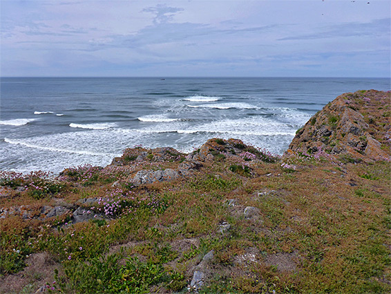
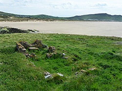
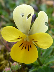
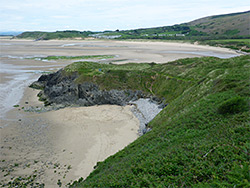
The land rises towards the north edge of Llangennith Burrows up to the limestone ridge that includes the tidal island of Burry Holms at its western tip. The island is cut-off for only a short time around high tide, and at low tide about half of its shoreline is accessible from below; the remainder is edged by steep cliffs, permanently submerged at the base. Much of the land is fairly flat, around 100 feet above sea level, and it contains one visible ruin, the low walls from a medieval chapel. It was also the site both of an Iron Age hillfort, and a Mesolithic camp, this latter in use around 9,000 years ago when it is thought the rocky hill was up to ten miles inland. The island has one named inlet (Vome Hole), on the steep-sided western edge, and its east end slopes gently down to an area of jagged strata known as Spaniard Rocks. Sea campion, buckhorn plantain and sea thrift are some of the most abundant plant species.
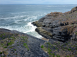
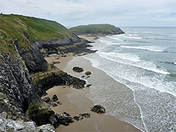
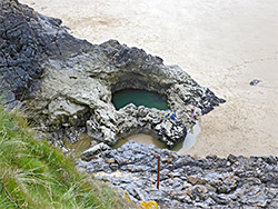
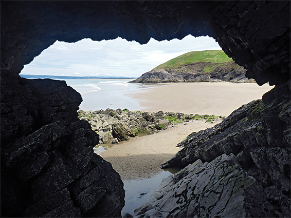
Burry Holms and Broughton Bay are linked by the line of layered, limestone cliffs, rising to a high point of 200 feet, and just traversable from below around low tide; in several places the cliffs jut seawards to form little peninsulas that are passable for only an hour or so. A path runs over the top of the cliffs, and a short spur descends about halfway along to Blue Pool Bay, named after a huge pothole, submerged only at high tide and retaining water at other times, up to 20 feet deep, and so is a (relatively) popular place for swimming and diving. On the far (west) side of the bay is a natural arch or cave, named Three Chimneys of account of three small openings in the roof, while beyond are several smaller inlets between jagged promontories, before the intertidal sands widen approaching Burry Holms. The cliffs continue a short distance east of Blue Pool Bay, to Foxhole Point and then Twlc Point, at the edge of Broughton Bay (see panorama), where the coast path veers southwards towards the caravan park.