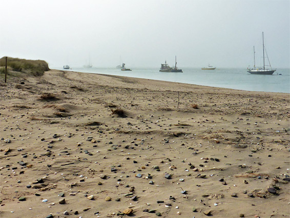
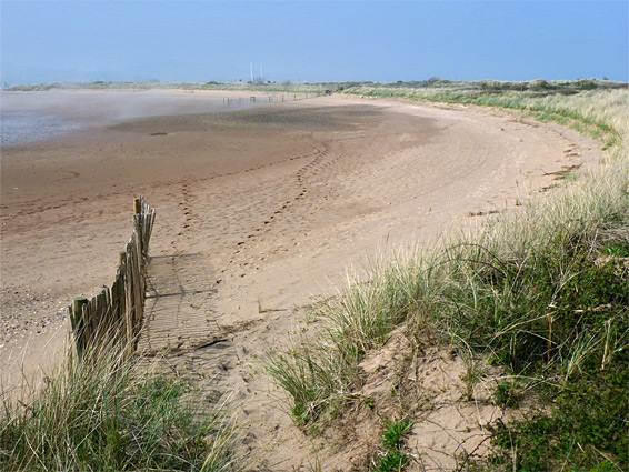
Sandy promontory at the mouth of the River Exe containing varied habitats, home to many plant species. Lined by a long sandy beach to the south, and estuarine mudflats to the north
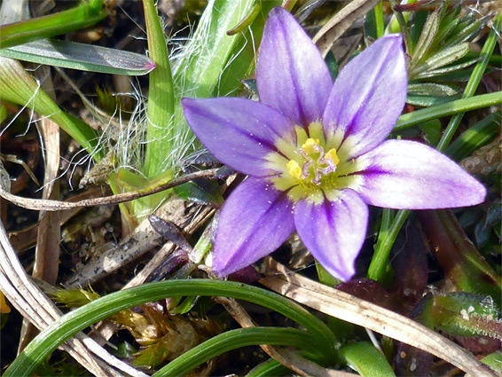
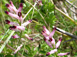
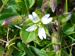
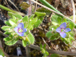
Dawlish Warren is a low, sandy promontory on the west side of the mouth of the River Exe, extending 1.5 miles northeastwards from the mainland, covered by a mix of habitats - sand dunes, wet and dry meadows, marsh, saltflats, freshwater ponds, woodland, and dune slacks, which are flat depressions between the dunes, typically supporting a number of rare plant species. The least common plant in the warren is the sand crocus, which produces diminutive flowers in April and May, and which is found at only one other UK location, near Polruan in Cornwall. Other notable species include autumn lady's-tresses, marsh helleborine and southern marsh orchid. A list of all species (around 500) is available at dawlishwarren.co.uk.
The promontory is part of Dawlish Warren National Nature Reserve, which also includes a large area of tidal mudflats on the estuarine side; about half of the land is open to the public, while the remainder is occupied by the local golf course, though this too has a good variety of wildflowers, and its fairways are ideal territory for the sand crocus, which favours short, sandy grassland. Despite the national designation, the reserve is managed by Devon Wildlife Trust, and the southern boundary is along the edge of the dunes; the beach to the south is owned by Teignbridge District Council.
The warren is a popular place, though people do not in general come here for the wildlife or plants, or for the scenery, which is not so distinctive; instead it is the long, sandy beach and the amusement arcade beside the entrance which are the two main attractions, together with the network of paths across the grassy, sandy interior.
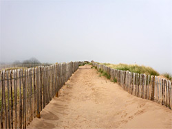
The Dawlish Warren promontory lies just beyond the town of the same name, and is accessed by a short road that passes under the coastal railway line via a narrow, traffic light-controlled bridge, leading to a large, metered carpark at the edge of the dunes.
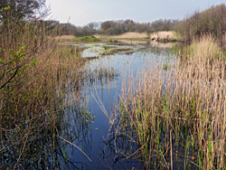
The shape of the Dawlish peninsula has changed regularly over time due to coastal erosion, and continues to do so. The land currently extends northeastwards for a mile - the Inner Warren, with a fairly constant width of around 1,000 feet, then narrows abruptly to a thin spit just 70 feet across, before widening at the far end to the Outer Warren, a 30 acre patch of grass, sand and scattered trees. The north side of the spit borders a semi-circular inlet known as The Bight. As recently as 2018 the spit was damaged by erosion during a storm, forcing closure of the path along its spine, and similar processes look likely one day to permanently breach this section, creating a tidal island beyond. Access to the far end of the promontory is currently only possible along the beach, and hence this section may be inaccessible around high tide. In Victorian times the promontory was different in both shape and position - the land was wider, and its seaward edge was up to 2,000 feet further south. It also contained a sizeable area of fresh water (Greenland Lake) linked to the estuary by a channel running almost the full length of the peninsula, but both were filled in early in the 20th century, leaving just a small residual pond. The site of the original lake is now partly wooded, partly grassy, and partly beneath the car park.
The main path into the reserve leaves from the far end of the car park, runs between two patches of trees and enters the largest area of grassland, at the edge of which is a staffed visitor centre, which is open all days of the year, then continues past more trees (concealing what remains of Greenland Lake) and through grassy flats and dune slacks, before emerging to the beach, opposite the eighth of around 15 groynes that radiate from the south edge of the dunes. The sand crocus grows right beside the visitor centre, in particular on the shortgrass meadow to the northwest, and also on the dune slacks. Other paths cross the dunes near the coast and one follows close to the northern boundary of the public section of the reserve, close to the golf course. The one path to the far end of the promontory is open for a short distance only, then closed because of the erosion, so visitors have to take the beach route instead. A half mile loop path circles the vegetated part of the outer warren, beyond which are more dunes and wide sandy beaches, with good views across the estuary towards Exmouth.