Granite outcrops in Dartmoor National Park, viewed along a loop hike also visiting Grea Tor, Greator Rocks, a ruined medieval village, an unusual stone tramway and several old quarries
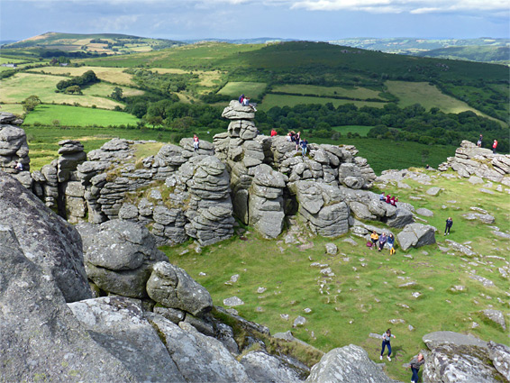
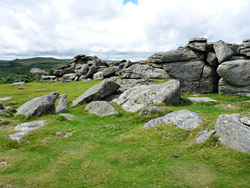
Haytor Rocks and Hound Tor are two of the most visited of the dozens of granite outcrops sprinkled across the 370 square miles of Dartmoor National Park, popular since they are large, prominent, and close to a paved road, requiring an easy walk of just a few minutes. Both consist of several groups of weathered rocks, rising up to 50 feet above the grassy, moorland surroundings, and are fun to climb, offering easy scrambles and some short cliffs suitable for technical ascents. Both have grand views across many miles of the moor, and, for the former, towards the sea in the east, since this peak lies right at the edge of the moor.
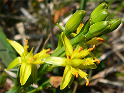
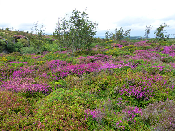
The two summits can be viewed on a loop hike of around 4.5 miles - several routes are possible - that also visits two other granite outcrops (Grea Tor and Greator Rocks) plus a stream flowing through a wooded valley, the remains of an abandoned medieval village, and several relics from granite quarrying in the 19th century including sections of stone tramway and a few quarry pits, one filled with a large pool. The hike is perhaps the most varied in Dartmoor National Park over this relatively short length. The moors are made more colourful by abundant wildflowers in spring and summer, and are home to wild horses, in addition to the ever-present sheep. One desirable aspect lacking on the hike, however, is solitude, as both the main tors are usually busy, though far fewer people walk between them.
The loop can be started from the parking area near Hound Tor, along a minor road, but more usual is from the slightly busier B3387, on the south side of Haytor Rocks, one mile west of the village of Haytor Vale. Parking is free, in common with most places within the national park, and the location is already high, at 1,200 feet; the views extend to the Teignmouth coast, 12 miles away. All the hillsides hereabouts are traversed by numerous paths, and cross-country walking is straightforward over the higher, grassy areas, so the walk can easily to be extended to include other nearby features.
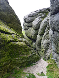
The main path from the parking area on the B3387 rises gently by 150 feet to the base of the Haytor Rocks, which are divided into two main sections, separated by a grassy flat. The western part is larger, and somewhat easier to ascend; the smaller eastern component, which at its summit contains a lichen-covered cavity named Rock Basin, is slightly harder. A path loops all the way round the base of the rocks, and others radiate out in various directions. The outcrops are formed of the dark grey granite characteristic of Dartmoor, embedded with white crystals of feldspar.
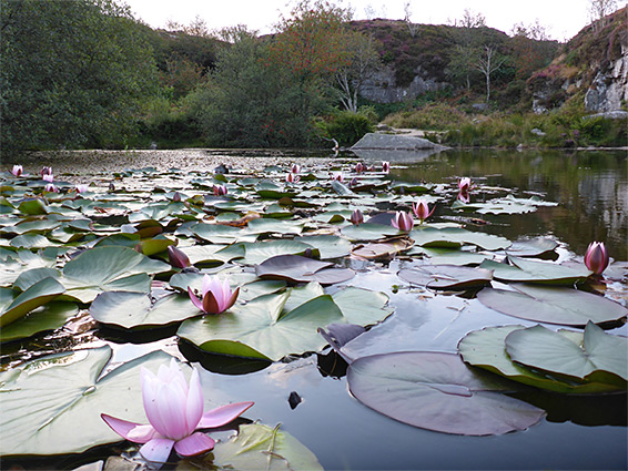
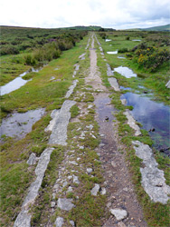
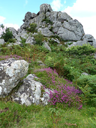
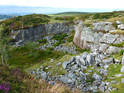
The largest of the Haytor Quarries is a quarter of a mile northeast of Haytor Rocks; a sizeable excavation 400 feet across, partly cliff-bound, containing a permanent pond, its edges lined with two species of lily pads, the white-flowered nymphaea alba and the yellow-flowered nymphoides peltata. The granite slopes are densely blanketed in heather, bright purple in summer, and the whole place is very photogenic. Entry is from paths on the east and west sides. The continuation of the loop hike is to the west then the northwest, along a path which soon intersects one branch of the Haytor Granite Tramway, a ten mile route that was constructed in 1820 to take material from the quarries, down to the Stover Canal, which in turn linked to the navigable lower section of the River Teign. The rails were fabricated out of stone rather than metal, the only instance of this construction method in the country. The full course of the tramway, and the canal, can be followed via an 18 mile footpath, the Templer Way.
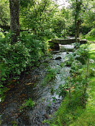
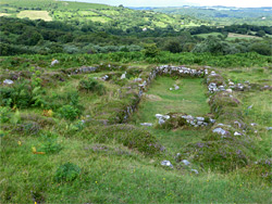
Continuing northwest, the trail passes a small pond and arrives at Grea Tor, a smaller granite outcrop, overlooking the valley of Becka Brook below, reached by descending an overgrown slope, through ferns, bracken and bushes, into thick woodland around the stream, which is crossed on a wooden bridge. The overgrown valley sides harbour many species of fungi. The trail to the west rises through the undergrowth before emerging out of a strip of trees to more ferny uplands, and on past Hound Tor Deserted Medieval Village, which consists of low stone walls from four longhouses (elongated dwellings used by both people and livestock) and several smaller buildings, thought to have been inhabited from Norman times until the early 15th century. The site is managed by English Heritage, and some aspects remain a mystery - excavations have revealed relatively little about the occupants, in part due to the acidic soil that causes most material to degrade quickly.
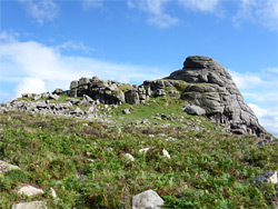
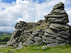
Hound Tor itself is a quarter of a mile west of the medieval village, on the crest of a ridge, high above the East Webburn River, which flows through a broad valley below to the west. The rocks are scattered over a large area; two main groups surrounded by smaller piles, and the place is very popular, with perhaps several dozen visitors here at busy times. This is the furthest extent of the loop hike; the return is back to the village site then southeast past Greator Rocks, another granite tor, quite overgrown around its base. A trail heads south and later descends back to Becka Brook, crossing on a stone slab and rising briefly up the far side to rocky, ferny ground between Grea Tor to the north and Holwell Tor, to the south, this adjoining another of the Haytor Quarries, which may be visited via a short diversion. The onwards path climbs steadily for a while, passing a third, smaller quarry and then skirts the base of the western component of the Haytor Rocks, beneath a section lined with vertical cliffs, and soon intersects the wide, grassy path from the parking area.