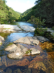
Remote, 4 mile section of the River Dart between steep, wooded slopes on the east side of Dartmoor, from Newbridge to Dartmeet, with many pools, cascades, and some tributary waterfalls
Location
Accessed from parking areas at Newbridge (TQ13 7NT) or Dartmeet (PL20 6SG)
The River Dart begins high on Dartmoor, as two forks, East and West, which join at the tiny settlement of Dartmeet, after flowing through relatively shallow valleys with sparse tree cover. Below the confluence, the river enters a much more dramatic gorge, up to 500 feet deep, between steep slopes thickly covered by ancient oak woodland, and flows over numerous cascades and little waterfalls. The next road crossing is not for another 4.3 miles, at Newbridge, below which the valley continues, now less steep-sided and more accessible, for 6 miles until the hills recede and the river meanders past Buckfastleigh and on towards the coast.
The most spectacular and photogenic part of the gorge, between Dartmeet and Newbridge, can be explored via paths along both sides of the river (there are no viable crossing places), either via a ten mile loop hike or by shorter, one-way walks. Most of the gorge and its woodland is part of Dart Valley Nature Reserve, which extends upstream from Newbridge for about 3.4 miles; the last mile, to Dartmeet, is somewhat shallower and the woodland more limited.
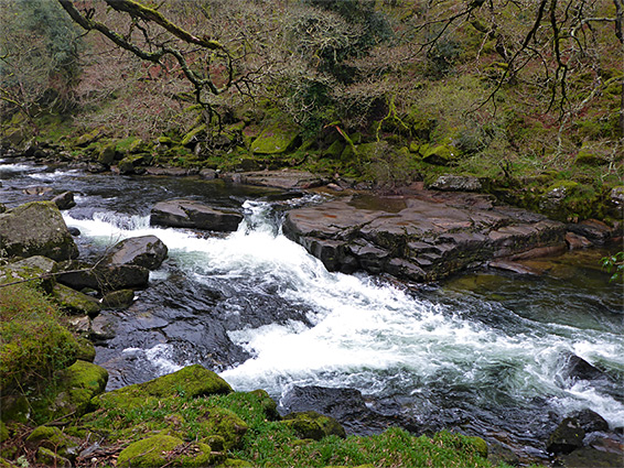
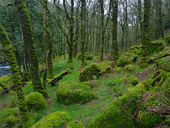
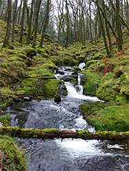
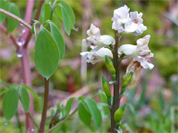
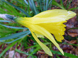
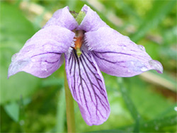
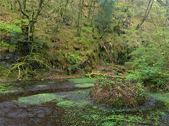
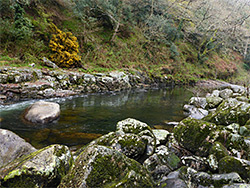
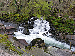
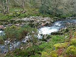
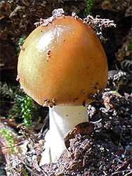
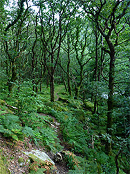
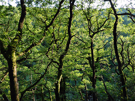
The river, its rapids, boulders, cascades, ledges and islands, provide one main attraction, while the other is the ancient woodland, which is permanently cool and moist, the floor carpeted by ferns, lichens and mosses, very atmospheric at all times of the year. The reserve also includes open moorland, above the trees, and is very large, over 700 acres. Wildlife includes butterflies, birds, otters and bats, while the usual array of woodland flowers are present, plus a few rarer species including climbing corydalis and marsh violet, but the scenery is the main reason to visit.
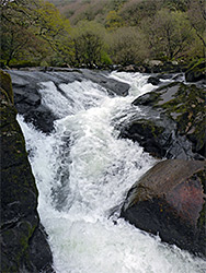
The most used entrance is at Newbridge, at the east end of the gorge, where the river is crossed by a narrow road, between Dartmeet and Ashburton. Parking is at a sizeable fee-paying area on the north side of the bridge. One mile north is another nature reserve, Blackadon, which also contains a mix of valley and moorland scenery, adjacent to a major tributary of the Dart, the River Webburn. At Newbridge, one path starts from the car park, along the north side of the river, while a wider and more used route (part of the Two Moors Way) follows the southern bank. Many people come to spend time beside the pools below the bridge, or perhaps walk a little way to the first notable feature, Horseshoe Falls after a quarter of a mile; only a few walk further into the reserve.
Dartmeet is a settlement of a few homes at the east end of the B3577 (the westwards continuation is undesignated), just upstream of the confluence of East Dart and West Dart. The road bridge parallels the remains of an ancient clapper bridge, made of huge, flat stones, beside which is another fee-paying car park, used mainly for walks into the adjacent moorland (Yewtor Down). The unsigned path along the river, on the north side, begins by crossing a field, veering around a house and another field then returning to the riverbank, staying close nearly all the way to Newbridge. The south bank path begins at the end of a short lane, crossing the West Dart River via stepping stones then climbing through woodland and across fields, later descending alongside the tributary of Venford Brook, though an unofficial route (described below) stays close to the river.
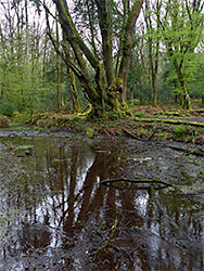
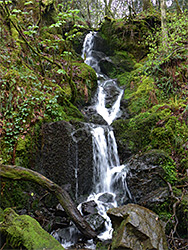
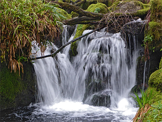
The path along the south side of the river seems to be the most interesting route, encountering a mix of scenery including tributaries with cascades, extensive ancient forest and photogenic woodland pools. The walk is 3.5 miles (one-way) to Venford Brook or 4.3 miles to Dartmeet, and is for the most part fairly level, with just a few short climbs to pass cliff-lined sections of the river. The path starts just south of the road bridge, entering flat, moist woodland, and soon coming close to the remains of a culvert used to supply water to a nearby mining operation, then moving alongside the river in the vicinity of Horseshoe Falls, where the waters have eroded a U-shaped cavity through an inclined ledge. The wide path, originally a vehicle track, continues through the closely-spaced trees of Cleave Wood, rising gradually to pass a cliff as the river bends to the west, allowing brief views of the moorland beyond. Soon after is a junction, with a track to the south, marked as private. The path descends towards the river and crosses a tiny stream in vicinity of Wellsfoot Island, one of several places where the river briefly splits into two channels. To the north is an area of the wood that has previously been partly felled, resulting in a lattice of downed trunks between the surviving trees. The stream flows from a shallow, boggy pool lined by old trees, beneath a near-vertical slope densely draped with mosses; a very photogenic location. The river stays out-of-sight for a while as a track runs northwestwards through Holne Wood, then briefly through a meadow before returning to the trees, rising slightly and crossing an unnamed tributary that forms a pretty waterfall.
The next feature along the river is Bellpool Island, the longest in the gorge, and then, a little way after a wall and gate, Sharrah Pool, a 300 foot-long stretch of deep, clear water below a cascade, flanked by sandstone benches on either side; a popular location for wild swimming. The pool marks the end of the old vehicle track, but a narrower path continues northwards, generally higher above the river, though this can still be followed at water level by walking along benches. Ahead are many more cascades and boulder-filled stretches, plus another small island, as the river bends to the west and then southwest. Some patches of the trees, now part of White Wood, and the ground beneath, have an especially dense moss covering, making this region very pretty. Another tributary, Venford Brook, joins from the south, flowing down series of cascades and little falls, and here the path heads up the slope, leading to a road at Venford Reservoir, 0.7 miles away, and linking with an upper-level path to Dartmeet.
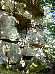
Although the main path heads up the slopes beside Venford Brook, a narrow path continues westwards, climbing a way than levelling out across open, fern- and moss-covered ground, winding between ancient trees. Below is Black Pool, while just opposite, on the far side of the river, are the angular cliffs of Luckey Tor, visible between gaps in the trees. 0.8 miles from the brook, another small tributary joins, also flowing through some minor waterfalls, at which point the river curves to the north, and briefly divides into separate channels, either side of Combestone Island. Just opposite is a fence marking the edge of privately-owned Combestone Wood, though a path does continue, through overgrown terrain then across some grassy areas, which extend to Dartmeet, where another trail joins from the west; this crosses the West Dart River via stepping stones then follows a short lane to the B3357.
From Dartmeet, the lesser-used north-side (or east-side at this point) path through the valley crosses a field, climbs slightly into a patch of trees, passes an information board about the nature reserve then heads south through a mix of heath and sparse woodland, with good views of the river. After half a mile the trees become more extensive, while the ground remains flat, allowing easy walking through the shady groves, interrupted after another half mile by the granite rock face of Luckey Tor, below which is a tiny stream. To the east, the valley sides become noticeably steeper, staying so for nearly 2 miles, and requiring the path, which is now often rather faint and hard-to follow, to make many short climbs and descents, in a few places running right beside the water, otherwise crossing the overgrown, rocky slopes, which include another named granite outcrop, Hockinston Tor. The trail becomes better-defined once past Sharrah Pool, still traversing steep terrain for a while, until the land flattens out again, and walking becomes easier, over more open ground in the vicinity of Wellsfoot Island then through the last patch of woods leading to the carpark at Newbridge.