Low limestone cliffs at the tip of the peninsula between the rivers Wye and Severn, and a small tidal island centred on a ruined medieval chapel
Location
South end of Beachley Road; NP16 7HH
Beachley Point is the southern tip of a low peninsula that separates the lower end of the River Wye from the Severn Estuary, accessed by a single road running south off the A48 near Chepstow. Once a quiet backwater of farm fields and a few scattered houses, it was first developed during World War 1 by construction of a shipyard, later converted to an army barracks, still in use (though scheduled for closure in 2027), then again in the 1960s when the Severn Bridge was built across. Most of the peninsula is lined by mud flats and grassy banks, not at all scenic, though an 800 foot band of rock is exposed along the south edge - mostly thin-layered carboniferous limestone, with some dolomitic conglomerate and Mercia mudstone.
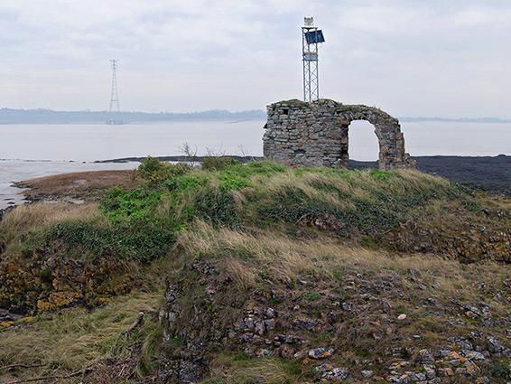
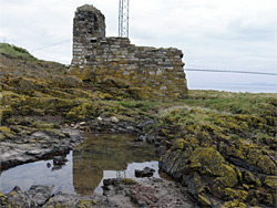
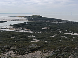
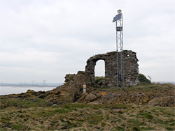
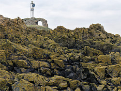
At low tide an irregular bed of limestone is uncovered, extending a quarter of a mile southwards into the estuary, and centred on Chapel Rock, a tiny tidal island rising only about ten feet above the high water mark. The island contains the fragmentary ruins of a 13th century chapel, dedicated to St Twrog or St Tecla - the surviving parts are only two walls and a round-arched doorway but the site is quite evocative, albeit somewhat spoilt by a modern, solar-powered signal emplacement positioned right beside. The island is accessible on foot for about two hours either side of low tide, by walking across 700 feet of muddy, slippery rocks, mostly covered by seaweed.
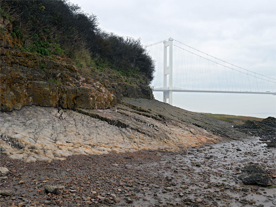
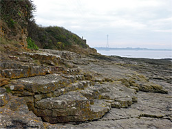
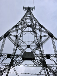
Beachley Road ends in a parking area beside a building housing the Severn Area Rescue Association, just south of the site of the jetty from the former Aust ferry, which closed in 1966 once the Severn Bridge opened. The western pier of the bridge lies 400 feet offshore, its foundations extending 11 metres below the riverbed to reach a hard (limestone) rock layer, while the bridge itself crosses the peninsula high above the parking place, from where a path runs south through a belt of trees for a quarter of a mile to the far edge of the land, on a small rocky bluff. This is also the site of the 488-foot high Beachley pylon that carries powerlines across the Severn, its companion being on a pier near Aust. Below the path, the beach to the east is all mud with some marshy grassland, but exposed to the south are low cliffs of inclined limestone, covered by yellow lichen, while the intertidal zone beyond is formed of jagged limestone terraces. There is one small (pebble) beach, formed where the underlying conglomerate is exposed, by faulting.
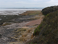
The marine terraces to the south, uncovered at low tide, slope gently down to a low point, a flattish channel where once again the dolomitic conglomerate is exposed, then rise a little more steeply on the far side to the island of Chapel Rock, all of which is formed of the same, lichen-covered limestone. The chapel ruins consist of one wall containing the doorway and another short wall at right angles, to the southeast; a longer wall that once extended northwest is no longer apparent above ground. Although a chapel had stood here since Saxon times, when the peninsula was part of Wales (Gwent), the present structure dates from the 1200s, at least partially, and was abandoned in the middle of the 16th century, seemingly as its difficult-to-reach location discouraged worshippers. The site also incorporated a holy well, its position no longer evident.